
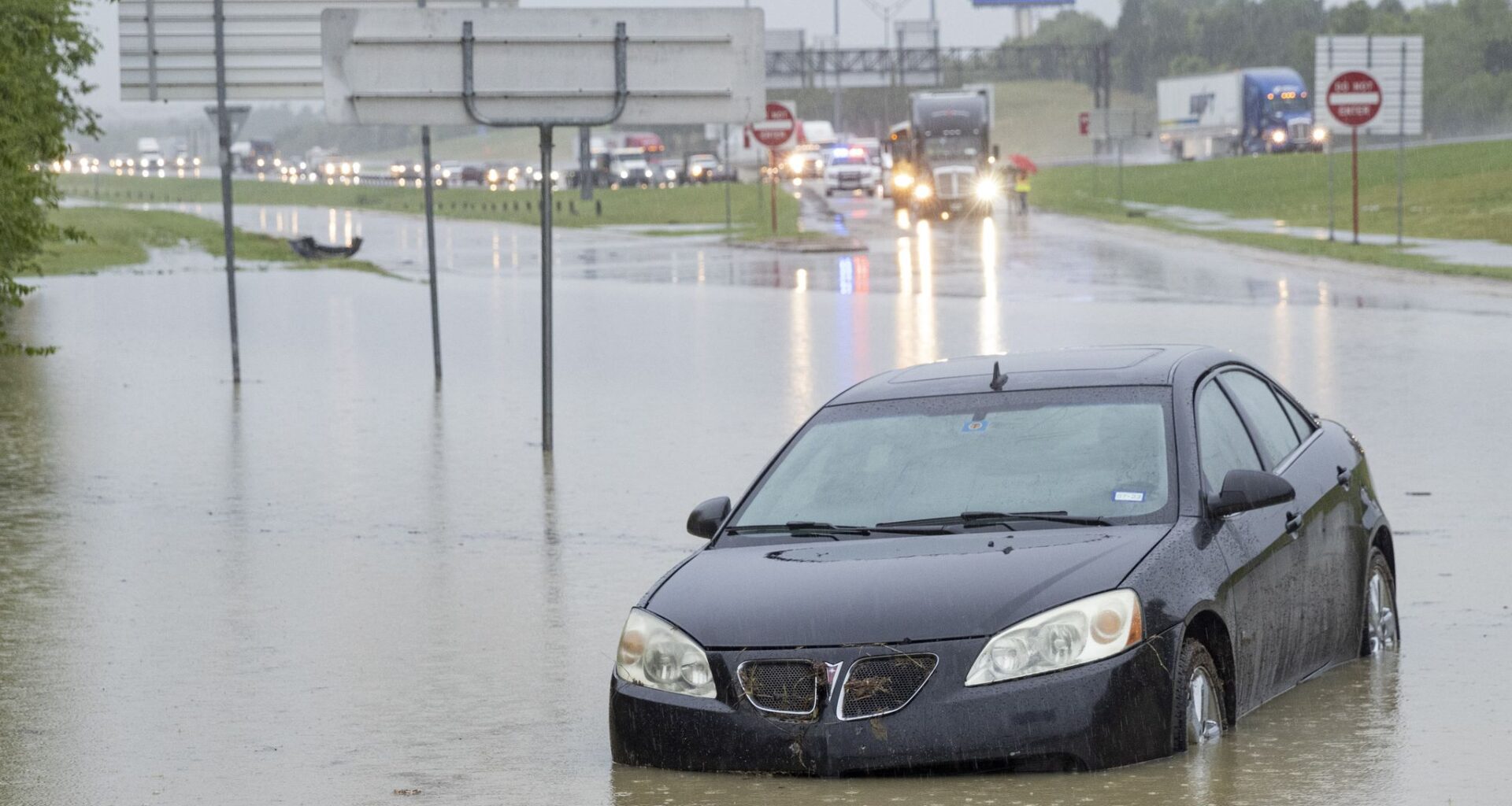
A file photo shows stalled cars sitting abandoned on the flooded Interstate 635 Service Road on Monday, Aug. 22, 2022, in Mesquite, TX.
Juan Figueroa/Staff Photographer
With heavy rains expected to pound Dallas-Fort Worth over the next several days, there are some known trouble spots for road flooding that drivers may want to avoid.

Dallas Fire-Rescue responded to about 1,100 incidents of vehicles stalled in water between 2021 and early 2026. Those situations include rescuing people from vehicles and stalled cars where the driver is not in immediate danger.
To understand which roads flood the most, The Dallas Morning News analyzed fire department data to identify places where firefighters have repeatedly responded. This list is not comprehensive and should not be used to determine whether it is safe to drive through water.
Article continues below this ad
In some parts of the city, the trouble spots are an entire area instead of a particular intersection.
The streets around White Rock Lake had the most incidents anywhere in Dallas, over 100 in the last five years. The top spot in this area was the intersection of Garland Road and North Buckner Boulevard, but Lawther Drive around the lake also had dozens of incidents.
The area around Dallas Love Field airport was the next most hazardous. Streets there were connected to about 70 fire department incidents, with the most at the intersections of Northwest Highway at Harry Hines Boulevard and Lemmon Avenue at University Boulevard.
The stretch of Interstate 35E from Northwest Highway to Interstate 635 also repeatedly caused problems for drivers. Approximately three miles of that road and its associated entrances and exits were connected to about 50 fire department calls.
Article continues below this ad
These individual roads also caused repeated issues for drivers:
Elsie Faye Heggins Street near Parkdale Lake in South Dallas
East Illinois Avenue just before its intersection with I-45
Interstate 35E near the split with TX-183
The intersection of Mountain Creek Parkway and West Kiest Boulevard
Barbara Minsker, an environmental engineering professor at Southern Methodist University, said locations with dangerous flooding are often in proximity to creeks, particularly ones that rise rapidly like White Rock Creek. She specifically mentioned the intersection of Park Central Drive and I-635, where a man died in June 2025, as well as Bachman Branch Creek and White Rock Creek.
Minsker explained these streams rise so rapidly, in part, because of development on the north side of Dallas. Water that could have been absorbed by grass and trees instead runs quickly off pavement and roofs, rushing into the nearest creek and rapidly raising water levels.
“The more developed an area is, the faster the water rises,” she said. “We’ve had a lot of development here, so it’s bad, and it’s probably only going to get worse.”
Article continues below this ad
Climate change also contributes to the rush of water during big storms, Minsker said. Storms produce more rainfall for every additional degree of heat in the air. As Texas warms, extreme rain has increased. That extra water in the system exacerbates flash flooding patterns.
To prevent or limit flooding, Minsker said the water usually has to be captured further upstream through built wetlands or detention ponds. She noted that a significant number would be necessary for the volume of water moving through D-FW, which is geographically difficult to implement when the region is already so developed.
Dallas Water Utilities, which manages stormwater for the city, employs short- and long-term strategies to control water, according to an emailed statement from Rick Ericson, a city communications officer. The city regularly clears debris from storm drains, maintains existing floodplains and operates warning systems. Long-term strategies include improvements to storm drains, channels and pump stations.
Minsker noted that, in some parts of the country, developers are required to capture the storm water that would have been naturally absorbed by a property before construction – whether through ponds, industrial tanks buried under parking lots or other strategies. But for Dallas, the impact of a regulatory solution could be limited.
“It’s a little bit of a ‘closing the barn door after the horses have gotten out,’ given how much development has already happened in North Dallas,” she said.
Article continues below this ad
The least expensive and most immediate solution in Minsker’s eyes is to reroute drivers around flooded areas, but it can be difficult to get people to heed warnings. Most flash flooding deaths in the U.S. are from vehicles driving into flooded roads, according to the National Severe Storms Laboratory.
“A lot of it is just trying to keep people out of the way of the water,” she said.