
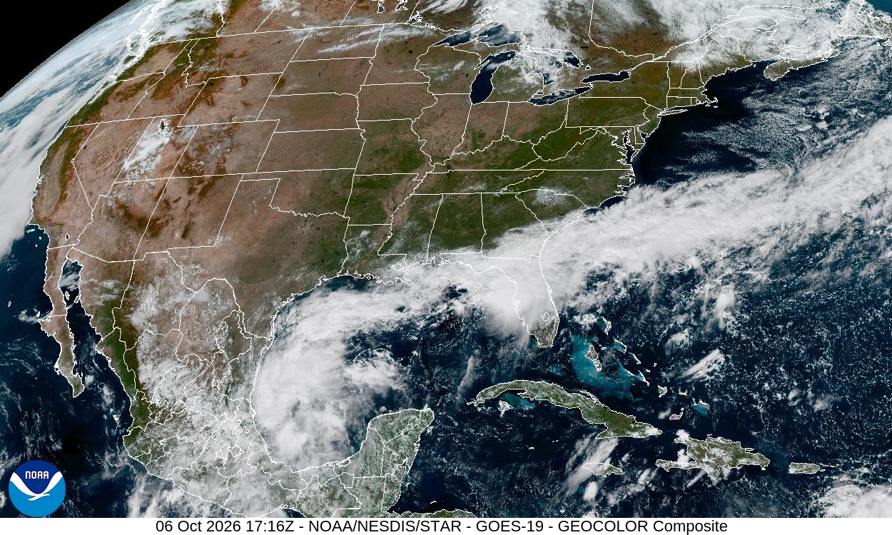
In this weather satellite photo of the continental United States, dense clouds clustered along a stationary frontal boundary are straddling the northern coastline of the Gulf of Mexico. An area of low pressure is on the southernmost tail end, spinning in the Bay of Campeche near the Yucatan Peninsula.
National Weather Service
Although we’re entering the final act of the Atlantic hurricane season, we’re once again watching a tropical system take shape. A tropical disturbance is developing over the southwestern Gulf of Mexico in the Bay of Campeche and is likely to become a tropical depression, or possibly Tropical Storm Isaias, soon. It currently has a nearly 100% chance of development in the next 48 hours.

If it continues to strengthen, the system not only could become the ninth named storm of the 2026 Atlantic hurricane season, it also might reach hurricane status and end the season’s unprecedented streak without a hurricane.
Article continues below this ad
A tropical disturbance in the southwestern Gulf of Mexico has a nearly 100% chance of development in the next 48 hours.
National Hurricane Center
As we enter the final eight weeks of the season, the southwestern Gulf is one of the areas we’ll be watching closely. The Bay of Campeche is a typical launching point for late-season tropical systems and can occasionally produce some big storms.
As we wait to see if Invest 92 becomes Tropical Depression Isaias, it’s worth noting that the southwestern Gulf is a favored area for tropical development this time of year. 🌴🌀
#txwx #hurricaneseason https://t.co/CENY1ryMha
— Mary Wasson (@Mary_Wasson) October 6, 2026
Where is the tropical system headed?
According to the National Hurricane Center, showers and thunderstorms are showing signs of organization in association with a broad area of low atmospheric pressure located over the southwestern Gulf. As of Tuesday afternoon, it was bringing gusty winds and areas of heavy rainfall to the western portions of the Yucatan Peninsula in southern Mexico.
Article continues below this ad
The most recent forecast has this area of low pressure drifting eastward into the central Gulf of Mexico on Wednesday before it turns toward the northern Gulf Coast by the end of the week.
A tropical disturbance in the Gulf of Mexico is projected to travel to the east-northeast over the next few days.
WeatherBell
“It is still too early to determine specific impacts to the northern Gulf Coast, but interests from the Florida Panhandle to Louisiana should closely monitor the progress of this system,” meteorologists at the National Hurricane Center said on Tuesday morning.
National Oceanic and Atmospheric Administration hurricane hunter aircraft are expected to investigate the system on Wednesday as well.
Article continues below this ad
What does this mean for Texas?
Not a lot will happen to Texas — at least for now. Most forecast models show the tropical low pressure system spinning in the Gulf for the next couple of days before turning north, with the potential for a landfall somewhere along the Louisiana or Mississippi coast.
For Central Texas, that likely means staying on the drier side, with limited moisture and lower rain chances as the system remains well to our east.
“Current steering flows suggest that this disturbance moves north northeastward across the Gulf,” meteorologists at the regional National Weather Service office for Austin and San Antonio said in the daily forecast bulletin Tuesday. “Though models strongly diverge on timing and track, so for now it is still a bit too far out to put any confidence in a particular model solution.”
Article continues below this ad
All eyes are on Invest 92 in the Gulf, which has a 90% chance of developing into a tropical cyclone over the next 48 hours.
The good news for Texas: the system is expected to stay east of the coast, with perhaps just a few showers along the coast Friday and Saturday. 🌧️
#txwx https://t.co/Lo4rEhR0Up
— Mary Wasson (@Mary_Wasson) October 6, 2026
For now, the best chance of seeing rain from this tropical low will be along the Texas coast. Scattered showers are possible Friday and Saturday, with rainfall totals generally ranging from a quarter-inch to an inch.
Record-breaking season of no hurricanes
The 2026 Atlantic season has set a record for the latest formation of a hurricane since satellite tracking began in 1966. By late September, we had gone longer without a hurricane than any previous season since 1914 — a year with the least active Atlantic hurricane season on record, with just one known tropical storm. This year, however, we’ve had eight tropical storms.
Article continues below this ad
The unusually quiet season has been largely driven by a strong El Niño, which has produced increased wind shear across the Atlantic and made it difficult for tropical systems to organize.