
HOUSTON – Anytime you hear the sentence, “There is a hurricane in the Gulf …”, most of us will immediately look to see if we will, as many times before, have to start gathering supplies and literally batten down the hatches.
This week, though, SE Texas will be merely a distant observer of what is brewing in the central Gulf.
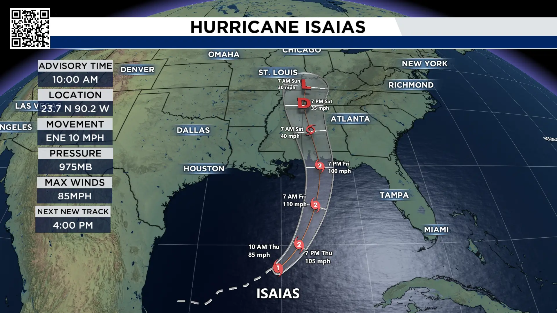 10am update on Isaias (Copyright 2025 by KPRC Click2Houston – All rights reserved.)
Hurricane Isaias formed Wednesday and is gaining strength as it starts to turn north, heading towards the Alabama/Florida Panhandle coastline.
Isaias is expected to track well east of Houston, with the storm’s stronger winds and heaviest rain staying closer to the central and eastern Gulf Coast.
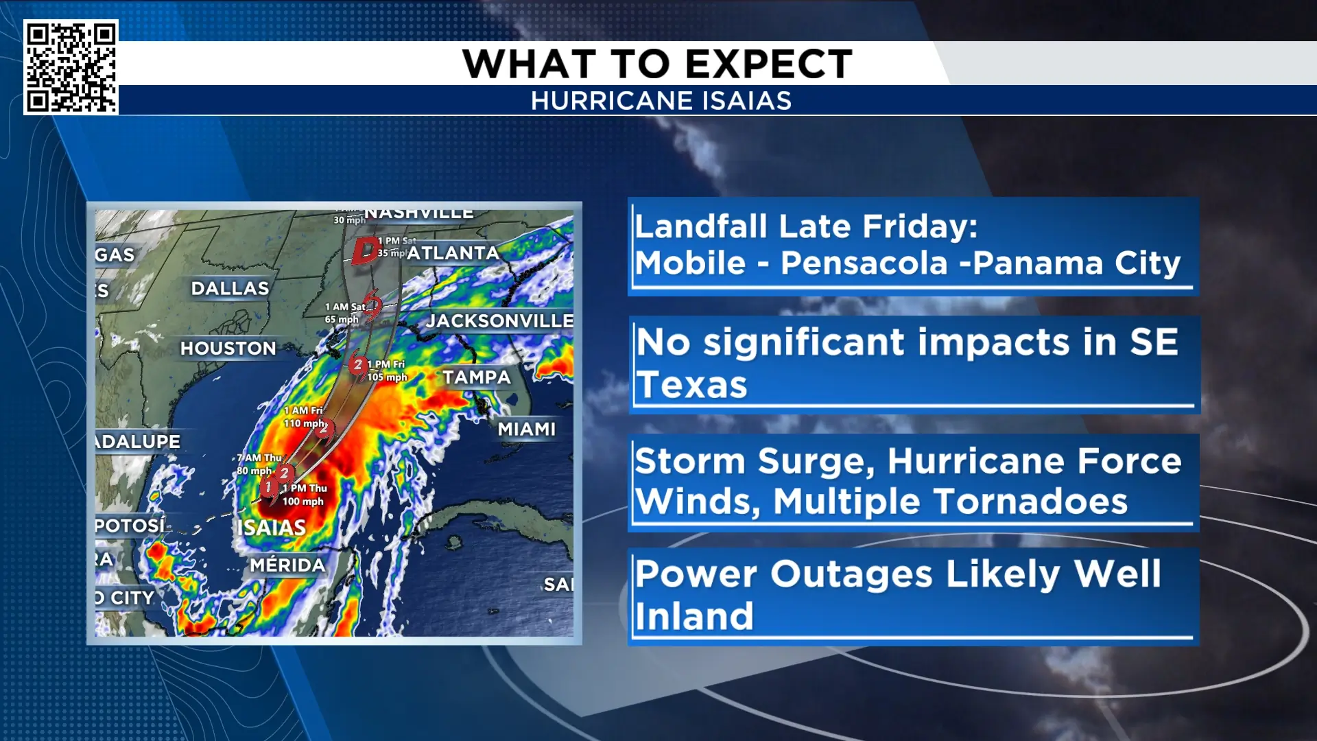 Isaias headlines of what to expect (Copyright 2025 by KPRC Click2Houston – All rights reserved.)
While impacts will be significant from the coast of Mississippi eastward into the Florida Panhandle, Houston will see very little to no impact.
Why is that?
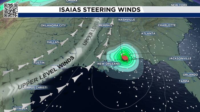
When you think about impacts of a tropical system, cut the storm into four quadrants: East sides of the center will see the worst impacts, while the western sides of the storm will see less significant impacts. Think of it as a “clean” side (west) vs a “dirty” side (east).
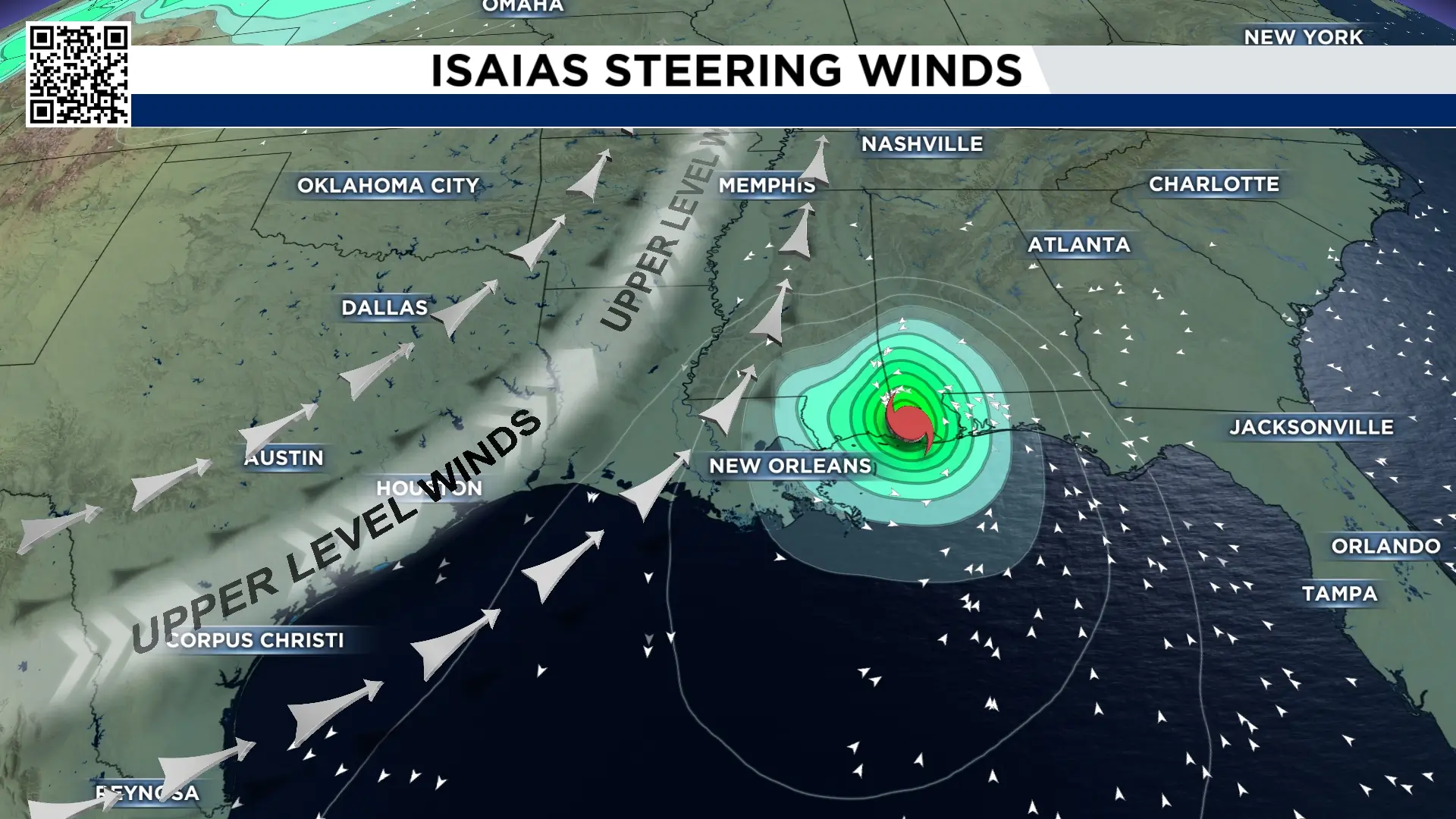 Isaias steering winds for the hurricane (Copyright 2025 by KPRC Click2Houston – All rights reserved.)
Houston will be on the clean side of the storm. Right now, two big atmospheric features are working together to pull Isaias away from Southeast Texas:
A dip in the jet stream/trough: A trough is developing over the south-central U.S. and northern Gulf Coast. Think of it as a large dip in the atmospheric river of wind in the air. That dip is helping create southerly flow that turns Isaias north and eventually northeast towards the AL/FL coast.
High pressure building to the east: A large area of high pressure over the western Atlantic is building westward. This creates a clockwise flow around the high, which helps push the hurricane northward instead of allowing it to continue west toward Texas.
Think of Isaias like a leaf floating down a river
The hurricane has its own circulation, but the larger atmospheric winds are the river carrying it. Hurricanes don’t have their own steering wheels, so they are at the mercy of the larger circulations around them.
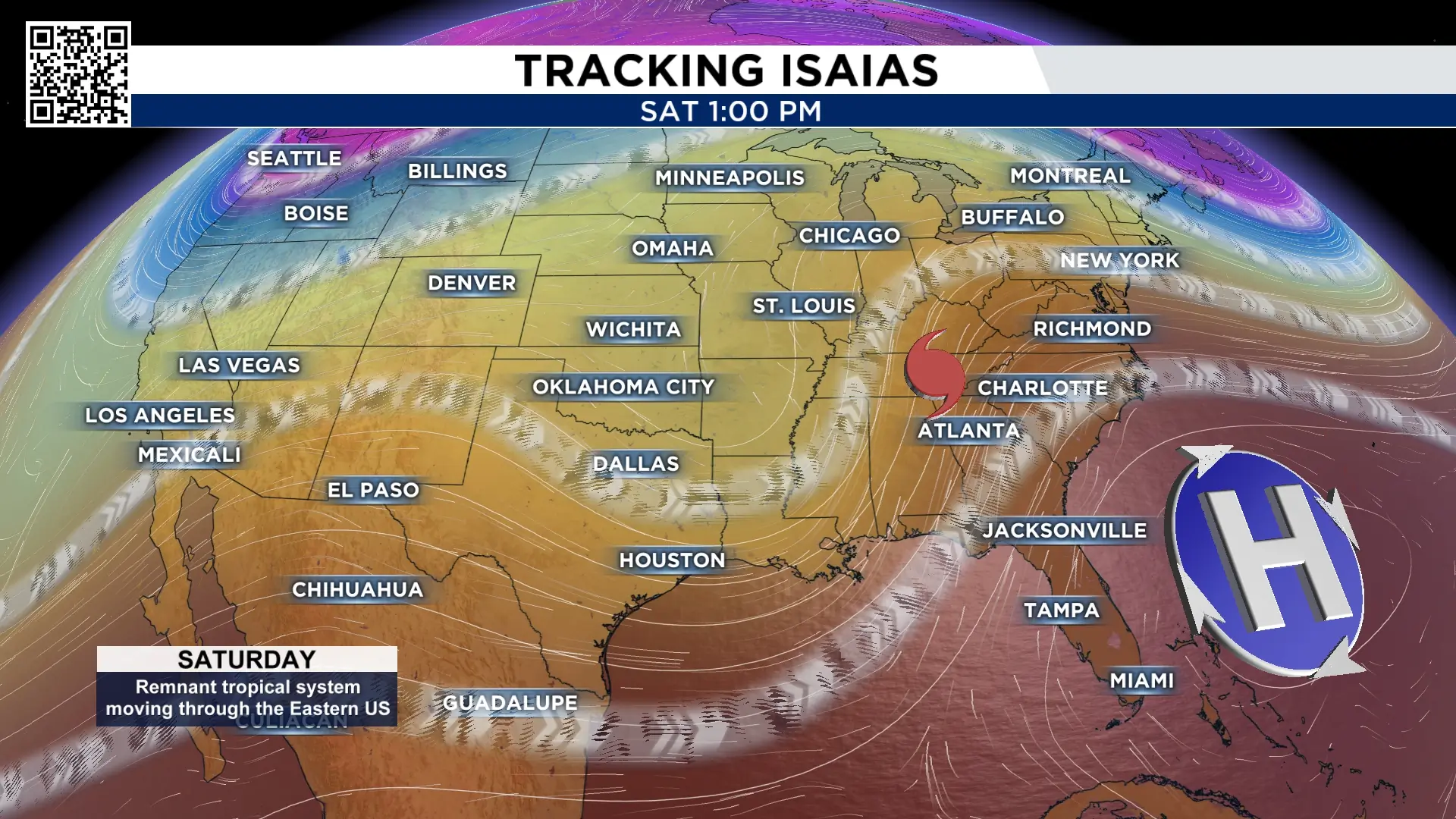 Steering currents for Isaias (Copyright 2025 by KPRC Click2Houston – All rights reserved.)
Right now, a dip in the jet stream is helping pull the storm north, while high pressure to the east is blocking it from simply continuing west toward Texas.
That combination is why the forecast track bends Isaias away from Southeast Texas and toward the northern Gulf Coast.
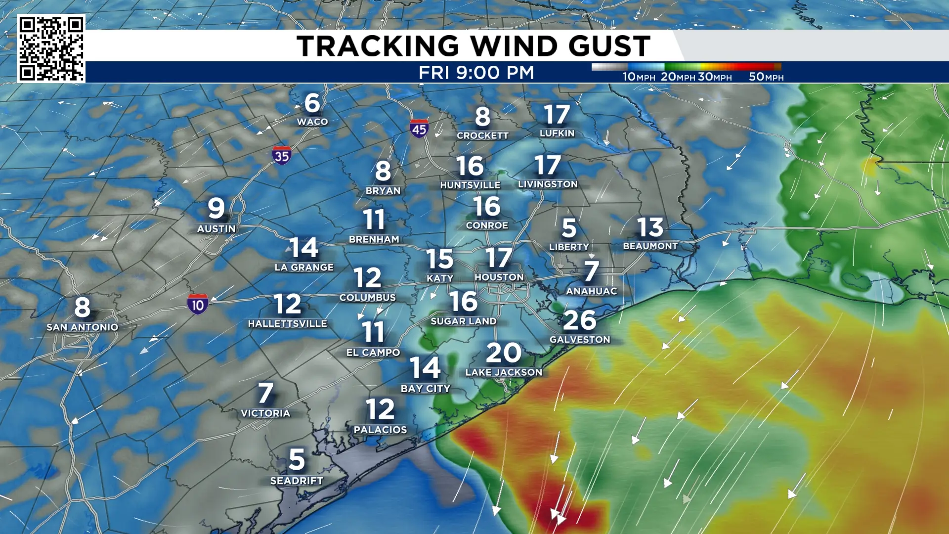 Friday wind gusts across SE Texas (Copyright 2025 by KPRC Click2Houston – All rights reserved.)
Coastal areas could still see some rougher surf, stronger winds and minor coastal flooding, but for most of us, Isaias should be more of a storm to watch on the map than one that creates major problems here.
Copyright 2026 by KPRC Click2Houston – All rights reserved.