
While the first few days of October were relatively cool in San Antonio, as afternoon temperatures hovered in the upper 70s to low 80s, bright sunshine has returned to the region this week, forcing temperatures back to above-average levels.
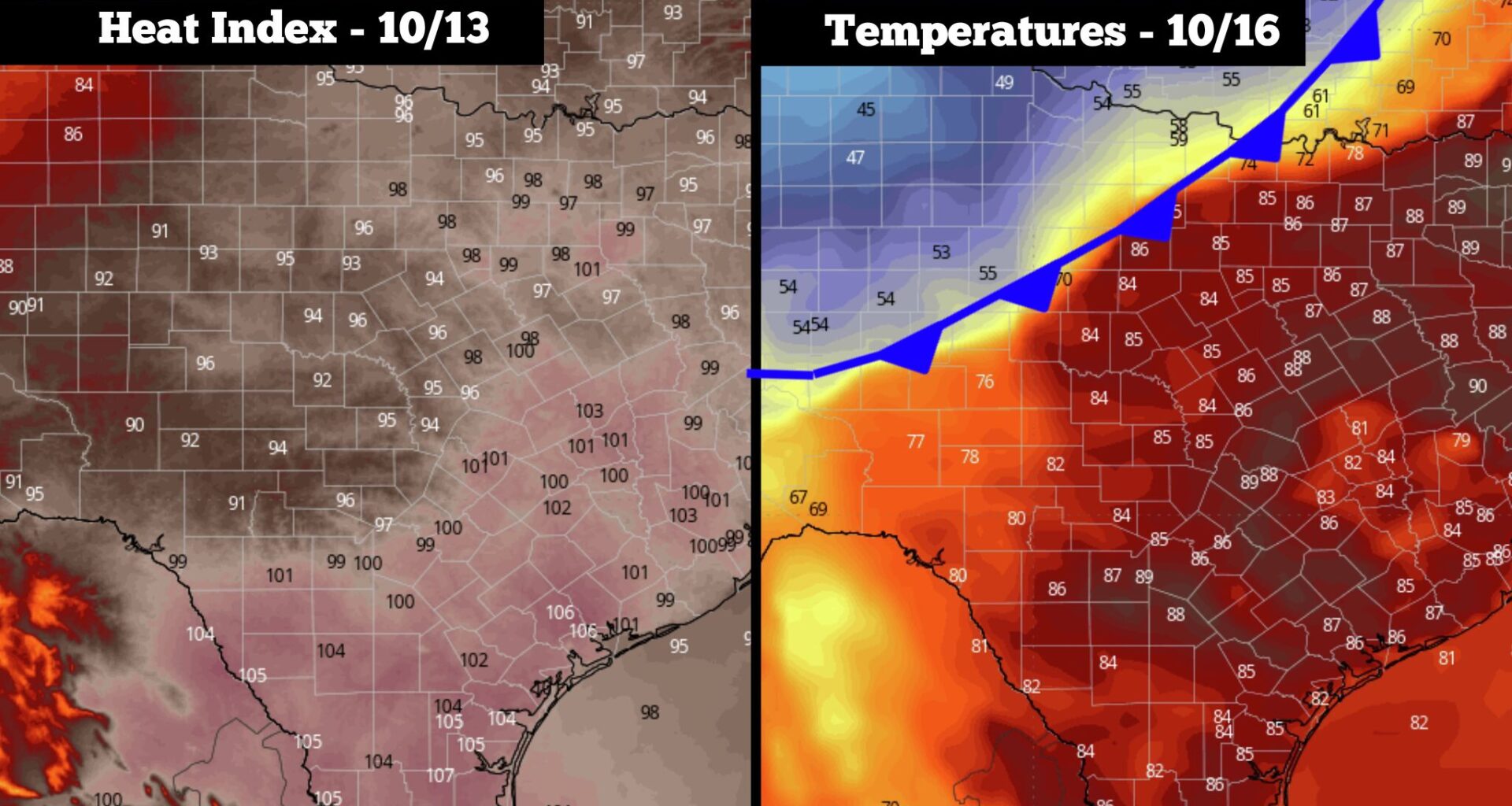
San Antonio neared the 90-degree mark both Wednesday and Thursday, and that trend is expected to continue Friday and into the weekend. However, that’s just the start of it. Unseasonably high heat will worsen early next week, as high humidity will force heat index values to near 100 degrees, a rarity for October.
Another cool and comfortable morning is expected in San Antonio on Friday, although not quite as cool as the previous couple days when predawn temperatures fell into the lower 60s. Instead, expect temps to sit between 67 and 70 degrees before 8 a.m., under mostly clear skies.
Temperatures will rise rather quickly throughout the day, reaching 80 degrees just after 10 a.m. Afternoon temperatures are expected to peak near 90 degrees, which is 5 degrees above average for Oct. 9. An isolated shower remains possible, but overall chances are less than 10%. Winds will be light, coming in from the northeast at 5-10 mph.
Very similar weather is expected into the weekend across South Texas. On Saturday, morning temperatures in the mid- to upper 60s will transition to afternoon temps near 90 degrees. Sunday temperatures are expected to rise by a degree or two, reaching 91 or 92 degrees. Winds will also increase on Sunday, with some gusts likely exceeding 20 mph.
Winds will turn southerly by the start of next week, which will cause Gulf and Pacific moisture to return to the area. While it won’t cause significant rain chances, it will force very high humidity levels back into South-Central Texas.
High temperatures are expected to stay in the lower 90s through the middle of next week. However, with summer-like muggy weather, heat index values are likely to rise to near 100 degrees each afternoon from Monday through Wednesday. Mornings will also become much warmer, likely hovering in the mid-70s each day.
Rain chances will stay low during this time, but a few isolated showers or pop-up storms are possible. Overall chances for precipitation in San Antonio will only be 10% to 20%.
Long-range weather models are showing a significant cold front in Texas by the end of next week. The front may start moving through West Texas next Friday, before reaching South-Central Texas that weekend. However, because this is still a week away, exact timing is still very uncertain.
While this front has the potential to be significant, capable of keeping peak daytime temperatures stuck the 70s, it also could bring widespread rainfall into Texas, but exact locations and the severity of the storms have yet to be determined.