
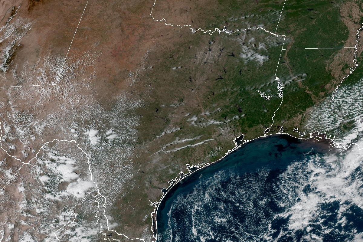
In this weather satellite photo of Texas taken around 1:45 p.m. Friday, the skies over the Lone Star State are largely cloud-free as a high pressure system keeps rain chances out of the picture.
Geostationary Operational Environmental Satellites/CIRA and NOAA
We’re all the way into the second week of October and Austin has gotten stuck with 90-degree temperatures again. Will true fall weather ever stick around for good? Here’s what the National Weather Service is looking at in the days ahead.

What’s the Saturday forecast?
We’ll have plenty of sunshine and dry weather in Austin but rain chances reappear the later we get into the upcoming work week, forecasters said. Our biggest influence on the weather will be a subtropical ridge of high atmospheric pressure that will squelch rain chances and keep daily temperatures well above normal.
Article continues below this ad
While Saturday is shaping up to be gorgeous, afternoon temperatures will approach 94 degrees, which would be several degrees warmer than normal for Oct. 10. Under mostly clear skies, nighttime temperatures will bottom out around 69 degrees overnight into Sunday morning.
“Expect continued hot weather with highs in the upper 80s north to mid-90s south over the next couple days as the subtropical ridge aloft maintains a hold over Texas,” the weather service wrote in a forecast bulletin posted online Friday.
As more moisture-rich air is pulled in by south-southeast breezes Saturday afternoon, “this subtle change will not be noticeable in the short term but will add the changing trends in the days to follow,” forecasters said.
Article continues below this ad
“While the daytime heat has been quite the nuisance for this time of year, the continental winds have been more helpful on allowing for a more pleasant and seasonal nighttime temperature,” the weather service said.
What’s the Sunday and Monday forecast?
Austin on Sunday should be sunny and breezy, with temperatures reaching 93 degrees amid south winds increasing to 5 to 10 mph in the morning and gusts as strong as 20 mph. Skies will turn partly cloudy Sunday night, but the gusty south-southeast winds persist.
Article continues below this ad
“While the subtropical ridge (of high pressure) maintains a good hold over Texas, undercutting it will be a deepening tropical flow,” the weather service said of the southerly winds. “This pattern is being accelerated slightly, thanks to a shift in the track of now Hurricane Simon over the eastern Pacific.”
Temperatures in Austin will climb into the lower 90s by 3 p.m. Saturday, according to the National Blend of Models, a composite weather forecast model.
National Blend of Models/Pivotal Weather
Forecasters explained that Simon’s “more direct charge toward the coast of Mexico appears to be having an influence on the moisture influx into Texas for early next week.”
By Monday, Austin could have a 20% chance of afternoon rain on an otherwise mostly sunny day. Temperatures are still expected to reach the lower 90s, and the gusty south-southeast winds should still be in place.
Article continues below this ad
The weather service is anticipating that “by Monday, a deeper moist (atmospheric) layer could get established, and the mild morning lows return to the warm and muggy conditions seen in September.”
A more troubling prospect, though, is that “the highs are also expected to still punch into the 90s for many areas, so there could be some heat index values pushing toward triple digits again by Monday afternoon,” forecasters said.
What’s up with the remnants of Simon?
Will the remnants of Hurricane Simon affect Texas at all? So far, forecasters expect that “what’s left of Simon gets pulled across the high terrain of Mexico, missing us mainly to the northwest.”
Article continues below this ad
“However, with the sharp topography over the west coast (of Mexico) likely destroying Simon rather quickly, the fragments of the remnants could get hung up in Mexico for several days, leading to a potential heavy rain event when our next cold front is suggested to arrive about nine days out,” the weather service said in its bulletin Friday.
Forecasters said a similar situation arose in 2015 when (Hurricane) Patricia generated “two well-separated heavy rain events over the area from two
different cold fronts.”
“So, for now, the extended forecast continues with heat, humidity, and some spotty rains, but the next big pattern change may be just over the horizon,” the weather service said.
Article continues below this ad