
Shown are the potential heat index values across Texas on Tuesday
WeatherBell
Over the past few days, light northeasterly winds have brought dry air into Southeast Texas, lowering humidity and cooling morning temperatures. However, the wind is about to shift back to the south, bringing high levels of atmospheric moisture back into the region.
The rising moisture will significantly increase humidity. Heat index values will exceed 100 degrees this week, a rarity for mid-October. Scattered showers and thunderstorms will also become possible, though rainfall totals will likely stay light. Here’s what you can expect.
Sunday’s forecast
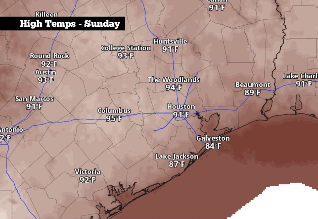
Before the heat arrives this week, Sunday will be the most pleasant day to be outside. Morning temperatures will sit comfortably in the upper 60s to near 70 degrees under mostly clear skies. Temps will rise steadily, likely reaching 80 degrees as early as 10 a.m. before high temps top out in the low 90s.
Article continues below this ad
Shown are the expected high temperatures across the region on Sunday
Pivotal Weather
Scattered clouds are expected in the afternoon, but no rain is expected. Winds will be breezy, 10 to 15 mph, with some gusts over 20 mph. These southerly winds will also transport high amounts of atmospheric moisture into the region, which will become more noticeable by the start of the work week.
Comfortable weather is expected to continue Sunday evening, as temperatures hover in the 80s through 8 to 9 p.m. Overnight lows will fall into the low 70s, staying slightly warmer than the past few nights.
High heat and scattered storms
Atmospheric moisture will continue to rise each day this week, bringing brutal humidity. On Monday, High temperatures will once again reach the low 90s, but with heat index values rising as high as 99 degrees. Tuesday and Wednesday will be even warmer, with heat index values as high as 103 degrees.
Article continues below this ad
Overnight lows won’t cool off much, only dropping into the upper 70s on Tuesday and Wednesday nights.
The increased moisture will also bring scattered showers and thunderstorms, especially as the seabreeze develops each afternoon. Houston’s rain chances will be near 30% on Monday, rising to around 40% on Tuesday and Wednesday. The scattered nature of this activity will limit rainfall totals, with most areas likely to see less than a half-inch of rain throughout the week.
A possible cold front coming?
As a low-pressure system moves across the central and northern U.S., a cold front is likely to move through Texas by the end of the week. While timing remains uncertain, the front is most likely to move through Houston by late Friday or early Saturday.
Article continues below this ad
The strength of the cold front also remains uncertain. However, it could bring fall air back into the region. High temperatures could fall into the 70s by next weekend, with lows in the 50s and 60s.
Additionally, the front may bring a chance of scattered showers and thunderstorms, some of which could be strong. Houston will have about a 30% to 40% chance of storms on Friday, before drier air likely moves in behind the front over the weekend.