
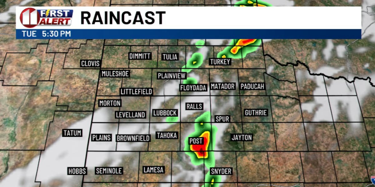
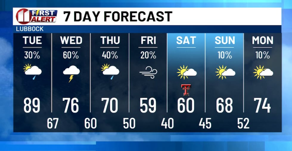
LUBBOCK, Texas (KCBD) – A strong storm system will move into the region beginning Tuesday afternoon, bringing an unsettled weather pattern with the potential for severe thunderstorms and significant rainfall through Thursday.
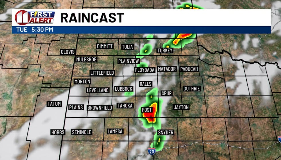
Activity will remain quiet through much of Tuesday morning and early afternoon, but conditions will become increasingly unstable as an upper shortwave trough moves over the region late in the day. Thunderstorms are expected to develop during the late afternoon and evening, primarily along and east of the I-27/US-87 corridor.
 KCBD(KCBD)
Some storms during the afternoon and evening could be strong to severe, producing wind gusts up to 60 mph and heavy rainfall. A low-level jet stream will help sustain overnight convection, with the main severe threat being damaging wind gusts from wet microbursts. All hazards remain in play, including the potential for flooding.
 KCBD(KCBD)
Heavy rain poses a significant threat, particularly where storms train over the same areas. Atmospheric moisture levels are running 90 percent or higher than average for this time of year, with precipitable water values near or exceeding 1.75 inches. The greatest heavy rain and flooding threat through midnight Tuesday will be generally along and east of I-27.
 KCBD(KCBD)
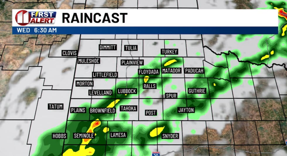
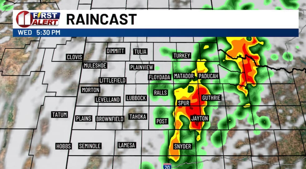
Precipitation will back-build westward early Wednesday morning before becoming generally confined east of the Caprock Wednesday evening through Thursday afternoon. Severe storms remain possible during this entire timeframe.
 KCBD(KCBD)
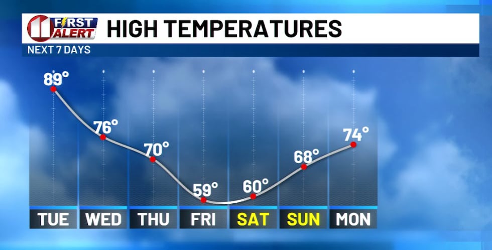
Rain should end everywhere in the forecast area by early Friday morning. Much cooler fall-like temperatures with highs in the 50s and 60s are expected Friday and Saturday, before temperatures rebound Sunday into early next week.
 KCBD(KCBD)
Tuesday will be the last warm day before this significant cooldown takes hold.
 KCBD(KCBD)
Copyright 2026 KCBD. All rights reserved.