
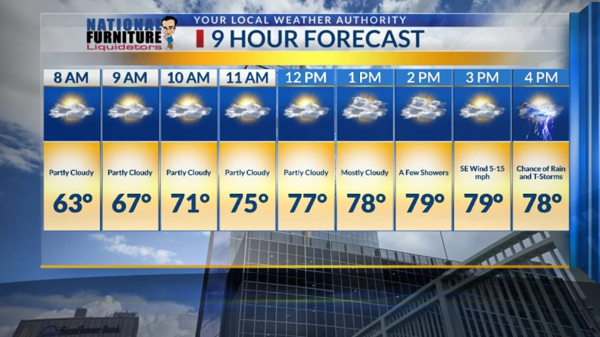
After a nice, cool, fall weekend, we are in for a little warm up this week. During an “El Nino” year (and this one is a strong El Nino pattern), the Southwest U.S. is likely to have a wetter than average fall and early winter. That will certainly be the case this week with a pretty good chance of rain Monday, Thursday, Friday, Saturday, and Sunday. Here’s your exclusive 9-Hour Forecast for Monday:

TONIGHT: The skies will be partly to mostly cloudy. We have a slight chance of a few raindrops here and there… nothing major. The SE winds will range from 5-10 mph, and the low will be a warmer 56.
FORECAST: Monday will be partly to mostly cloudy and warmer with a high of 79. The relative humidity will be relatively high, so expect that muggy feel. The atmosphere becomes unstable, so we’ll have a chance of t-showers. The SE winds will range from 5-15 mph with gusts near area storms. Tuesday will be partly cloudy and warmer with a high of 84. I am downgrading the chance of t-storms to isolated area storms. Wednesday will be the warmest day of the week with a high of 86. We’ll have only a slight chance of an isolated area t-storm. Thursday will be partly to mostly cloudy with a chance of t-showers and a high of 85. Friday will be 79 with scattered t-showers. Saturday will be 75 with scattered t-showers.

Copyright 2026 Nexstar Media, Inc. All rights reserved. This material may not be published, broadcast, rewritten, or redistributed.For the latest news, weather, sports, and streaming video, head to KTSM 9 News.