
AUSTIN, Texas — As October wraps up this weekend, we are already feeling some seasonal changes. The heat is still kinda here but doesn’t quite have that same punch as it did in August and September. Cold fronts are now back in the realm of possibilities, and we’ve already had one real taste of fall, and it was truly glorious. But this is a bit of a strange Fall season so far! We just wrapped up the hottest September Austin has literally ever seen, and now we’re in the midst of a pretty dry and warm October. We had one sizable rainstorm roll through Austin, right around weekend 1 of Austin City Limits, resulting in a giant mud pit.
So why has it been so dry? We’re in the middle of the strongest El Niño in human history! Shouldn’t El Niño be bringing in rainier weather by now?
In short, yes, it should be. But El Niño Southern Oscillation (ENSO), the El Niño, Neutral, and La Niña cycles, is a long-term trend, not a pattern of change. Meaning that not all El Niño seasons are rainy and cooler, and not all La Niñas are warm and dry. (INSERT: https://cbsaustin.com/news/local/strongest-el-nino-in-decades-possible-later-this-year-what-it-means-for-texas)
ALSO| Civil rights leader Dolores Huerta passed away at 96
The reason we’ve been so quiet is pretty simple. We’ve had dominant areas of high pressure overhead these past few weeks. In certain situations, they can create roadblocks in the atmosphere, refusing to let cold fronts or rain chances move through the country. This results in drier and hotter weather. This is why it has been so quiet besides the lone October heavy rain event.
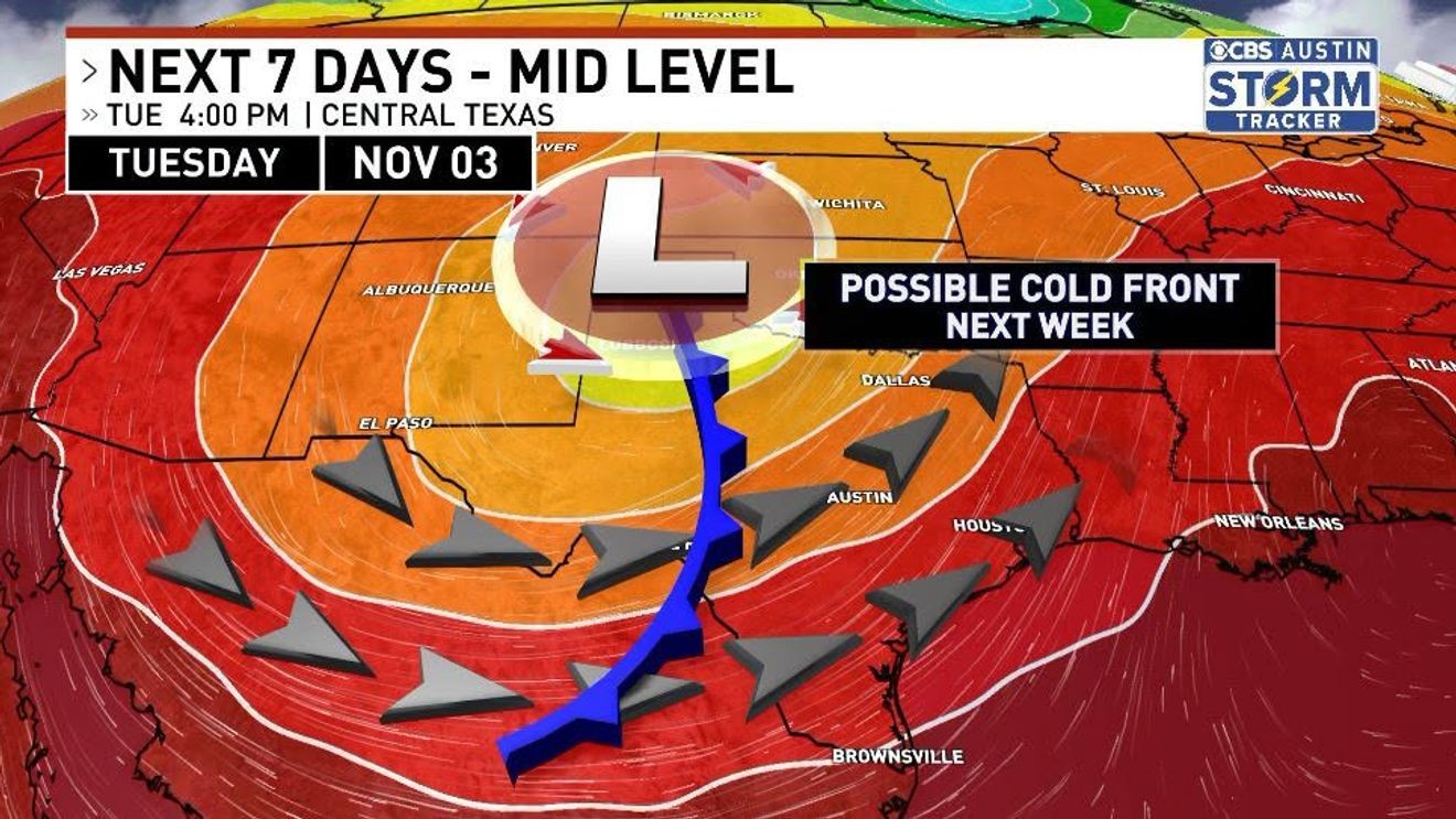
The term El Nada is being thrown around a bit. While we are still missing 65% of our expected rainfall for the average rainy season in Central Texas, we still have a way to go before we can declare this rainy season a bust. In fact, coming up next week, we’re expecting an Election Day cold front. The timing is still a little uncertain, but those who are voting on Election Day could face some issues, so get out there and vote early!
As for our rainy season, we have a lot of work to do. We have a long-term drought still lingering in Central Texas, with critically low levels in the Edwards Aquifer as proof of that. Be careful about calling this Super El Niño a “bust” because we are honestly just getting started.
El Niño and La Niña don’t really affect the summer months because of the sheer number of times that high pressure has a chokehold on the state of Texas. El Niño favors rainier falls/winters/springs because of the tendency for the strong Pacific jet stream to carry in more rainfall and humidity. But if a high-pressure system is overhead, it will send that moisture north in the form of cold fronts and severe weather during the summer months. But once things cool down, high pressure becomes less dominant, and eventually we get cold fronts and thunderstorms. Since this summer was so exceptionally hot, with a record-breaking September, highs are still being stubborn. We only had our first cold front shortly after ACL wrapped up.
The moral of the story is: don’t count your chickens before they hatch. Enjoy the cooler weather with this next cold front and get out and vote! Just not in a thunderstorm.