
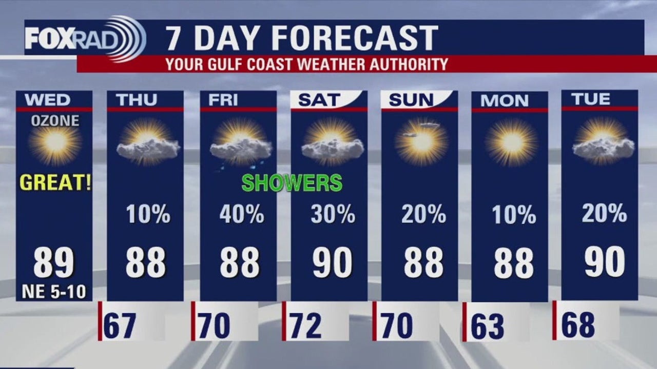
HOUSTON – Prepare for another sunny and dry afternoon for Wednesday as highs reach 90s. Humidity will begin to increase tomorrow along with rain chances. The highest chance of showers will be on Friday.
Beautiful pattern continues
Today will be another exceptionally warm and sunny day across the Houston-area, continuing a trend of well-above-average October temperatures. Afternoon highs will climb to around 90 degrees, making it feel more like late summer than mid-fall.
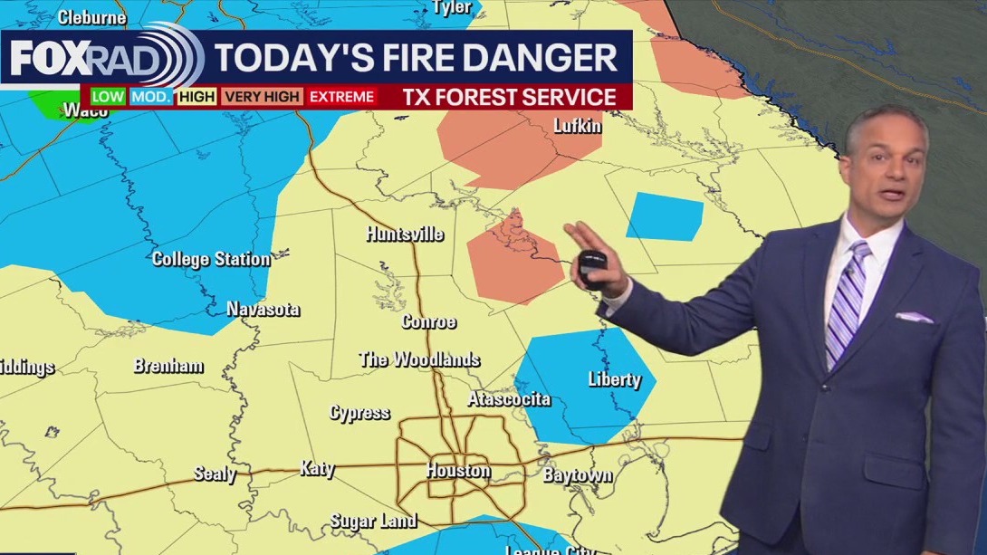
Burn bans in place
The persistent dry pattern and high temperatures have elevated the fire danger, prompting burn bans for many counties.
This high-risk scenario means that any sparks or uncontrolled flames could quickly escalate into a serious situation if anyone were to spark a grass or forest fire.
Some changes on the way
A slight shift in the air mass begins tomorrow, bringing in a noticeable bump in moisture from the Gulf. This increase in humidity will precede the long-awaited return of rain, which develop late this week. Expect the chance for scattered showers and storms to rise on Friday and continue into the weekend, providing the best opportunity for rainfall this month.
The Source: Your Gulf Coast Weather Authority