
AUSTIN (KXAN) — You can feel the humidity in the air now with dew points back in the 60s again in Central Texas Monday.
While clouds revealed plenty of sun Monday afternoon, the abundance of moisture will help redevelop widespread cloudiness overnight. Overnight lows will be warm and stay in the upper 60s or low 70s for most areas, roughly 20 degrees warmer than nights should be in Central Texas this time of year.
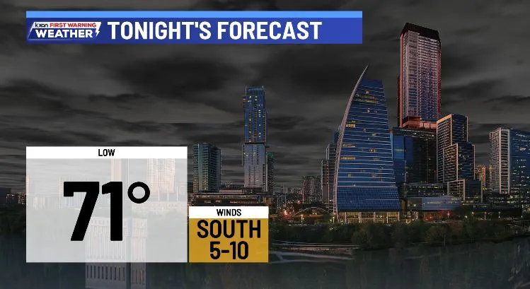 Tonight’s forecast
Tuesday
Tuesday should be close to a repeat of what we had Monday. Expect a cloudy morning with the addition of a few sprinkles in the air. The morning clouds will give way to afternoon sun with highs heading for the mid-80s again.
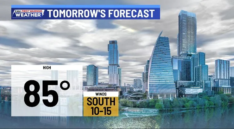 Tuesday’s forecast
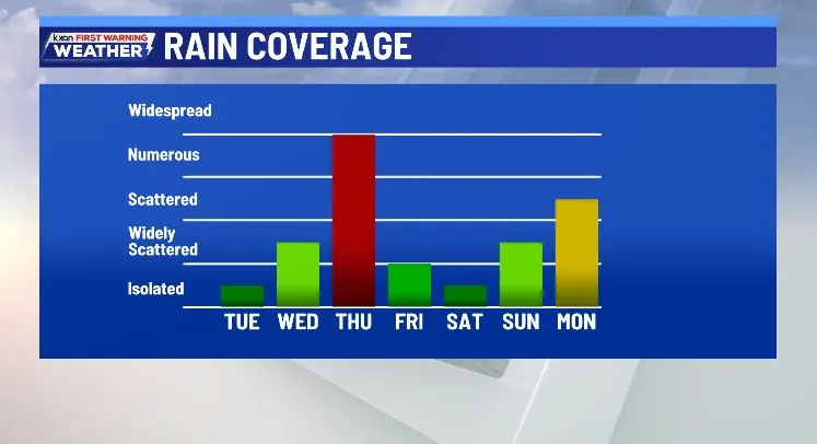
We’ve only got a 10% chance that those sprinkles turn into a measurable shower, but otherwise most of the area is dry tomorrow.
Rain and storms Wednesday through Thursday night
A strong Pacific storm will start to approach Central Texas on Wednesday, bringing a few showers and isolated storms during the day. Rain coverage will be limited to just 30% of the area during the daylight hours with an otherwise mostly cloudy sky giving way to partly sunny skies in the afternoon.
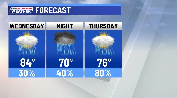 Rain chances Wednesday through Thursday
Higher storm chances work into the Hill Country Wednesday night into early Thursday morning when a few stronger storms are possible.
 Storms possible late Wednesday night into Thursday morning
A level 1 out of 5 severe weather risk is in place for the Hill Country Wednesday night into early Thursday morning.
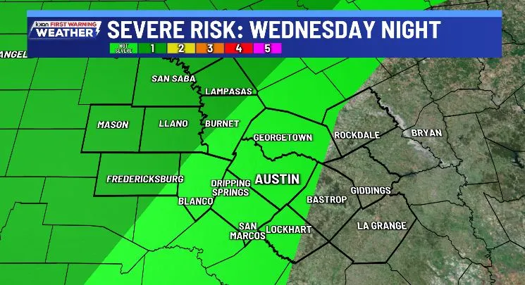 Severe risk Wednesday night into early Thursday morning
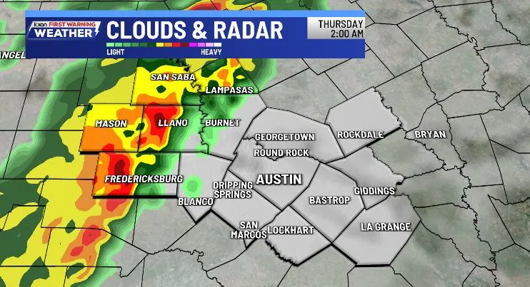
Thursday brings the most widespread rain, but it appears that it will take some time to move out of the Hill Country and into the Austin metro and east. In fact, most of the morning may be dry near and east of I-35.
Plan on increasingly wet weather as we head later into the day and into Thursday evening with locally heavy rain being a threat for much of the area.
A level 2 out of 4 flash flood risk is in place for most of Central Texas on Thursday.
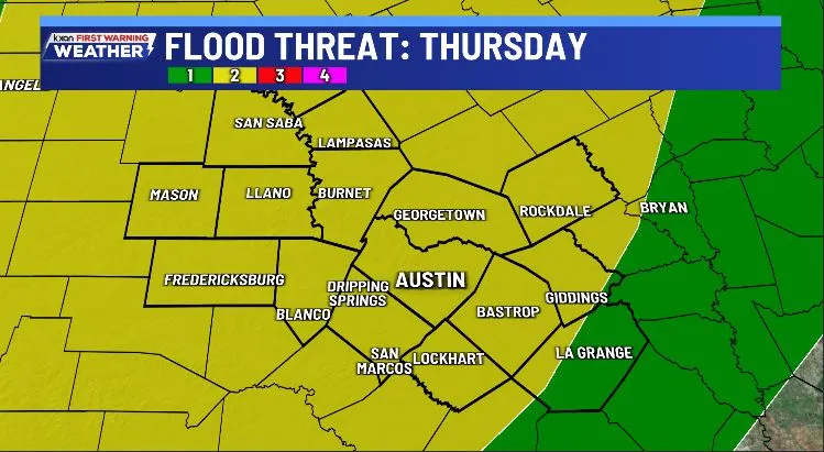 Flood Risk Thursday (WPC)
Rainfall totals by Friday morning should be 1-2 inches for most areas, with localized totals up to 3 inches.
Widespread rain should be gone by dawn on Friday, but a few lingering showers are possible as our cold front pushes through and out.
Another storm brewing?
Sunday into next Monday we could see yet another storm bringing rain to Central Texas. Details are slim this far out, but the potential for heavy rain.
 Rain chances for the next week
Stay with the First Warning Weather Team as we take you through both periods of wet weather.
Friendsgiving Challenge!
Our KXAN Friendsgiving Challenge is underway and the Central Texas Food Bank needs your help more than ever. Donate to the Evening Team or Morning Team in our friendly competition for a great cause.
We thank all of you who have made donations for this important fundraiser.
 2025 Friendsgiving Challenge
Get the latest weather updates
You have many ways to stay up to date with your Central Texas forecast. Download the KXAN First Warning Weather app for the latest updates and alerts, subscribe to our weather newsletters and download and login to the KXAN+ smart TV app for a custom forecast page.
Follow the KXAN First Warning Weather team on Facebook, Twitter and Instagram.
You can also follow our meteorologists’ individual accounts for livestreams and a little bit of what goes on behind the scenes:
Follow our meteorologists!