
With a weak La Niña forecast to be in place this winter, what does it mean for rain in Corpus Christi?
CORPUS CHRISTI, Texas — Heading into the cooler season in Corpus Christi means relief from the relentless summer heat, generally pleasant conditions outdoors, and the traditional ‘dry’ season in this part of the world.
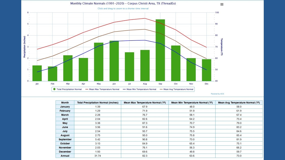
I’m going to define Winter as December, January, and February in this article. That’s meteorological Winter. While winters are generally mild/pleasant here, they are also dry.
In fact, they are the three driest months of the year on average.

This season, a weak La Niña a is forecast to be in place during the Winter months. What does that mean??
La Niña is a teleconnection we can use to gain insight into what a season may offer. La Niña is part of ENSO (El Niño Southern Oscillation). We look to the Eastern Equatorial Pacific waters to help define whether we are in a La Niña or an El Niño.
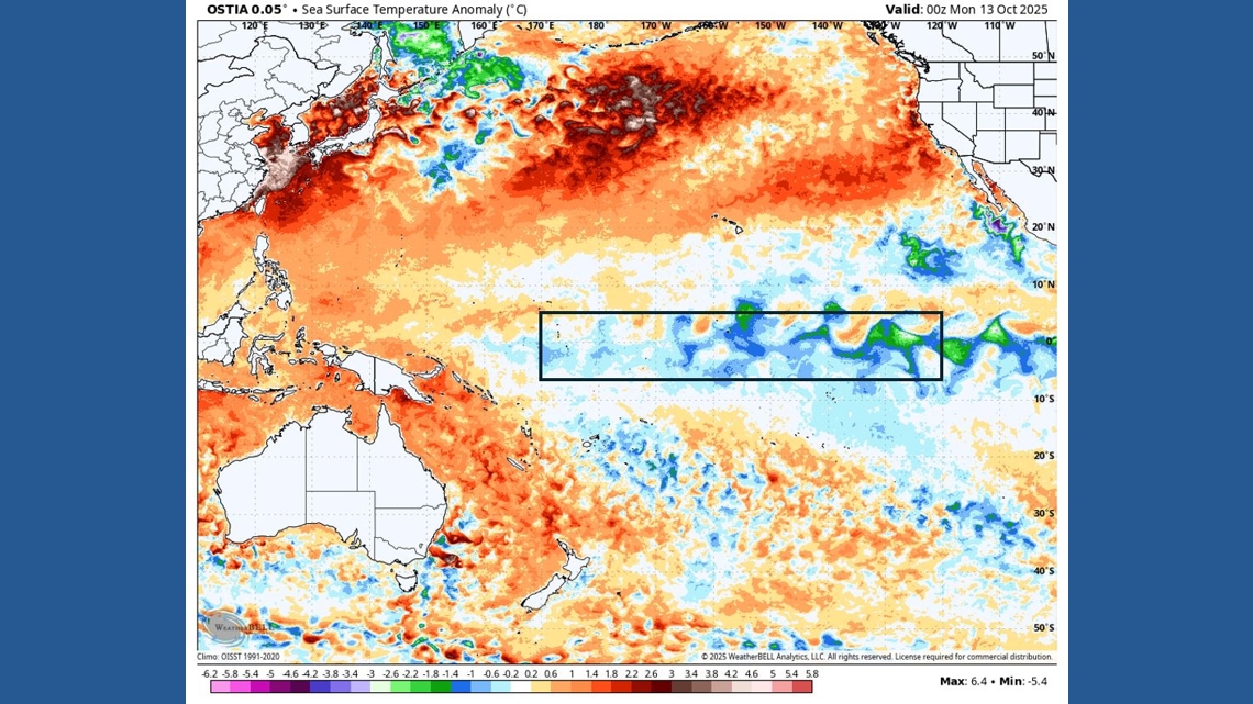
If sea surface temperatures are above average by more than 0.5°C, it’s an El Niño. If SSTs are below average by 0.5°C, it’s La Niña. We look at ENSO region 3.4 to determine this. In the map below, you can see that the SSTs are running below average in this part of the Pacific.

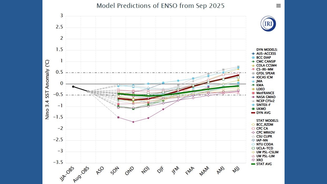
La Niña’s can be weak, moderate, or strong based on how far below average SSTs are running. ‘Weak’ is defined as 0.5-0.9°C below average, moderate as 1-1.4°C below average, and strong as 1.5-1.9°C+ below average. This season, a weak La Niña is forecast, with SSTs running between 0.5 and 0.9°C below average.

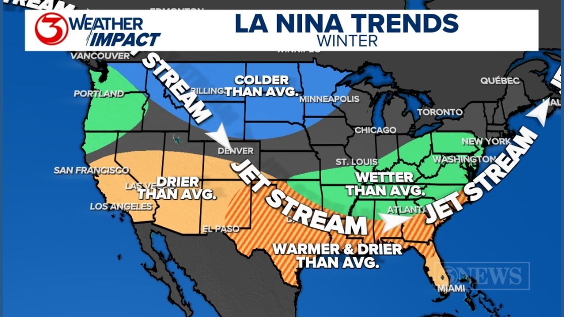
In the Continental US, La Niñas tend to deliver a wavier jet stream across the CONUS during the winter season. This can mean big temperatures fluctuations and active weather patterns for areas the jet stream is set up over.
In South Texas, we are typically removed from the storm track and we (on average) get drier and milder than average winters. This does not mean that every day will be warm and that there will be zero rain. It just means that as a whole, the numbers should be warmer/drier than what typically already happens. Remember, Winter in Corpus Christi represents the three driest months of the year on average.

For this article, I went back and gathered all of the La Niña years I could gather, dating back to 1950, categorized them into weak, moderate, and strong, and compared those years to how much rain fell in Corpus Christi in the Winter months (DEC/JAN/FEB).

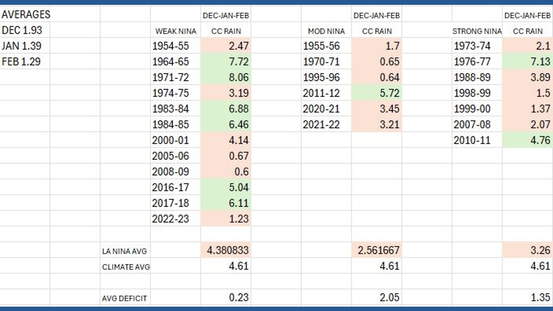
When you look at the data, it is true that as a whole, Corpus Christi runs drier than average during the Winter when a La Niña is present. But it’s not a hard rule. 9 of the 25 La Niña years on record saw above average rainfall in Corpus Christi – that’s about 36%, meaning that 65% of the time, it’s drier than average. That’s why the outlooks call for below average rain totals during La Niña.
It’s not a guarantee, but a bet on the average.
At a time when rain is sorely needed, given our water situation, heading into a La Niña Winter is not ideal. However, we only average 4.61″ of Winter rain, anyway. So, it’s not the end of the world and it’s possible we exceed expectations.

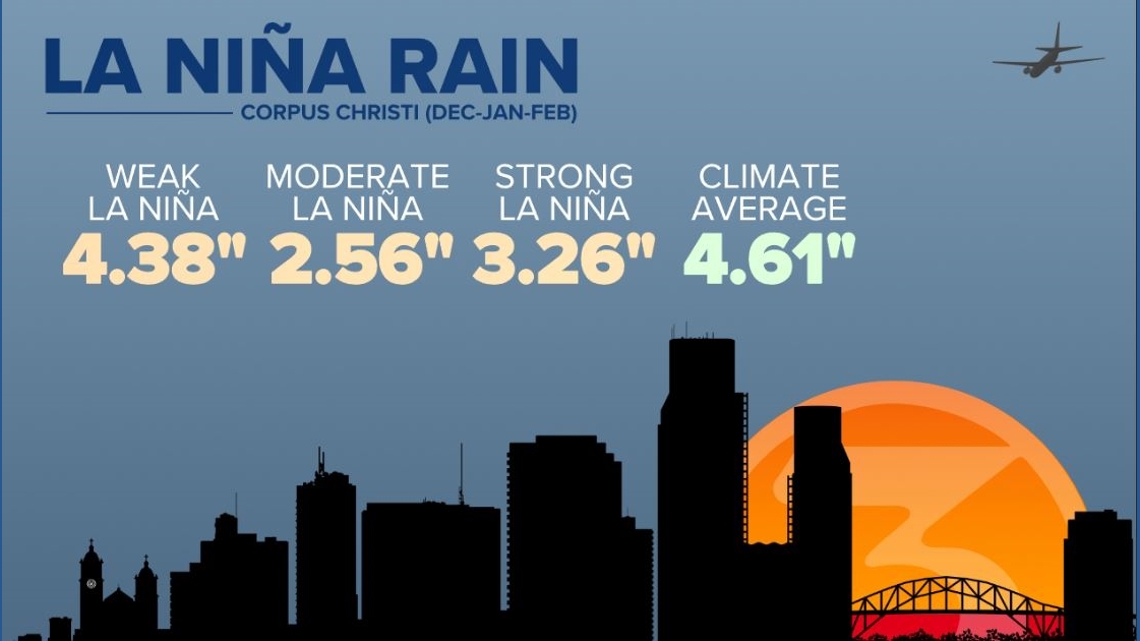
This is just a tidy graphic of the data presented above. On average, a weak La Niña rain gives Corpus Christi the closest to average rainfall. Moderate La Niñas are the driest.
I enjoy the airplane I put in to the top right corner. It makes me happy. There is no other reason for it in there. It also serves as a reminder that I need to update the skyline silhouette to reflect the new Harbor Bridge. I hope this information was useful to you and thank you for taking the time to read.