
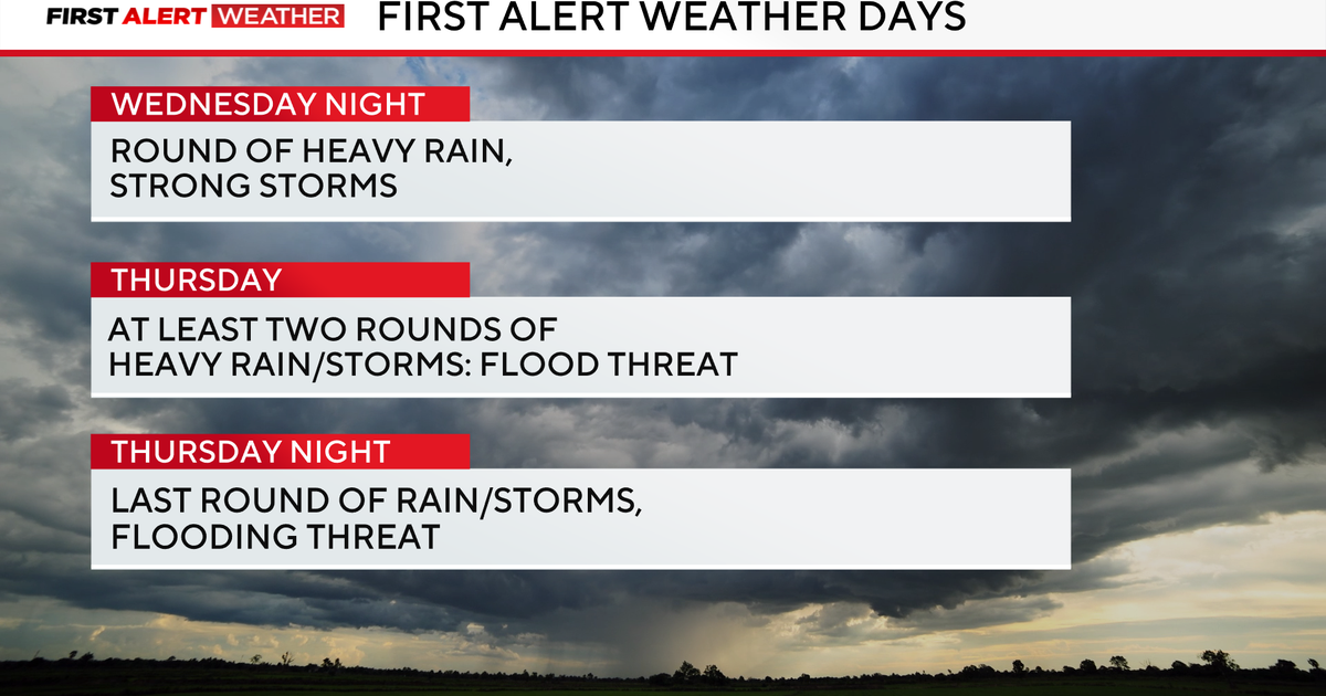
Strong storms and heavy downpours increase flood chances across North Texas today and tomorrow.
A First Alert Weather Day is in effect on Wednesday and Thursday due to those storms.
The National Weather Service Storm Prediction Center issued a Level 1 out of 5 threat for the potential of isolated severe storms. Not everyone will see a severe storm, but it is advised to prepare for damaging winds, hail and flooding Wednesday night. The risk for a tornado is very low, but non-zero.

CBS News Texas
It’s going to be muggy and warmer than average on Wednesday. In fact, the morning low was in the 60s, which should be the high temperature for this time of the year. Temperatures will continue to climb into the upper 70s by lunch and into the low 80s by the afternoon. Cloud cover will blanket the area and winds will come from the south at 5 to 10 mph.
Tonight, the storms fire up and continue through the early morning commute tomorrow. More rounds of rain will be expected, which will lead to a flooding risk. Some lingering rain is possible through Friday morning.
Once the cold front moves through on Friday, cooler weather will settle in for the weekend. The next big weather maker is on the way Sunday into Monday, which will bring another round of heavy rain and an additional flooding concern. Thanksgiving week will have a cooler and more unsettled weather pattern.

CBS News Texas
More from CBS News