
 Austin weather: Storms are coming
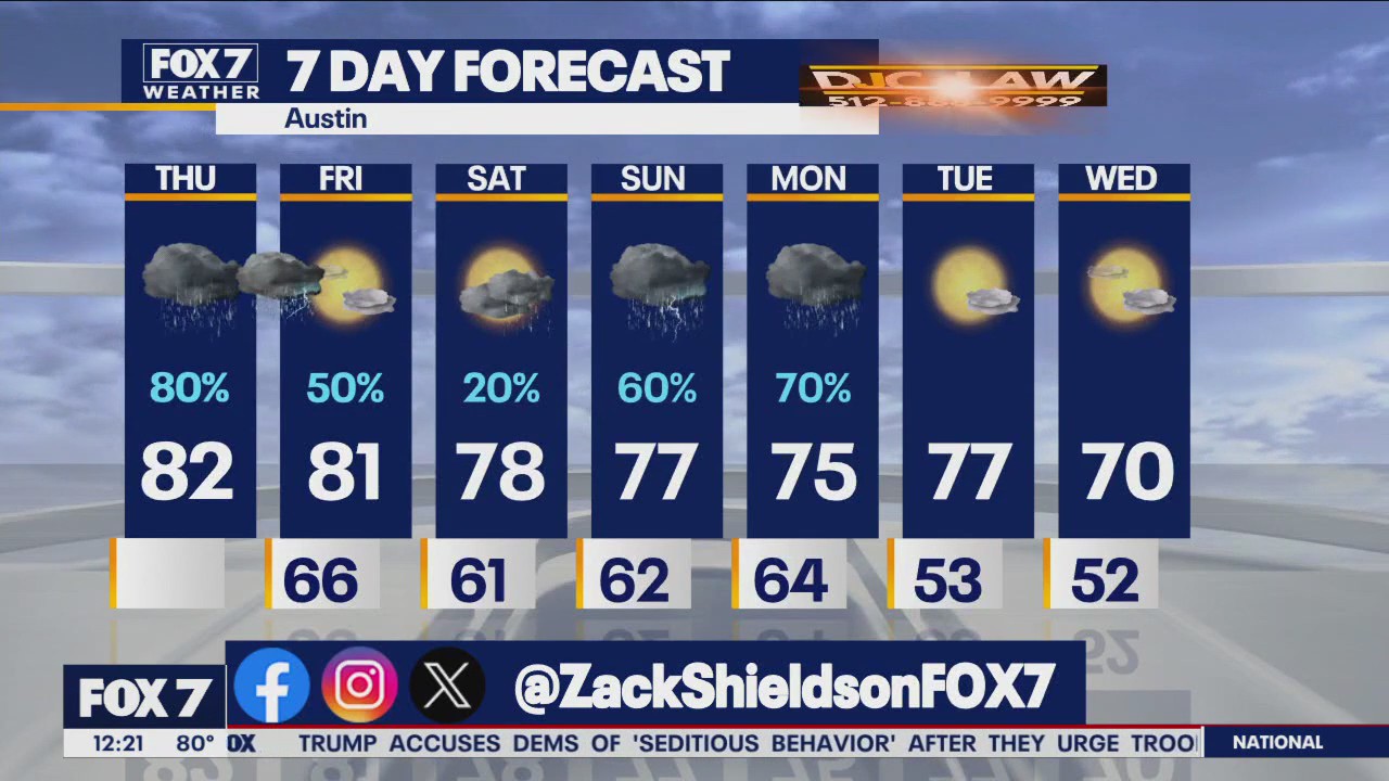
It’s storm day! The wait is almost over for rain and storms. Mostly cloudy, warm, humid and breezy before the line of storms rolls in. Zack Shields has all the details in his full forecast.
AUSTIN, Texas – It’s storm day! The wait is almost over for rain and storms, so get those umbrellas and rain gear ready.
What we know:
It’ll be mostly cloudy, warm, humid and breezy before that line of storms rolls in.
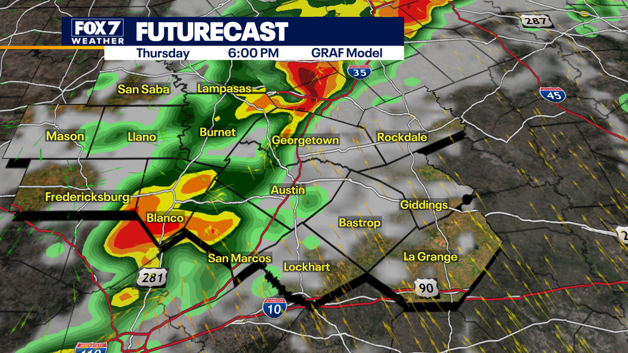
The storms will come in from the west, hitting the Hill Country by mid-afternoon today (Nov. 20), then the I-35 corridor around early evening and finally over our eastern counties by mid-evening.
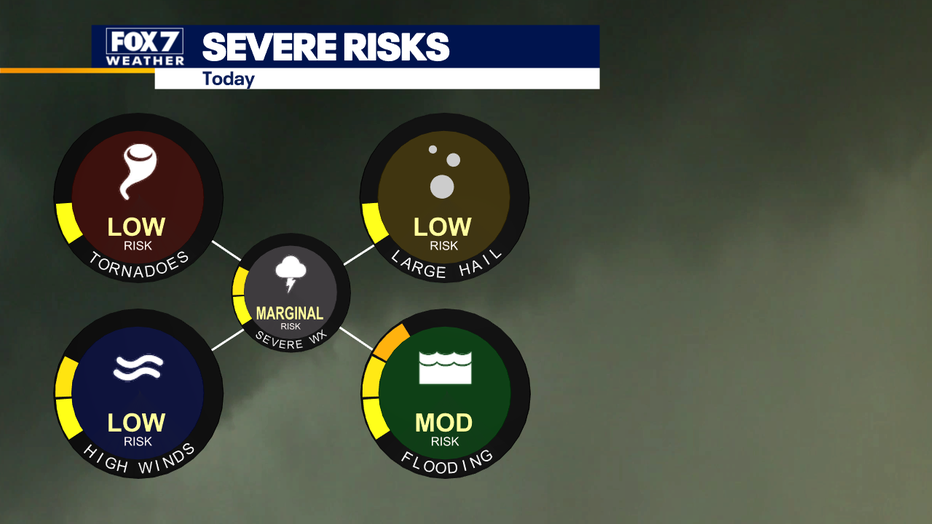
Today is a Level 1 out of 5 severe weather risk for gusty winds, heavy rain and lightning.
We will also see a Level 2 out of 4 for flooding risk. Some portions of our viewing area could see one to three inches of rain today and tonight.
Dig deeper:
The National Weather Service says there is a Flood Watch in effect for portions of South Central Texas until 6 a.m. Friday (Nov. 21).
The NWS is warning to be aware of excessive runoff resulting in flooding of rivers, creeks, streams, and other low-lying flood-prone locations.
The NWS is predicting rainfall amounts of one to two inches, with isolated totals of up to five inches possible in the western Hill Country and Southern Edwards Plateau.
What you can do:
Track your local forecast for the Austin area quickly with the free FOX 7 WAPP.
The design gives you radar, hourly, and 7-day weather information just by scrolling.
Our weather alerts will warn you early and help you stay safe.
The Source: Information from meteorologist Zack Shields