
An area of low pressure is currently moving through the southwestern United States and is expected to move into the Southern Plains by Sunday evening.
This system will gradually increase rain chances, with isolated shower activity expected west of 35 Sunday afternoon. Rain is then expected to overspread the rest of the North Texas region late Sunday evening and overnight into Monday morning.
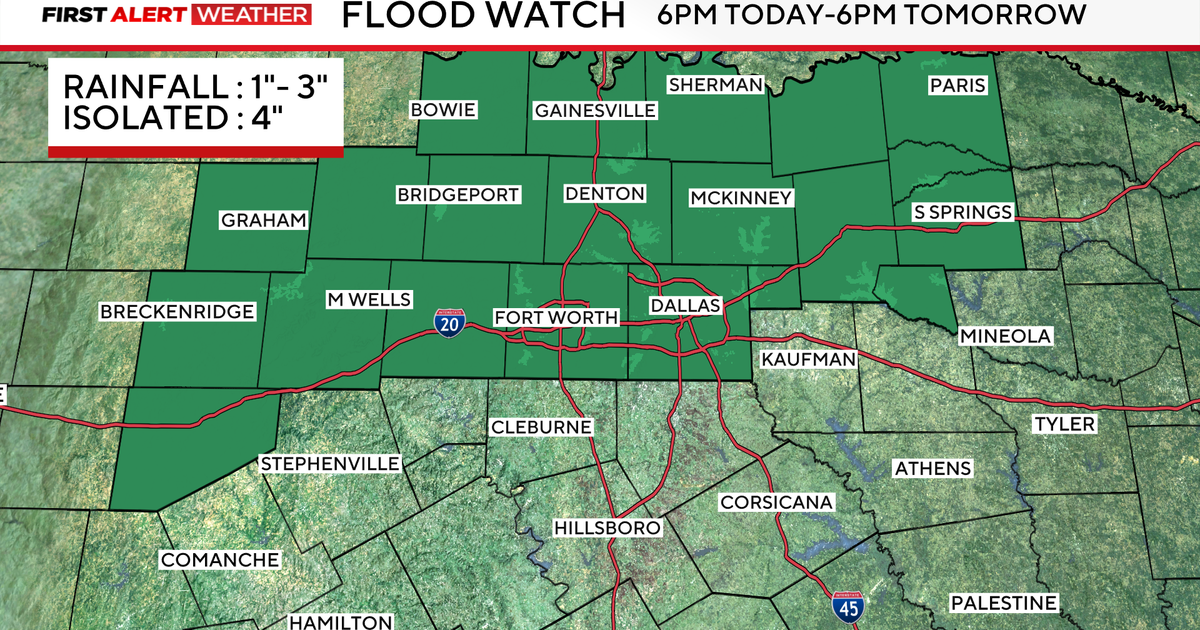
Due to the soil being already saturated from heavy rains late last week, the flooding threat is elevated, and a flood watch is in effect for the DFW Metroplex and other areas that saw the most significant rainfall last Thursday.

The threat for severe weather is a marginal, 1 out of 5 threat Sunday, for areas west of 35, where gusty winds and large hail will be the primary threats.
That threat for severe weather increases Monday for areas in southeastern North Texas and eastern Central Texas.

The areas highlighted in yellow are spots the First Alert Weather Team will be watching for threats of large hail, damaging winds, and a low-end tornado threat.
For DFW and areas west, most will be done with rain by about midday Monday, then it’ll be dry through midweek.
By Tuesday, we’ll be looking at more sunshine, with highs near 70.
Wednesday is our cooler day, but we’re still dry. Highs top out in the upper 50s.
For the Thanksgiving holiday, highs will be right close to average for this point in the year, topping out in the lower 60s, with mainly sunny skies.
Our next shot for showers looks to build into next weekend.

More from CBS News