
October is halfway over, yet the weather in South Texas continues to feel a lot more like May or early June. So far this month, San Antonio’s daily high temperatures have reached an average of 91.6 degrees, and temps have hit at least 90 degrees in 14 of the first 15 days of the month.
Thankfully, some minor relief from the heat is coming Thursday. High atmospheric pressure is weakening overhead, so instead of afternoon temps in the lower 90s, much of the region will be two to four degrees cooler, staying in the mid- to upper 80s. Are we finally done with the 90s for the year, though? Here’s a closer look at this week’s forecast.
Thursday and Friday
We’re expecting another cool and comfortable morning early Thursday as predawn temperatures drop into the mid-60s across the San Antonio metro area. The Hill Country will once again be cooler, with temps starting out in the mid- to upper 50s across Boerne, Kerrville and Fredericksburg.
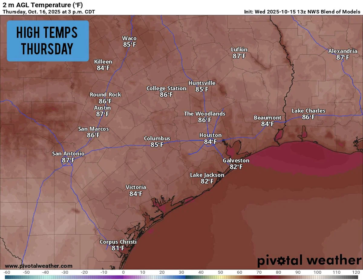
More atmospheric moisture is expected to slide in from the Gulf of Mexico. Humid air heats up at a slower rate than dry air, so this increasing moisture will keep temperatures in check. San Antonio temps won’t rise into the lower 80s until nearly noon, before continuing upward to around 86 to 87 degrees by the late afternoon.
While the air outside won’t necessarily feel “cool,” afternoon temperatures could be the lowest we’ve recorded in San Antonio in more than a month.
A few clouds will stream in from the south throughout the afternoon, but skies are still expected to stay mostly sunny. A few showers are possible to the southeast toward Victoria, but rain chances in San Antonio will be close to zero.
Warmer Friday: Temperatures peaking in the 80s could be short-lived. Morning temps will stay comfortable, hovering near 67 degrees in San Antonio, but afternoon highs are expected to rise back to around 90 degrees. That’s eight degrees above average for this time of the year.
Rain chances stay near zero on Friday, but our attention will turn to a weak cold front moving into the Texas Panhandle by Friday afternoon. Heading into the weekend, this front will become a bigger factor to the Texas weather forecast as a whole.
Weekend forecast
The weak cold front will hover across parts of the Panhandle and North Texas on Saturday. San Antonio, on the south side of the front, will continue to experience unseasonable heat as temperatures climb to 92-93 degrees under mostly sunny skies. The air will be humid, too, so expect heat index values of up to 95 degrees.
The front will slide across Central and North Texas Saturday night, bringing a chance of scattered thunderstorms, a few of which could turn severe across Northeast Texas. Severe weather chances are much lower for San Antonio, and overall rain chances will likely stay at 20% or less.
The cold front is expected to move through the San Antonio area overnight and into Sunday morning. This could bring gusty winds from the northeast, but temperatures will be cooler only by a few degrees, likely topping out in the upper 80s to near 90 degrees on Sunday.
Stronger front? Confidence is building over the possibility of a more significant cold front making its way through San Antonio by Oct. 23-25. Long range forecast models show the potential of a more significant drop in temperatures and good rain chances during this time. Be sure to stay with expressnews.com/weather for updates.
This article originally published at South Texas afternoon temps will climb only into the 80s today. How long will that last?.