
Happy last day of meteorological fall, y’all.
This season has been warmer than normal with an average temperature of 73 degrees. In fact, this fall is likely to take second place as the warmest fall on record for DFW Airport, but Sunday’s temperatures will factor in before that becomes official.
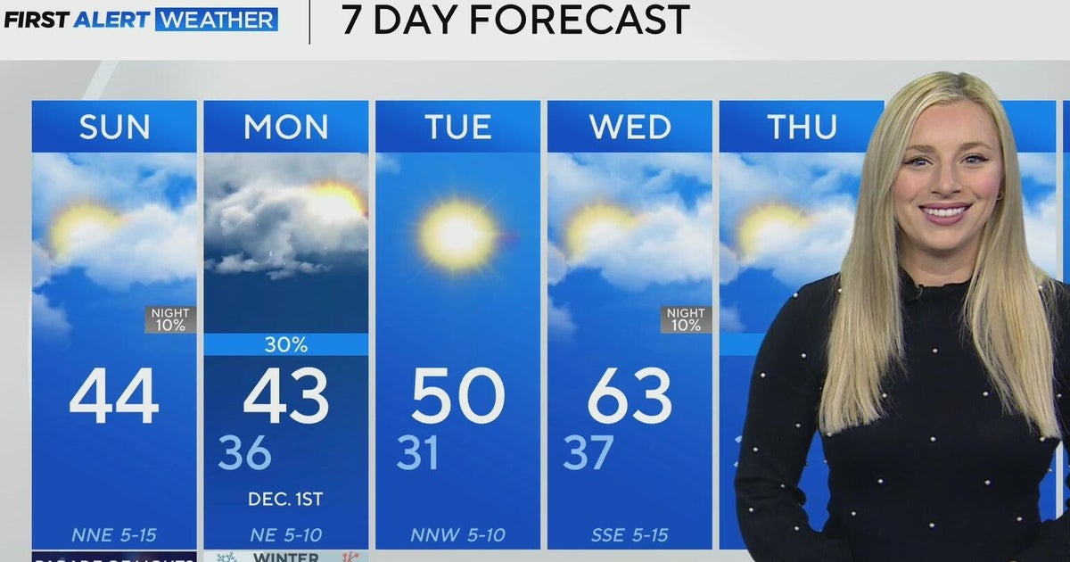
The average low is about 42 degrees, and the average high is 62 degrees; however, Sunday will be significantly below that. The strong cold front that passed through Saturday has brought in a cold, arctic air mass, causing temperatures to drop about 20 degrees in the past 24 hours.
Sunday morning, the low was in the low 30s, but the winds gusting around 25 mph from the northeast made the feels like value, known as wind chill, dip into the low 20s.

Cold weather is expected all day. The high is forecasted to reach the mid-40s for the metroplex, but the wind chill value will be in the upper 30s. Breezy northeasterly winds will gust up to 25 mph, and skies will have a few clouds.
If you’re planning on going to the Parade of Lights in Fort Worth, bundle up!

Monday will be chilly as well. Overnight, there may be a few spotty showers. Though temperatures across North Texas are expected to dip into the 30s once again Monday morning, it is looking like the likelihood of any wintry precipitation falling and sticking to the ground is slim.
Roads are forecasted to stay too warm for any travel impacts; however, it is something the First Alert Weather Team is keeping a very close eye on.
Temperatures climb through midweek until another cold front moves through the area late Wednesday or early Thursday. More rain and cooler weather are in the forecast for the end of the week.
