
LUBBOCK, Texas (KCBD) – Sunday morning was the coldest of the season so far. The Lubbock airport dropped to 24°. This seasons previous lowest temperature was 30° on both November 10 and 27. Sunday was the coldest at Lubbock since 22° on February 22.
Sunday’s low wasn’t a record for November 30. That’s 10° on the date in 1918. The high of 34°, however, was a record. Prior to yesterday, Lubbock’s November 30 record-coldest high-temperature was 35° (on the date in 1971).
It wasn’t the coldest November high temperature for Lubbock. That was recorded November 28, 1976, when the high was just 24°. 2.4 inches of snow fell that day and there was up to 4″ of snow on the ground. November 1976 was Lubbock’s second snowiest on record with 9.1 inches for the month. Second only to November 1980 with 21.4 inches.
Though a few tiny snowflakes were spotted around Lubbock Sunday morning, no snow was observed at the Lubbock airport this November.
 Not as cold as yesterday, but highs five to ten degrees below average for the start of December.(KCBD First Alert)
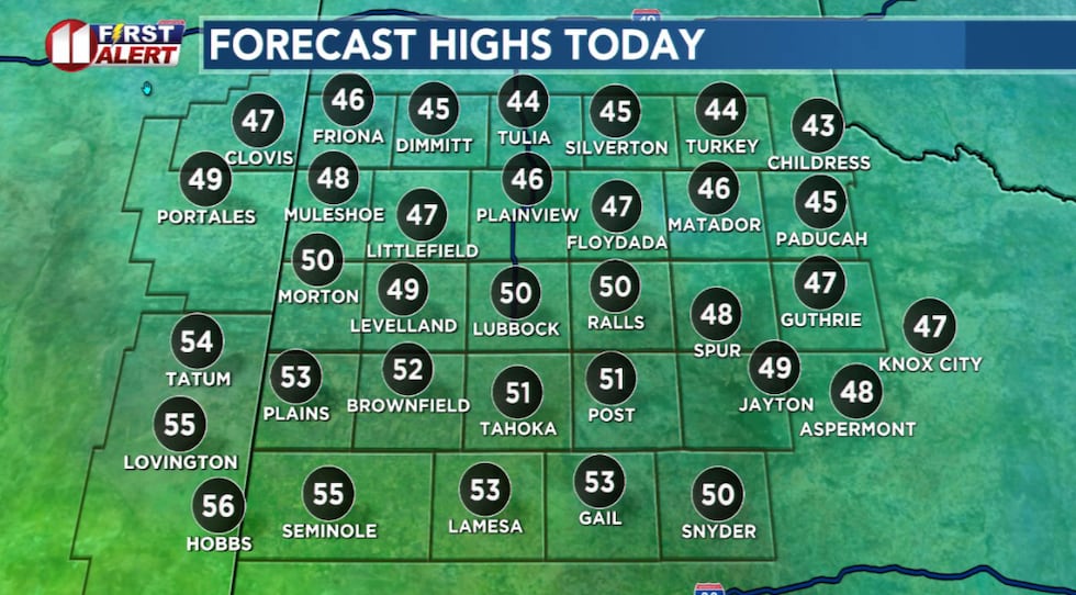
After another cold morning, the clouds will gradually give way to a mostly sunny afternoon. The afternoon will not be nearly as cold with highs five to ten degrees below average for the start of December.
A reinforcing shot of colder air, however, will arrive from the north late today which will make tonight slightly colder.
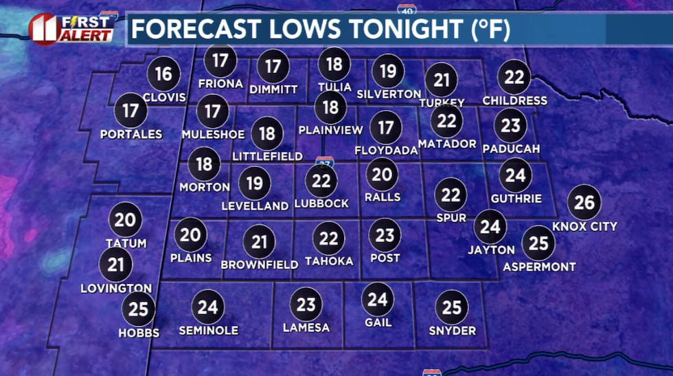 Another cold night on the way with lows eight to ten degrees below average for early December.(KCBD First Alert)
Tomorrow a strong southwesterly breeze will push temperatures to around five degrees above average.
Due to the afternoon wind, we are issuing (tongue in cheek) an “Inflatable Santa Alert” for Tuesday afternoon. Seriously, it wouldn’t hurt to make sure there are no items on your property that might tumble away or even become airborne in a strong wind.
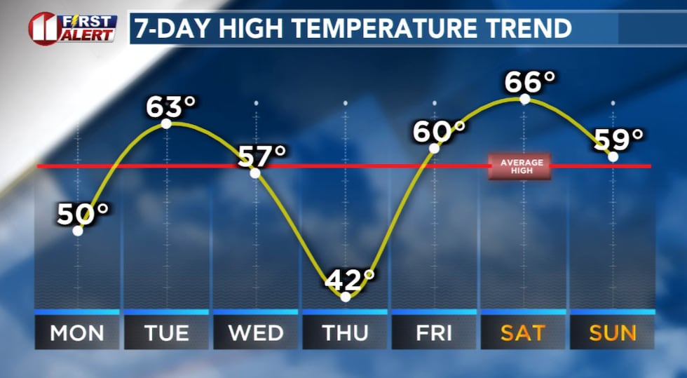 High temperatures forecast for Lubbock through the weekend.(KCBD First Alert)
Less wind and a slightly cooler afternoon, with temperatures peaking near average, is on the way Wednesday.
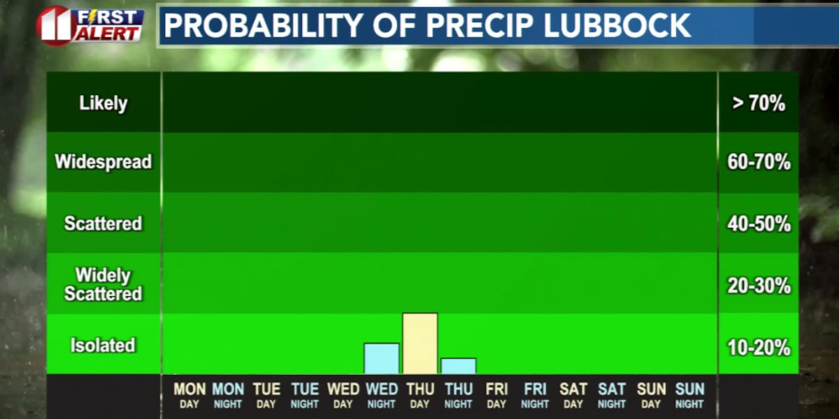
Our next potential precipitation producing system will move toward West Texas Thursday. The path it ends up on will determine if our area receives any precipitation.
It’s a familiar story. As it moves eastward, the storm may pass to the north of us. This would result in a nearly zero chance of measurable precipitation but would likely create very breezy to windy conditions Thursday and possibly Friday.
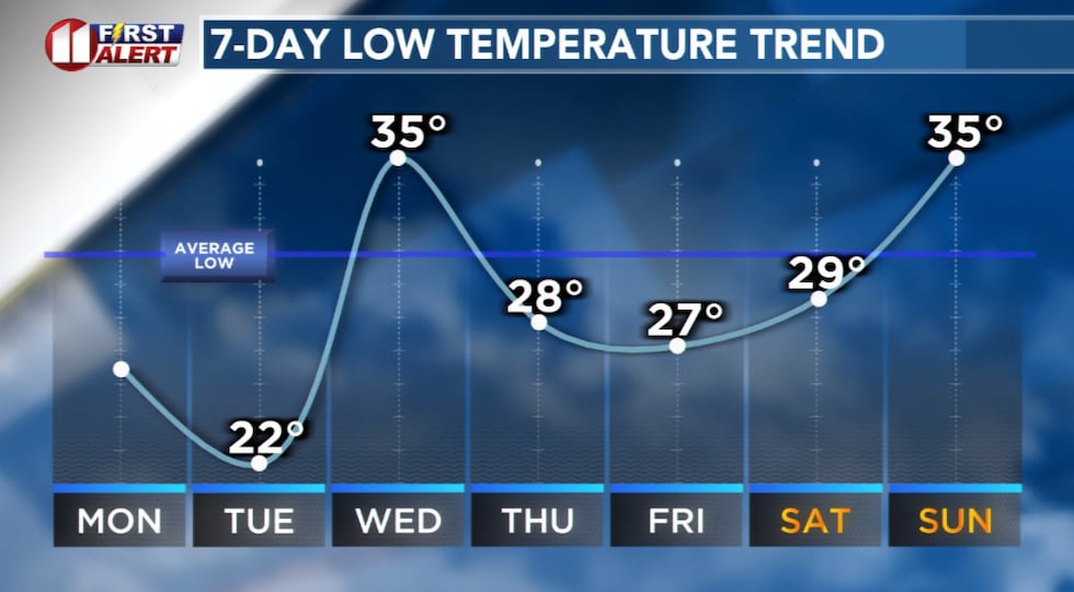 Low temperatures forecast for Lubbock through the weekend.(KCBD First Alert)
If, on the other hand, the low travels on a more southerly path it would mean a much greater chance of precipitation.
Based on today’s data, the window for possible precipitation is roughly from very early morning to early afternoon Thursday.
Now another familiar story. What form will the precipitation take. It will be cold enough for snow early Thursday. However, the depth of the cold air is expected to be shallow. Which means, at the altitude at which snow forms the temperature may be above freezing. If so, light rain or drizzle may instead develop at that level.
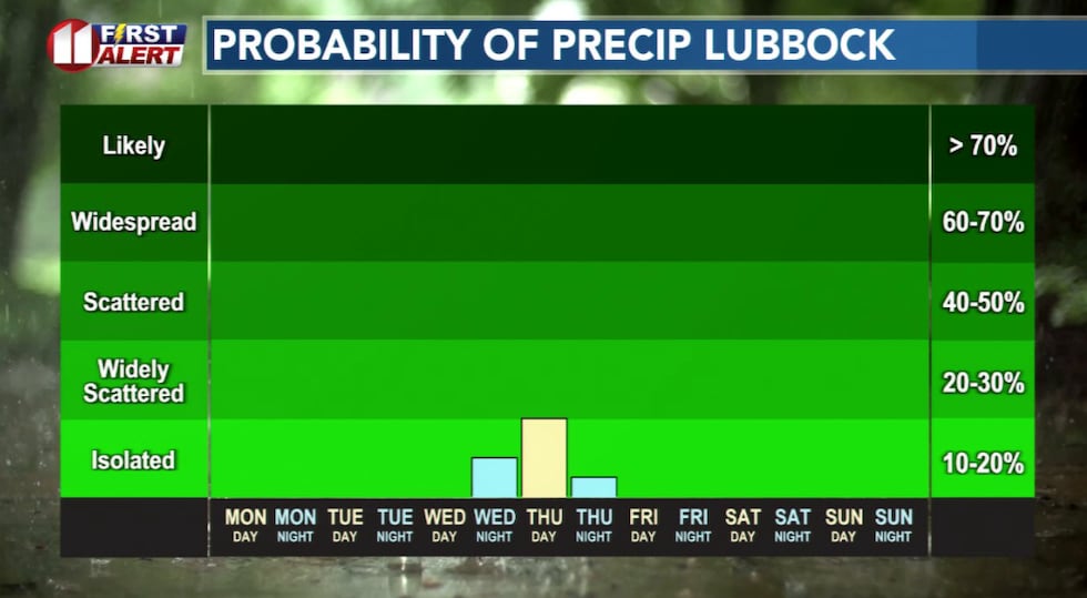 There is a slight chance of very light wintry showers early Thursday.(KCBD First Alert)
As the liquid precipitation falls through the colder layer of air below it may cool to near freezing. And when it hits surfaces below freezing (think roads, bridges, overpasses, stairs, decks, windshields) the rain or drizzle may freeze on contact, leaving a glaze of ice.
It is too early to lock in whether there will be precipitation, let alone what type or how much. My inclination, at this time, is that if we get any precip at all it will be very light. The next day or two should provide more clarity.
Be weather aware by keeping up with our latest forecast. It’s available 24-7 here on our weather page (after closing this story scroll down the page to the current weather and forecast section. You can also find the same information in our KCBD Weather app. It is free. Visit your app/play store and search for “kcbd weather”. If you do download the app, or already have, thank you. We appreciate you!
ON THIS DATE
On this date in 2009 a mix of wintry precipitation began to fall over the western South Plains during the pre-dawn hours. Periods of mixed precipitation and occasional snow continued to spread across the region with a band of heavier snowfall developing over the central South Plains in the evening and continuing into the early morning of the December 2. The heaviest snow fell along a narrow swath from near Hale Center to south of Floydada with 6 to 7 inches falling, but the maximum amount of snow on the ground was four inches.
(National Weather Service Lubbock)
Copyright 2025 KCBD. All rights reserved.