
HOUSTON – Wind chills across the area this morning were in the 30s and 40s, much like yesterday morning.
This afternoon, however, temperatures are expected to climb into the 60s. Expect these 60s to return by the weekend.
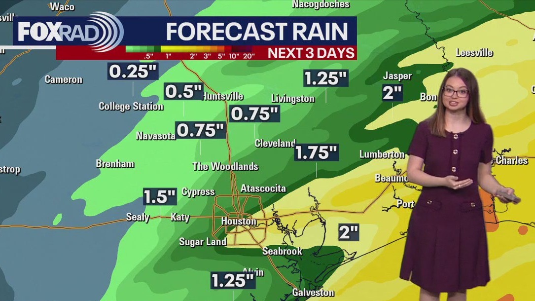
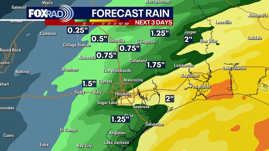
Rain returns tonight, lingering until Friday
Rain becomes more likely late tonight into Thursday, continuing into Friday. Periods of steady rain, possibly heavy at times — could lead to ponding and slick streets for the Thursday morning commute.
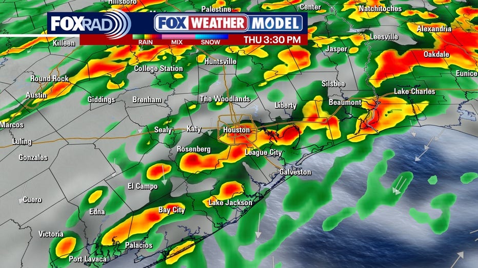
There is a chance for isolated street flooding, especially for areas near and south of I-10. Showers are expected through at least early Friday, then we’ll have some welcome clearing.
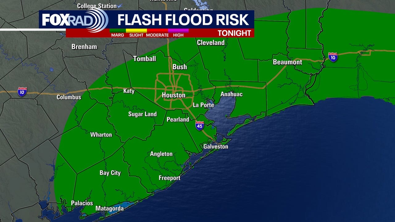
Severe weather is not expected with these showers, but we are in a level 1 risk of flash flooding for tonight into tomorrow.
 Looking forward to a nice weekend
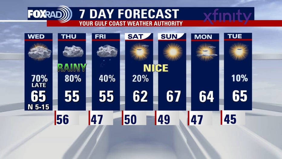
By Saturday and Sunday the skies should clear up. Temperatures heat up some, especially Sunday, and you’ll get a mix of sun and clouds. Rain chances are low and humidity should be comfortable, with highs in the 60s pushing low 70s in some spots.
The Source: The information in this article comes from the FOX 26 weather team.