
 article
DALLAS – It’s officially fall on the calendar, and the weather is finally catching up! We’re expecting one last weekend rumble with some strong storms before cool air heads to the Metroplex by Sunday.
Weekend Forecast: Strong Storms Incoming 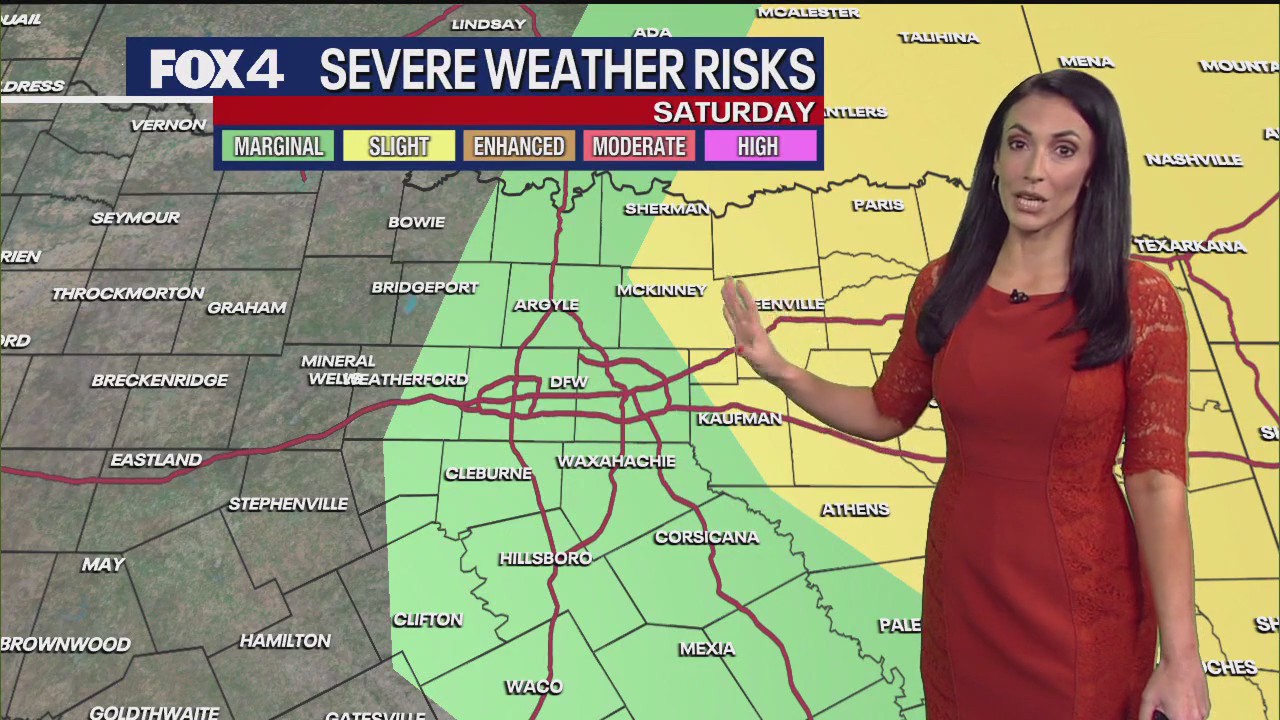
What we know:
Friday temperatures will heat up, with sunny skies and a strong breeze ahead of the next weather system. The air will not be as dry as recently experienced. Temperatures will finish just below 90 degrees in DFW, though a few spots west may hit 90.
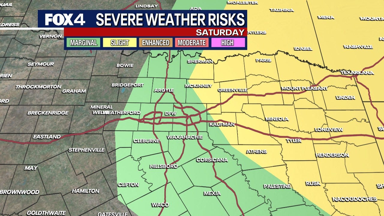
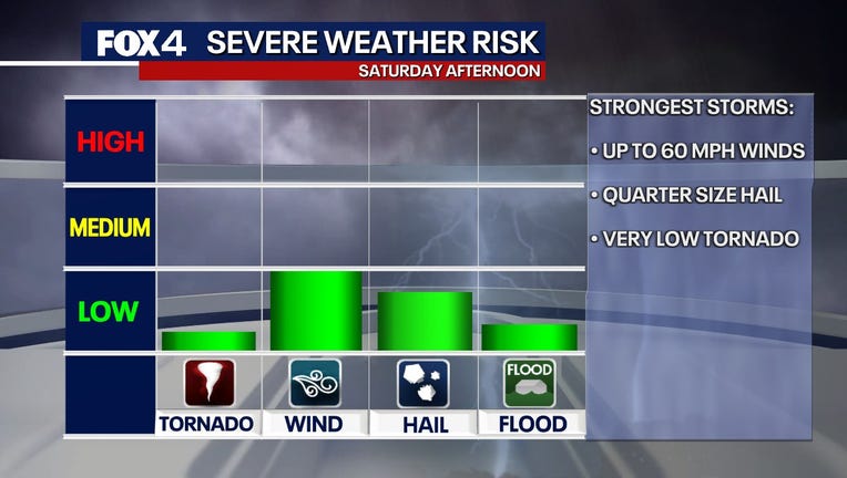
Saturday’s weather system will be slightly stronger. The most active weather is expected from late morning through the middle of the day into the afternoon. Mostly cloudy and very warm conditions will start the day. A few showers and storms may pop up late morning and become stronger after noon.
While initial storms do not look severe, between 1 p.m. and 4 p.m., a few stronger storms posing a risk for wind and hail are possible. Wind gusts up to 55 to 60 mph and hail up to quarter-size are possible. The tornado risk remains east of the Metroplex and storms should move east later in the afternoon, leaving the evening quiet.
The first decent cold front will cross overnight Saturday, shifting very dry air into the region for Sunday. It will be sunny and pleasant, with morning lows in the 50s and afternoon highs climbing to the upper 70s to near 80 degrees, close to the seasonal average.
7-Day Forecast 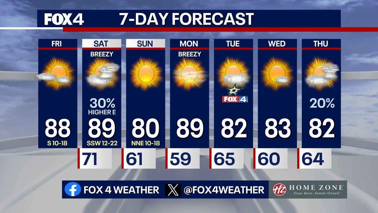
After a cool start Monday morning, the next system approaches. Dry air will remain in place, so no rain is expected with this system. Strong winds, potentially exceeding 30 mph, will develop later in the day as temperatures quickly return to 90 degrees under sunny skies.
A second cold front will move through overnight Monday and be quiet, briefly cooling high temperatures back into the 70s Tuesday with sunny conditions. By mid-week, another storm system approaches, causing winds and warmer temperatures in the 80s to return. Additional showers and storms could start appearing late Thursday afternoon and into the night.
The Source: Information in this article comes from the National Weather Service.