
An upper-level low pressure system will move over the central United States this weekend, dragging a cold front into parts of Texas by Saturday. Don’t get your hopes too high, though. This particular weather system is centered several hundred miles north of Texas, meaning the resulting cold front won’t move through the entire state, likely stalling before reaching South-Central Texas.
The front will essentially split Texas in half. On the north side, parts of Texas will experience relief from the heat, as well as scattered strong thunderstorms Saturday night. Meanwhile, on the south side of the front, areas like San Antonio could experience record heat.
Friday’s forecast
Above-average temperatures are expected through much of Texas on Friday, especially in San Antonio. Morning lows will sit comfortably in the mid- to upper 60s, but temps will rise steadily, reaching the mid-80s by noon before topping out near the 90-degree mark by around 4 p.m.
As more atmospheric moisture moves in from the Gulf of Mexico, you’ll likely notice increased humidity and warmer evening temperatures. San Antonio will still be in the mid-80s at 8 p.m., likely not falling into the 70s until 11 p.m.
Record heat Saturday
As the cold front slides into North Texas, San Antonio will stay roasting on the south side of the front. Morning lows will only dip to around 70 degrees before climbing quickly – near 80 by noon and likely topping 90 by 1:30 or 2 p.m.
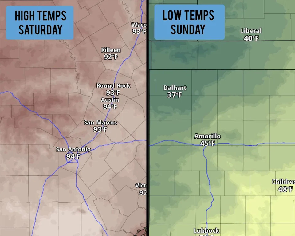
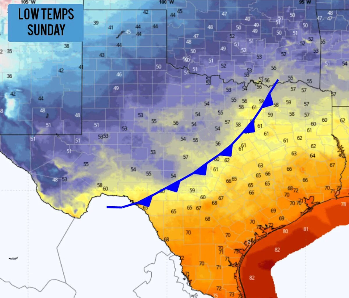
A wide range of temperatures are expected across Texas this weekend. At left, fternoon temps will rise into the lower to mid-90s in San Antonio on Saturday. Predawn temps will fall into the 30s in the northern Texas Panhandle Sunday morning. (Pivotal Weather)
Afternoon high temps are likely to reach between 92 and 94 degrees, potentially tying or breaking the daily temperature record of 93 set in 2007. The increased humidity will cause heat index values, or humidity-driven “feels like” temperatures, to max out at 95 or 96 degrees, which would be extremely rare territory for mid-October.
Who will feel the front?
The cold front will affect the northern third of the state the most. The Dallas-Fort Worth area will see temps drop by 10-12 degrees, as high temps in the lower 90s Saturday will drop to around 80 degrees on Sunday. Morning lows across North Texas are also expected to fall into the 50s.
The coldest air will settle over the Texas Panhandle, where lows Sunday morning will dip into the low to mid-40s in cities like Amarillo, Childress and Lubbock. Farther north, towns such as Dalhart, Dumas and Stratford could briefly drop into the mid- to upper 30s.
A few thunderstorms may also develop along the front Saturday afternoon and evening across North-Central and Northeast Texas. Some could turn severe, producing large hail and damaging winds. Storm chances decrease farther south, with only a 20% chance of rain in the San Antonio area Saturday night into early Sunday.
Will temps fall in San Antonio?
The front may slide through the San Antonio area overnight Saturday and into early Sunday. However, by this time, it will have lost much of its strength. High temperatures on Sunday are likely to reach the upper 80s, which would be only about a five-degree drop from Saturday’s near-record temps.
Afternoon temperatures are expected to stay hot, likely rising back into the lower 90s on Monday and Tuesday while morning lows hover in the upper 60s. After that, weather forecast models do show a more active weather pattern on the way, with a potential second cold front moving through Texas by Oct. 22-24.
This article originally published at Cold front hits Texas this weekend, statewide temps will range from the 30s to the 90s.