
LUBBOCK, Texas (KCBD) – A cold front is sliding through West Texas, and it’s setting the stage for a freezing night ahead.
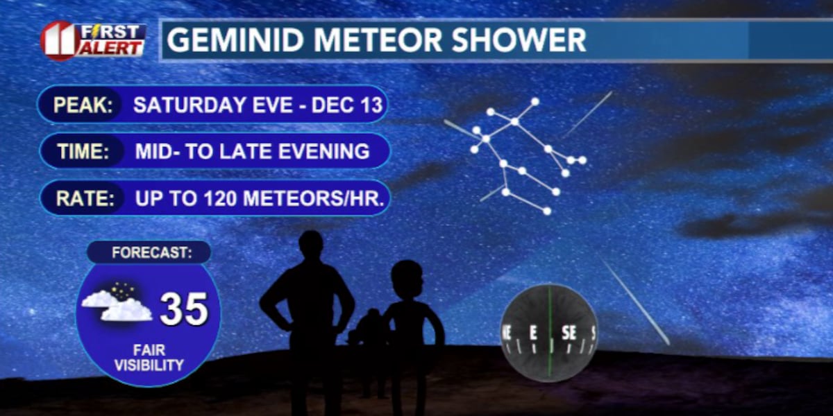
But if you’re planning on watching the Geminid meteor shower, skies should cooperate early in the evening.
 Geminid shower: best viewing is outside the city away from lights. Look to the east-southeast(KCBD)
The front itself is delivering a new air mass into the region that will push out the warmer air we had before and replace it with a much colder, denser air mass.
This air was formed farther north, where December sun angles are lower and nights are longer, so it arrives pre-chilled. Once the front passes, temperatures drop quickly and winds will turn northeasterly and continue to pull in colder air through the evening and overnight.
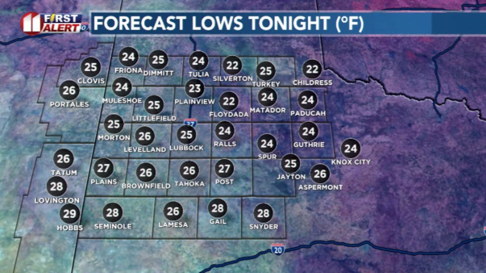 Lows tonight(KCBD)
That steady feed of cold air keeps temperatures dropping instead of levelling off after sunset. By early Sunday morning many of us will wake up to temperatures in the 20s and 30s, and will feel even colder with the wind chill factored in.
Sunday doesn’t offer much of a warmup. Very low clouds may linger through the morning, especially on the Caprock, this will block sunlight during the day and prevent temperatures from rebounding.
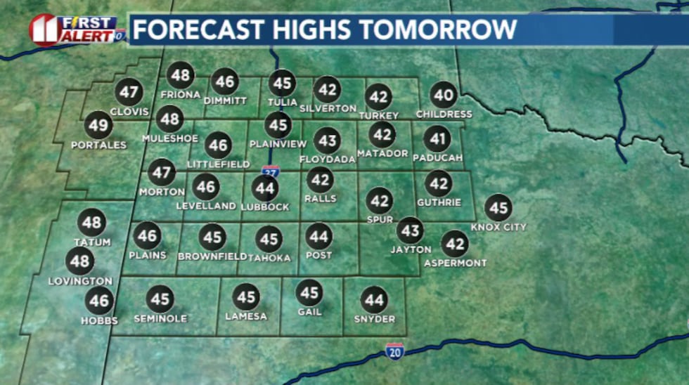 Highs tomorrow(KCBD)
Afternoon highs will struggle into the low to mid-40s. Which is a noticeable step from the near-record highs from the last few days.
The cold snap isn’t expected to last long. Sunshine returns late Sunday, and by Monday, winds turn back to the south and temperatures rebound quickly. Highs climb into the 70s by mid week with dry skies holding steady.
A weak front late Wednesday may cool things off but even that chill is short-lived, setting us up for another warm finish to the week.
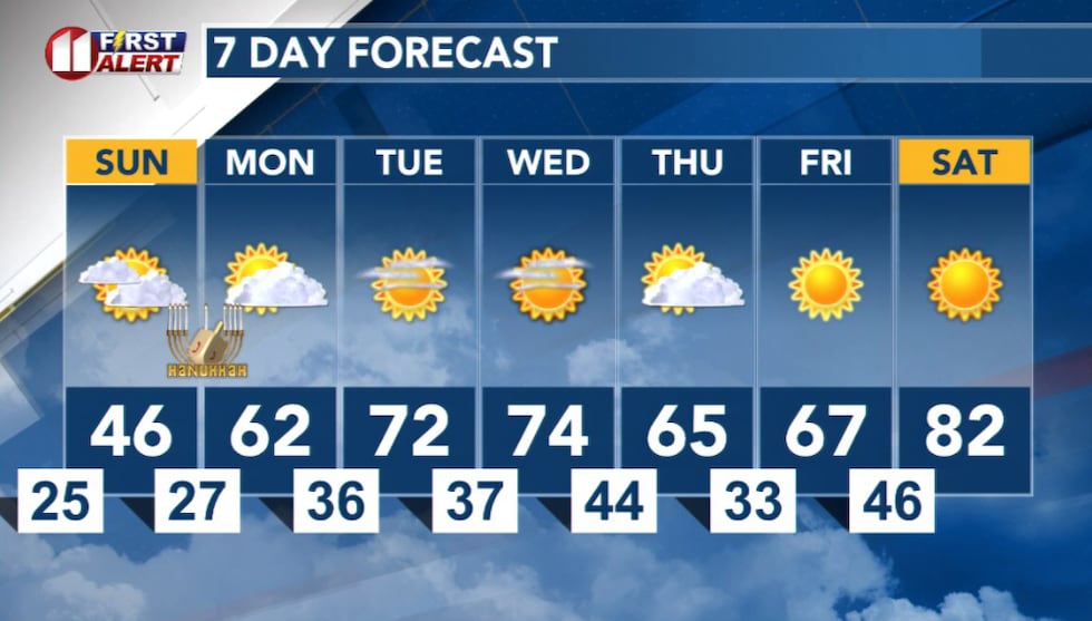 7 Day Forecast(KCBD)
Copyright 2025 KCBD. All rights reserved.