
LUBBOCK, Texas (KCBD) – The seasonally mild weather during the first two weeks of December will continue through this third week. Temperatures will rise and fall, but will remain above average for the time of year.
It’s the last week of Autumn. Winter begins with the Solstice Sunday morning at 9:03.
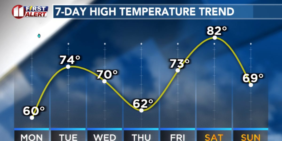
 Weill-above average high temperatures continue through the weekend.(KCBD First Alert)
The dry pattern with mostly above average to well-above average temperatures has been due to a blocking high. This is when persistent high pressure to the west of us forces Pacific storm systems to the north of us, and at the same time bottles up the coldest air to our north. This is expected to change this week. To some degree.
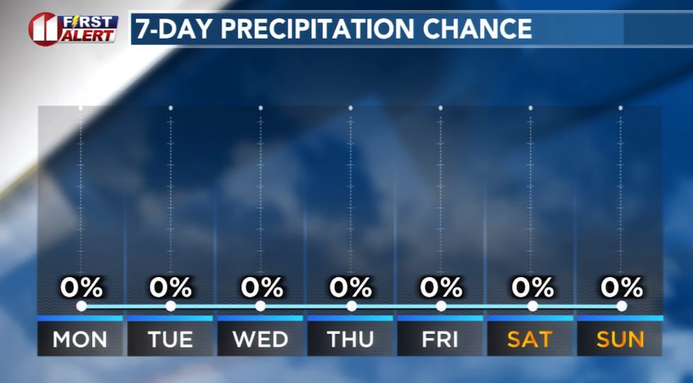 No measurable precipitation is expected through the weekend.(KCBD First Alert)
As the high departs the Southwestern US, the pattern will transition from one of blocking to what we refer to as zonal. This is when systems coming off the Pacific may cross the West Coast farther to the south, then move more directly from west to east (rather than northwest to near the Canadian border, usually followed by the system dropping southeast across the Northern Plains, the Great Lakes, and the Northeast).
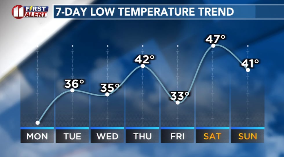 Low temperatures will continue above average for the time of year.(KCBD First Alert)
While this zonal pattern will allow storm systems to move along a more southerly path, that path is likely to remain just to the north of us. So what’s the bottom line?
Temperatures will continue to rise and fall but remain above to well-above end-of-Autumn averages. Both low and high temperatures. Our area also will remain dry. What we may experience, though, is more wind.
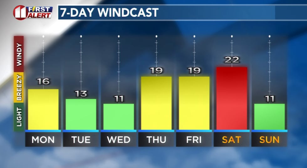 Forecast peak sustained winds are shown in this graph. Peak gusts will exceed the values shown here.(KCBD First Alert)
You can follow the day to day changes right here on our weather page. After closing this story scroll down the page just a bit to the forecast section. Of course, we have the same information in the forecast section in the KCBD weather app. It’s free from your app/play store.
On This Date
On this date in 1970, sustained westerly winds of 40-65 mph whipped up one of the worst West Texas dust storms in many years. Visibility was reduced to less than 1/8 of a mile over large areas.
(National Weather Service Lubbock)
Copyright 2025 KCBD. All rights reserved.