
I predicted 69 today, but nature said, “No, no, no!” Yes, 70 the official high today. And so it begins… the warmest week before Christmas that most of us have ever experienced. Here’s your exclusive 9-Hour Forecast for Wednesday with your 9-Day Forecast and record high information below.

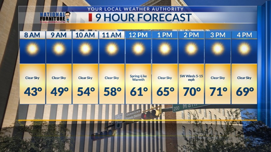
TONIGHT: The skies will be clear overnight, and the winds will be light out of the west at 5-10 mph. The low will be 38 at the airport, 34 in the valley.
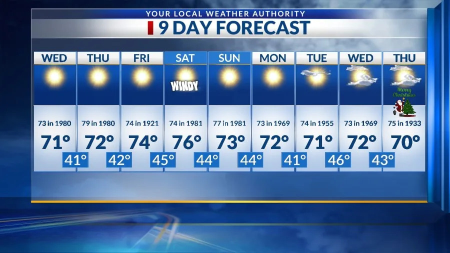
FORECAST: Wednesday will be sunny and 71 with warm southwesterly breezes at 5-15 mph. It will be a gorgeous day with a Spring-like feel. Thursday will be sunny and even warmer (and more unusual) with a high of 72. Friday will be sunny and 74. The SW winds will range from 5-15 mph. Saturday will be sunny and a little windy at times with a high of 76! The SW-W winds will range from 10-25 mph. A ridge of high pressure stays in place for the remainder of the weekend and week leading up to Christmas. Sunday will be sunny and 73. Monday will be sunny and 72. Tuesday will be partly cloudy and 71. Wednesday is Christmas Eve and will be partly cloudy with a high of 72. Winds will be breezy to low-end windy. Christmas Day will be partly cloudy and 70. Winter officially beings Sunday morning at 8:03. Below is a list of the record high temperatures and years for each day over the next 9 days.
Wednesday: 73 in 1980
Thursday: 79 in 1980
Friday: 74 in 1921
Saturday: 74 in 1981
Sunday: 77 in 1981
Monday: 73 in 1969
Tuesday: 74 in 1955
Wednesday: 73 in 1969
Christmas Day: 75 in 1933
Copyright 2025 Nexstar Media, Inc. All rights reserved. This material may not be published, broadcast, rewritten, or redistributed.
For the latest news, weather, sports, and streaming video, head to KTSM 9 News.