
LUBBOCK, Texas (KCBD) – If it weren’t for the holiday decorations, you wouldn’t notice that we’re nearing the end of December, based on these temperatures.
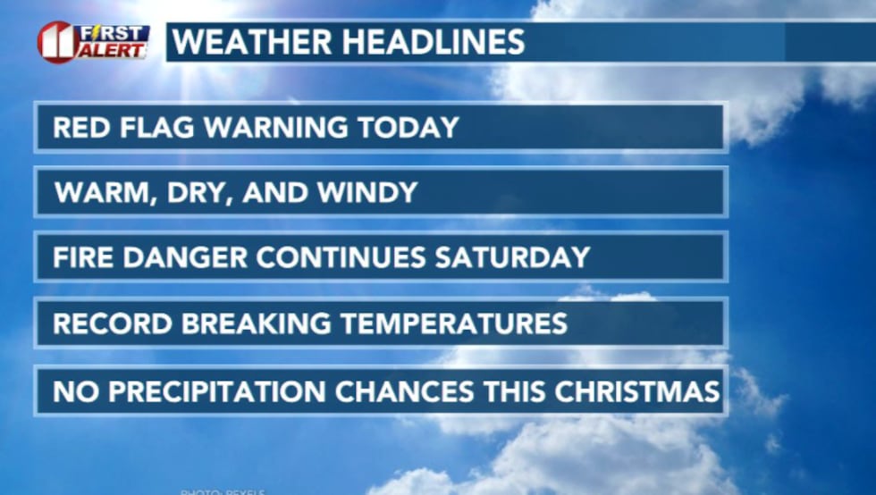 Weather Headlines(KCBD)
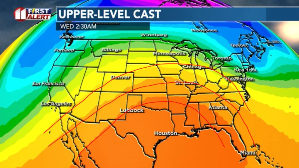
Friday’s warmth and wind is being driven by a very flat, fast-moving pattern in the upper atmosphere.
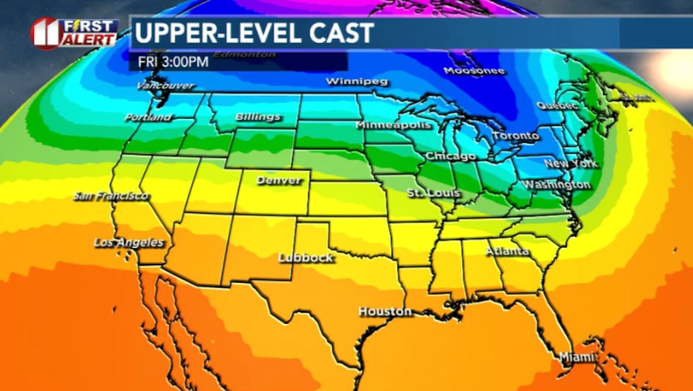 Upper level set up today: Today’s warmth and wind are driven by a very flat, fast moving pattern in the upper atmosphere.(KCBD)
The jet stream isn’t dipping south like it usually does around this time of year, which means we aren’t seeing colder air from the north reach our region. Instead, air is moving straight west to east, allowing warm, dry air to slide in and stay put.
At the surface, lower pressure deepening in the Rockies is pulling air across West Texas, and that’s why the wind is picking up this afternoon.
You’ll likely notice the wind first, warmth second. Southwest winds increase through the afternoon, gusty at times, and paired with very dry air. Temperatures climb into the low to mid 70s, which is well above average for late December.
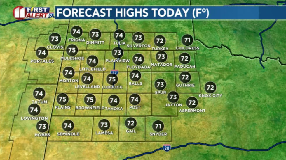 Highs today above average(KCBD)
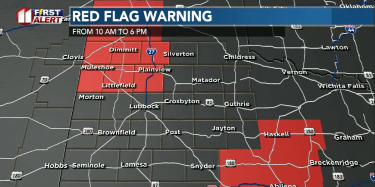
The combination of wind, warmth, and low humidity leads to elevated fire danger. A Red Flag Warning has been issued for northwest portions of our viewing area through 6 p.m.
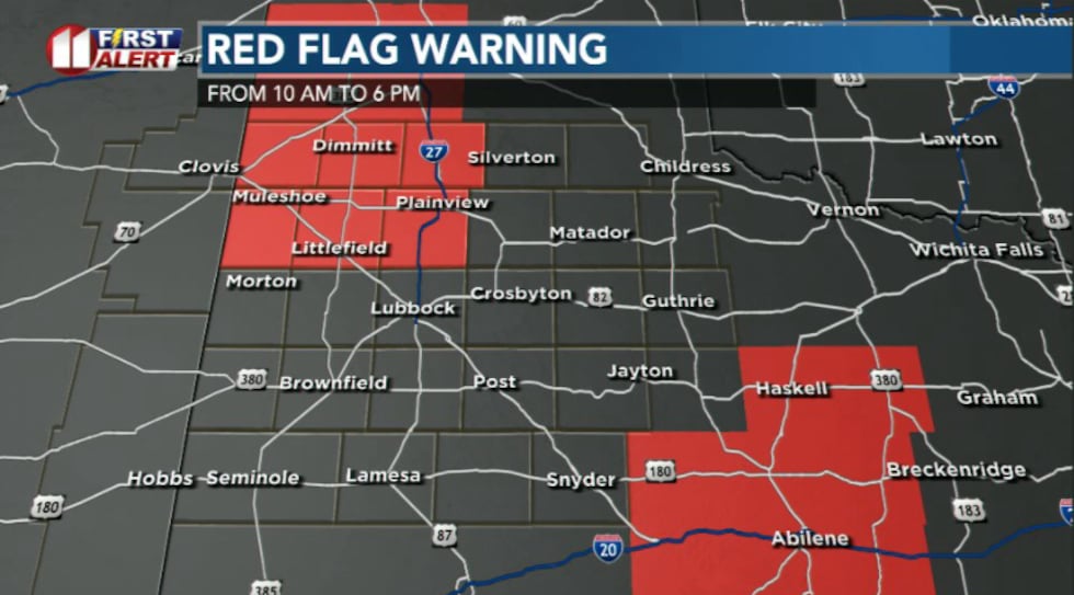 Red Flag Warning in effect for highlighted areas until 6 pm today. Expect elevated fire danger to continue into Saturday(KCBD)
Winds will ease slightly but not completely as we head into Friday night. A lingering breeze will act like a blanket, keeping temperatures from dropping too much. Expect lows in the mid 40s.
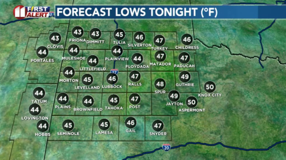 Lows tonight(KCBD)
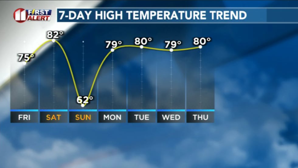
Saturday, temperatures are expected to peak.
Winds turn more west, which matters because air coming off the higher terrain in New Mexico dries and warms as it sinks and moves into lower elevations like here in the South Plains. That down sloping effect adds a few extra degrees, sending temperatures into the low 80s.
Here in Lubbock our forecast high could smash the daily record of 80 degrees set in 1921. But it could tie or break our all-time record high for the month of December – 83 degrees set back in 1939.
 Above average temperatures continue into next week(KCBD)
Late Saturday night, we finally get a brief reset. A weak cold front slips through, winds turn northeast, and high temperatures for Sunday will dip into the 50s and 60s.
Still above average for this time of year, but we’ll take what we can get.
Unfortunately, the same setup also spreads fire weather concerns across a wider area, making Saturday the most concerning fire day of the stretch.
By early next week, the pattern snaps right back into place. Winds shift southwest again, high pressure builds overhead, and temperatures rebound into the 70s and 80s.
 A ridge of high pressure will strengthen as we head toward Christmas, locking in dry, warm conditions, with no real sign of winter arriving any time soon(KCBD)
The ridge will strengthen as we head toward Christmas, locking in dry, warm conditions, with no real sign of winter arriving any time soon
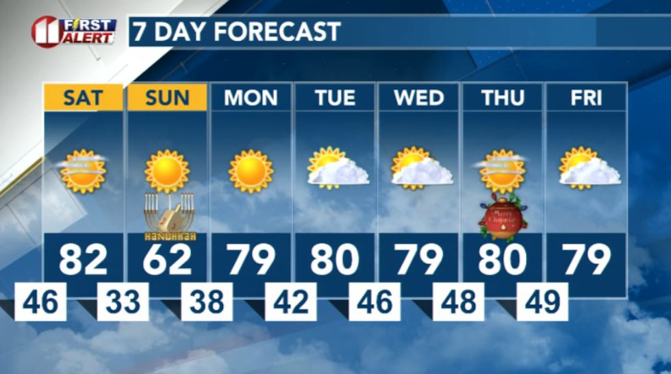 7 Day Forecast(KCBD)
Copyright 2025 KCBD. All rights reserved.