
LUBBOCK, Texas (KCBD) – We’re locked into a very warm, very dry pattern, with temperatures running well above normal and record highs possible.
High pressure at the surface is sliding east, which lets winds turn southerly this evening. That southerly flow shifts southwest on Monday, thanks to a developing low pressure trough to our west.
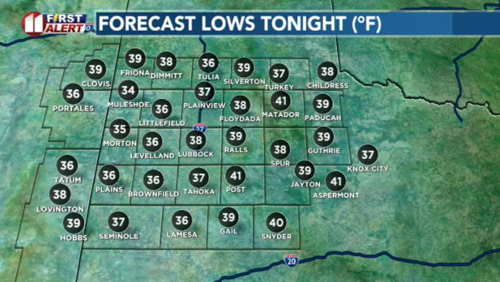 Temperatures tonight won’t fall too much(KCBD)
Overnight skies stay mostly clear, and temperatures don’t fall nearly as much as they should for late December.
Monday will be a bit breezy but not obnoxious. Winds will come in from the west to southwest at 10 to 15 mph.
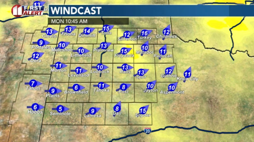 Winds will come in from the west-southwest and pick up a bit. Helping temperatures climb.(KCBD)
That westerly component will help warmer air flow into the South Plains. When winds blow from the west, they’re moving downslope off the higher terrain of New Mexico toward lower elevations of the South Plains. As air sinks, it compresses under higher pressure and warms. Like how air heats up inside a bike pump when it’s squeezed.
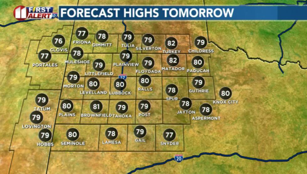 Highs tomorrow nearing record-potential(KCBD)
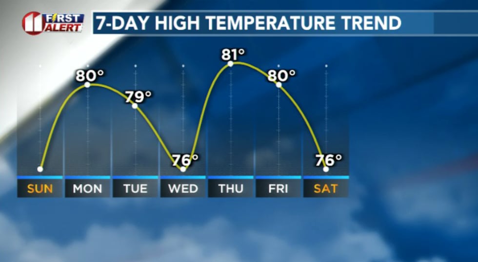
By the afternoon, highs will push into record territory, with Lubbock potentially tying or breaking a record of 79 degrees that’s stood since 1969.
A strong upper-level ridge sets up over the region and just sits there, acting like atmospheric roadblock, and keep away storm systems that might make it feel slightly more seasonable. Warm air will continue to build day after day.
 Very warm afternoon, mild nights, and a Christmas forecast that feels like spring.(KCBD)
The rest of the week will feature warm afternoons, dry conditions, and record highs possible on Christmas Day.
Looking ahead to next week, things get less certain. A storm system developing off the west coast could eventually shift the pattern but it’s still too far out to nail down any specifics. Maybe if we’ve been really good this year, Santa will bring some relief from this heat.
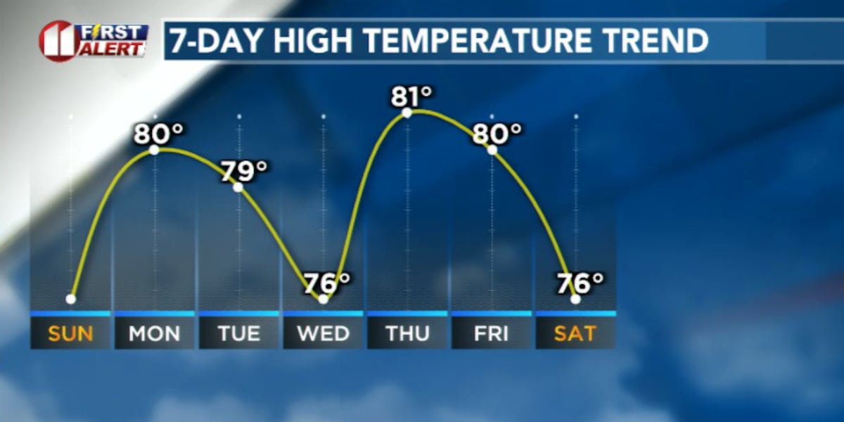
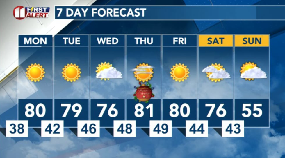 7 Day Forecast(KCBD)
Copyright 2025 KCBD. All rights reserved.