
HOUSTON – While widespread heavy rain is not anticipated, be prepared for some brief downpours today.
Spotty showers, storms this afternoon and evening
A jet stream disturbance, coupled with the persistent onshore flow from the Gulf, will provide enough moisture and instability to generate scattered rain and a few isolated storms this morning. While widespread heavy rain is not anticipated, be prepared for some brief downpours.
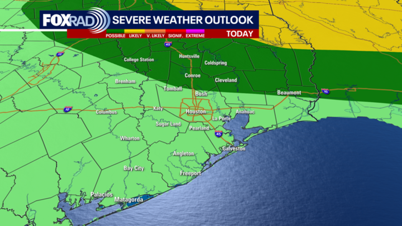
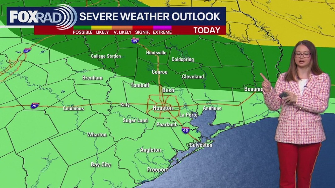
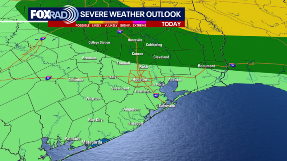
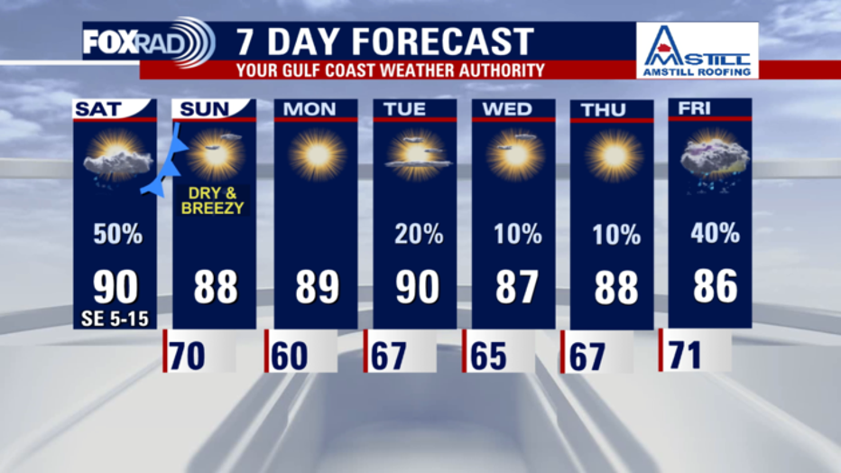
The main event arrives later in the day as a front pushes through. A few storms could be strong and severe, especially north and east of the Houston area.
Another thing to watch will be the chance that a lightning strike could start a fire in the driest, most vulnerable areas.
Areas north and east of Houston are at a level 1 risk of severe weather. Isolated small hail and strong winds are possible with storms in these areas.
Big changes Sunday
The cold front is expected to sweep through early Sunday morning. Once it clears the area, the afternoon will feature sunny skies, comfortable temperatures, but also a huge drop in humidity.
Very dry air along with northern breezes on Sunday mean a higher risk for fires across our area and much of Texas.
Finally, Monday morning should be the coolest of next week, with upper 50s possible.
 Tropics
The National Hurricane Center is still monitoring a tropical wave in the central Atlantic. This tropical wave is expected to continue moving west and eventually into the Caribbean Sea. It has a low 30% chance of developing into a tropical system over the next 7 days in the Caribbean.
Another weak area of low pressure in the northern Atlantic has a very low chance of turning into a brief tropical or subtropical system before moving into cooler waters.
Tropical development is not expected in any other part of the Atlantic basin for now.
Keep in mind that hurricane season runs through the end of November.
The Source: Your Gulf Coast Weather Authority