
Texas weather continues to defy the calendar this holiday season. Just one day after Christmas, much of the state is experiencing temperatures more typical of late spring, with some locations approaching or breaking all-time December record highs. While the warm, sunny conditions may feel pleasant, a sharp change is already on the way.
A strong cold front will move through Texas late this weekend into early next week, bringing much colder air, gusty north winds, and a dramatic temperature drop. Here’s what to expect over the next several days.
Near-Record December Heat Across Texas
Friday and Saturday will continue the unusual warmth across the state. Afternoon highs are climbing well into the 70s and 80s, with a few locations flirting with record December temperatures.
In several areas, overnight lows are also running far above normal. Parts of East and Southeast Texas are seeing overnight temperatures in the 60s, which is warmer than many locations typically see for highs this time of year.
This warmth is being driven by persistent southerly winds, dry air aloft, and a lack of strong storm systems across the southern U.S. The result feels more like April or May than late December.
Fog and Low Clouds, Especially Overnight and Mornings
With warmer air and increasing moisture in place, fog and low clouds are becoming a regular feature, particularly across:
East Texas
Southeast Texas
The Texas Gulf Coast
Parts of Central Texas
Patchy to locally dense fog is most likely late at night through mid-morning, especially Saturday and Sunday mornings. Drivers and travelers should allow extra time during early hours, as visibility may be reduced in spots.
Fire Weather Concerns Continue
Despite the recent warmth, dormant winter vegetation remains highly susceptible to fire. Combined with low humidity and gusty winds, this setup has brought elevated to locally high fire danger, especially across:
Outdoor burning, dragging chains, or any activity that could spark a fire should be avoided. Even areas with moist soil can still see rapid grass fire spread under these conditions.
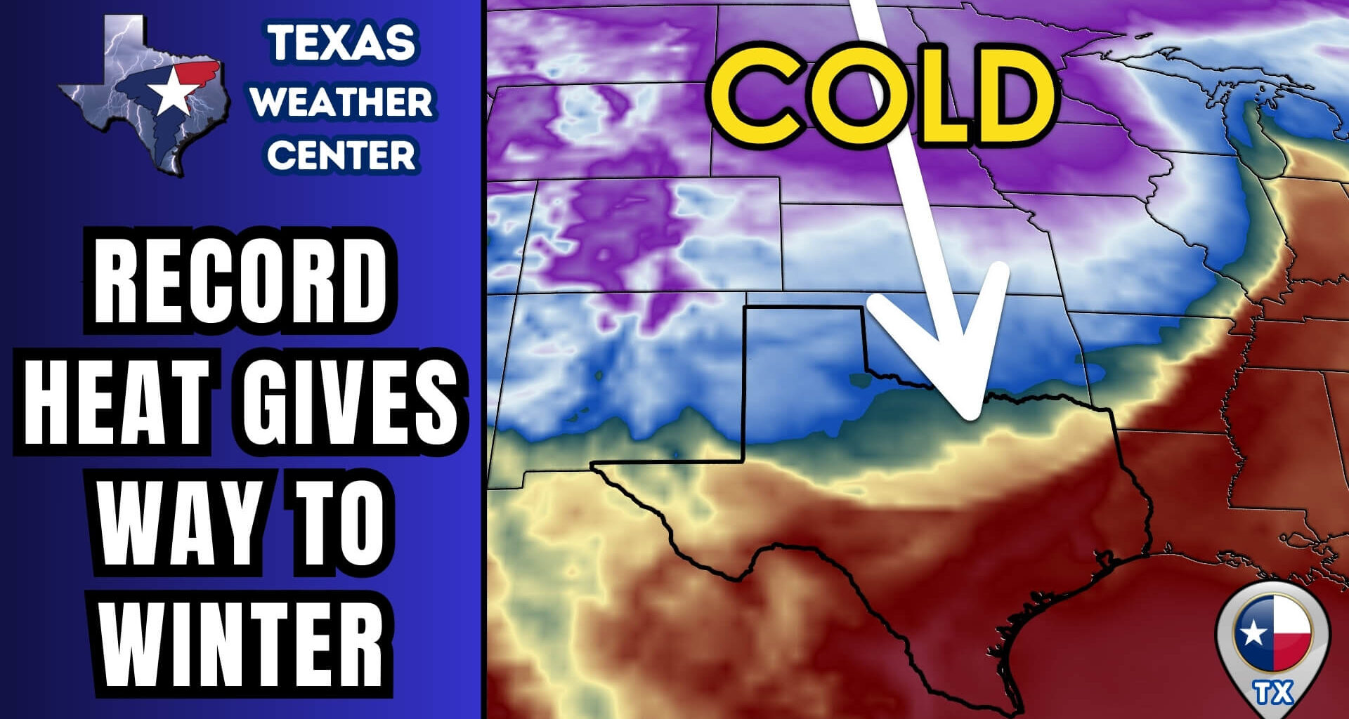
Major Cold Front Arrives Late Weekend
The pattern flips quickly heading into Sunday and Monday.
A strong cold front will surge south through Texas, bringing:
A rapid wind shift to strong north winds
Gusts potentially exceeding 40–45 mph
A temperature drop of 40 to 50 degrees in some locations
For parts of the Panhandle and North Texas, the cold air may arrive early Sunday, meaning the “high temperature” could occur early in the day before readings begin falling sharply.
Coldest Weather Early Next Week
By Monday and Tuesday mornings, temperatures will be dramatically colder statewide:
20s and teens across the Panhandle
30s across much of North and Central Texas
Near or below freezing extending southward, including parts of the Hill Country and along I-10
Wind chills will make conditions feel even colder, especially Monday morning. While this is not an Arctic outbreak, it will be a sharp shock compared to the recent warmth.
Any Rain or Snow?
Moisture with the front looks limited, but a few scattered showers are possible as it moves south Sunday into Sunday night.
In Far West Texas, including the Guadalupe Mountains and Trans-Pecos, there is a small chance for light snow Monday. Any accumulation would be minor and confined to higher elevations, but we’ll continue monitoring trends closely.
Bottom Line
Texas is experiencing near-record December heat immediately after Christmas
Fog and fire weather concerns remain ongoing through the weekend
A strong cold front will bring much colder air Sunday into Monday
Temperatures rebound again later next week after a brief cold snap
Texas weather is doing what it does best: refusing to behave seasonally.
For the latest updates, interactive radar, and daily forecasts, keep checking back here and watch the full Texas Weather Roundup video embedded above.
Stay weather-aware, enjoy the warmth while it lasts, and get ready for a very different feel early next week.