
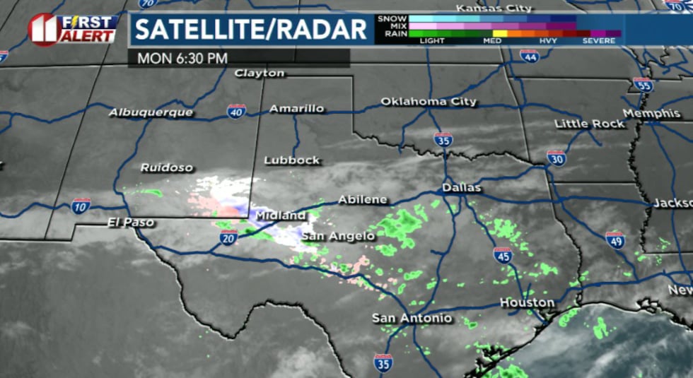
LUBBOCK, Texas (KCBD) – Clearing skies and frigid temperatures will grip the region tonight as a wintry precipitation system continues its expected track well south of the area.
 KCBD(KCBD)
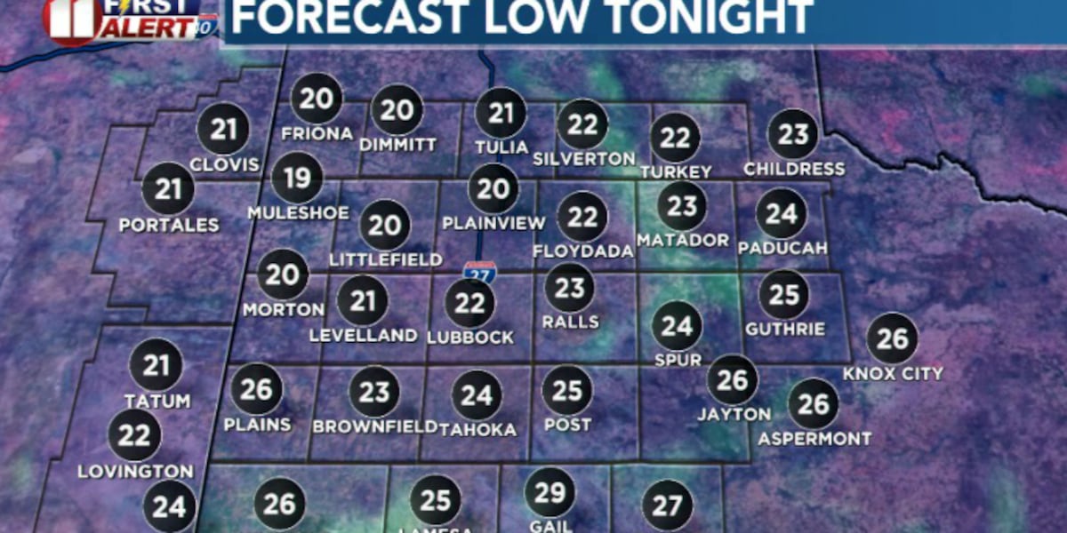
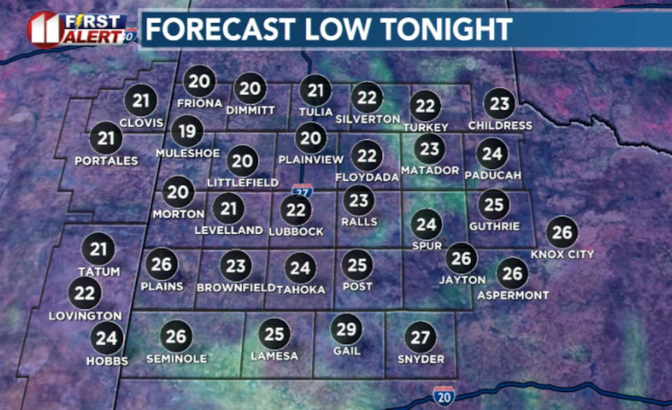
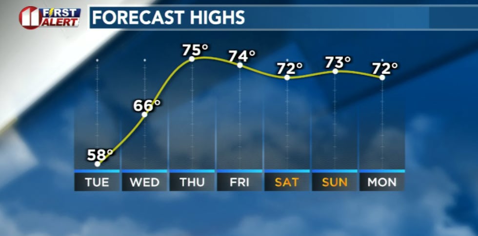
Tonight will bring lows in the teens and 20s across most of the region, with the coldest readings expected over the northwest and northern South Plains. Light winds will keep wind chills manageable, but residents should prepare for a chilly night.
Hard freeze is expected so protect your Pets, Plants, and Pipes!
 KCBD(KCBD)
All wintry precipitation will quickly diminish this evening, with skies clearing overnight.
Warming Trend Begins Tuesday
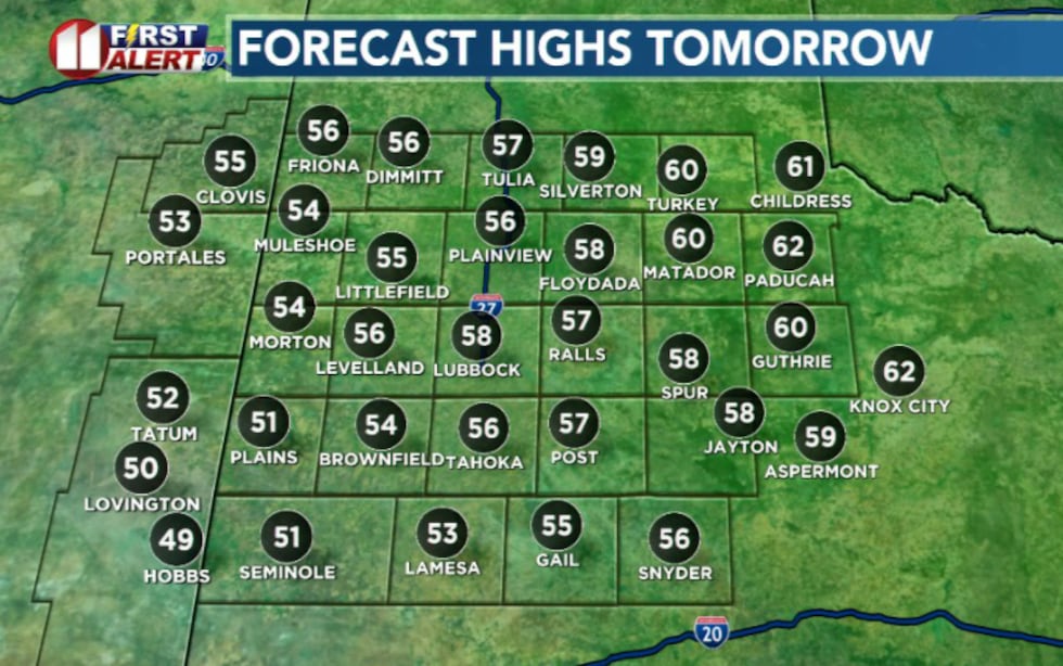
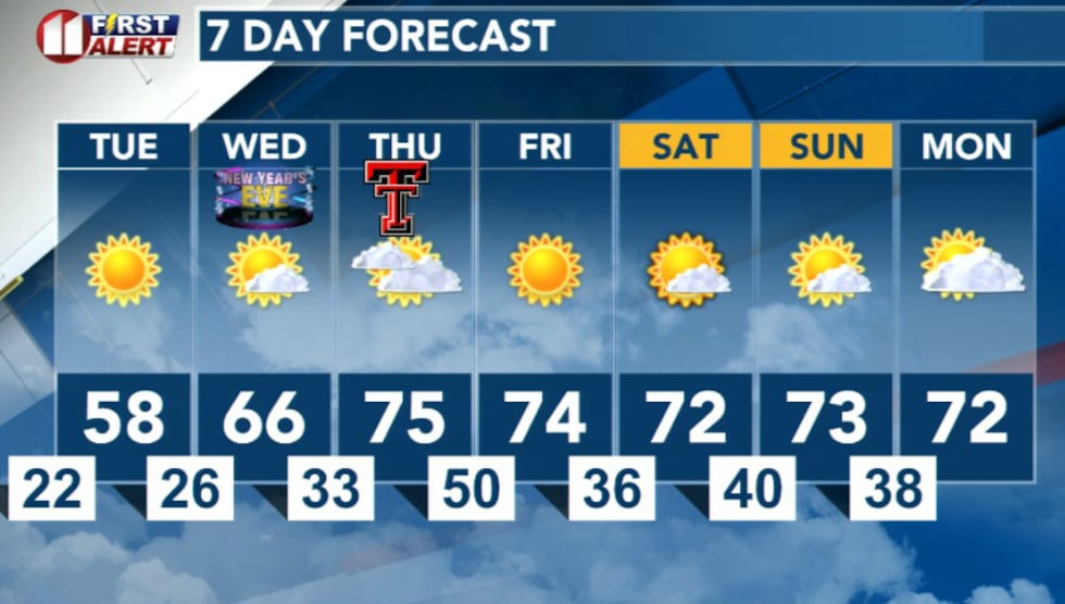
The cold snap will be short-lived. After a chilly day Monday and cold start Tuesday morning, temperatures will warm to the middle and upper 50s Tuesday afternoon as sunny skies prevail. A few spots off the Caprock could even briefly breach the 60-degree mark.
 KCBD(KCBD)
High-pressure systems moving into the region will usher in a significant warming trend beginning Tuesday and continuing through the week.
Highs Wednesday will climb into the 60s, with even warmer conditions expected as 2026 begins. Plenty of 70-degree readings are expected to kick off the new year.
 KCBD(KCBD)Looking Ahead
The warming trend will continue through the first week of 2026 with dry conditions expected to persist. Southwesterly flow will begin to establish and linger by Wednesday, bringing increasingly warm air into the region.
 KCBD(KCBD)
Copyright 2025 KCBD. All rights reserved.