
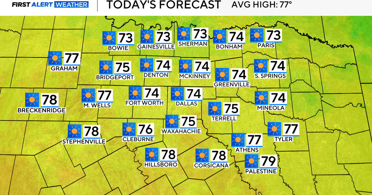
It has been 38 days since North Texas has seen a below-average day, and Sunday will break that streak. It will finally feel like fall.
Expect sunny skies, low humidity, a high in the 70s and a slight breeze from the north with gusts up to 20 mph. It will be a fabulous day to enjoy the outdoors.
Monday, temperatures climb once again ahead of the next frontal passage. The high will be in the upper 80s, and winds will come from the south, gusting up to 30 mph.
The warmer-than-average temperatures, high winds and dry conditions will create high fire danger for North Texas. The high fire danger continues Tuesday due to another cold front that will move through, dropping temperatures and keeping winds gusty.
Conditions stay dry until the end of next week. Another strong front is expected to move through the area Thursday night through Friday.
As of now, storms look to be strong on Friday, so the First Alert Weather Team is keeping a close eye on this forecast and the latest model runs. A First Alert Weather Day may be issued; stay tuned.
