
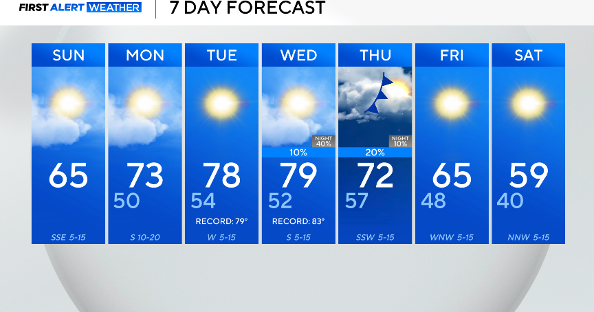
It’s a cool start to Sunday, with lows in the 30s and low 40s across North Texas. Grab a jacket if you’re heading out the door, but note, you won’t need one by the afternoon.
Highs are forecasted to be in the mid-60s, sitting around 10 degrees above average.
A few clouds will be in the skies, with winds from the southeast around 5 to 10 mph. It will be a Sunday for any outdoor activities.

Monday, winds from the south kick up and gust up to 25 mph.
The southerly wind and high pressure at the surface will increase the temperatures over the next few days.
The highs will be in the upper 70s on Tuesday and Wednesday, which will come close to or even break the daily record high temperature.
There is an end to the warmth in sight. A cold front at the end of the week will knock temperatures down into the 50s by the weekend.
The front will also likely bring an end to the dry streak for North Texas. The chance for rain and storms is back in the forecast Wednesday night into Thursday. The exact timing and how much rain will fall are still being ironed out.
