
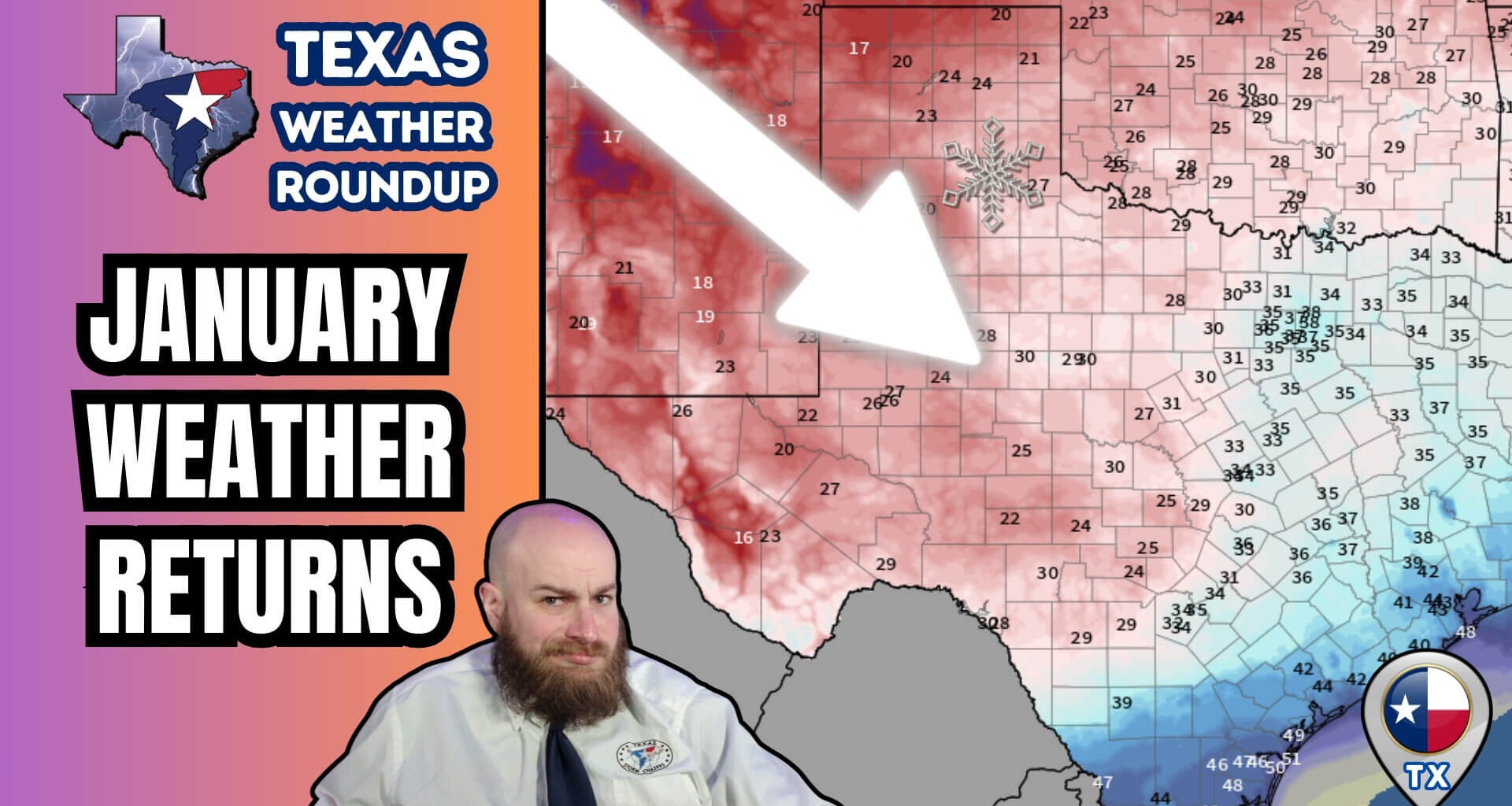
Texas is seeing a little bit of everything today, from accumulating snow in the Panhandle to strong thunderstorms in East Texas, followed by a crashing cold front that finally drags the state back toward January-normal temperatures this weekend.
This system marks one of the more active weather days Texas has seen so far in 2026, with winter weather, severe storm potential, wildfire concerns, and gusty winds all in play across different parts of the state. It’s a good time to have the free Texas Storm Chasers mobile app downloaded for your weather information needs.
Snow Impacts Focused on the Northern Texas Panhandle
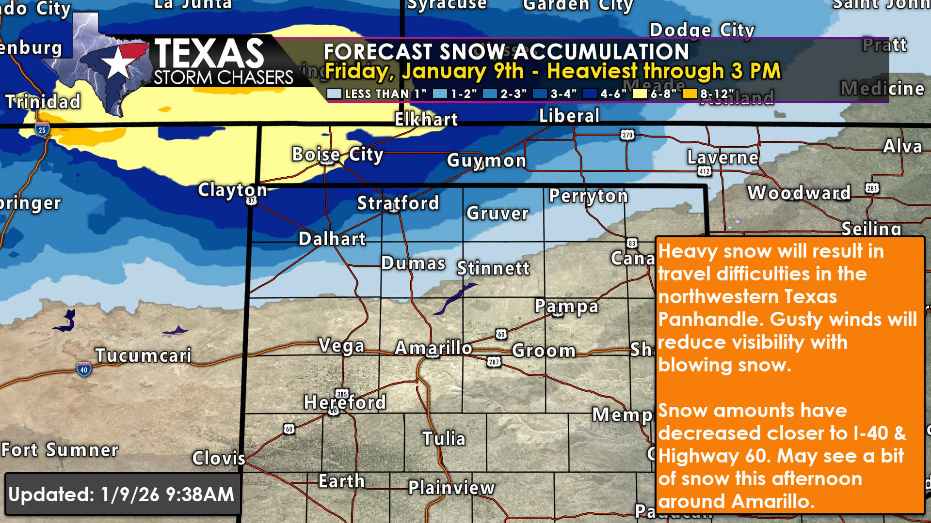
Heaviest snow expected across the northwest Texas Panhandle Friday.
Snow is ongoing across the northern Texas Panhandle, with the highest impacts expected north of Interstate 40. Areas near Dalhart, Stratford, and locations closer to the Oklahoma Panhandle have the best chance to see accumulating snow, with totals generally ranging from 2 to 5 inches, and locally higher amounts possible closer to the state line.
Farther south, including Amarillo, Hereford, Pampa, and Canadian, snow totals drop off quickly. Many of these locations may see only a dusting to around an inch, if anything accumulates at all. This sharp cutoff is due to the storm track shifting slightly north, keeping heavier snow bands out of the southern Panhandle.
Travel impacts are expected in the northern Panhandle, especially where snowfall combines with gusty north winds, leading to blowing snow and reduced visibility through the afternoon hours.
Strong to Severe Storms Possible in East and Southeast Texas
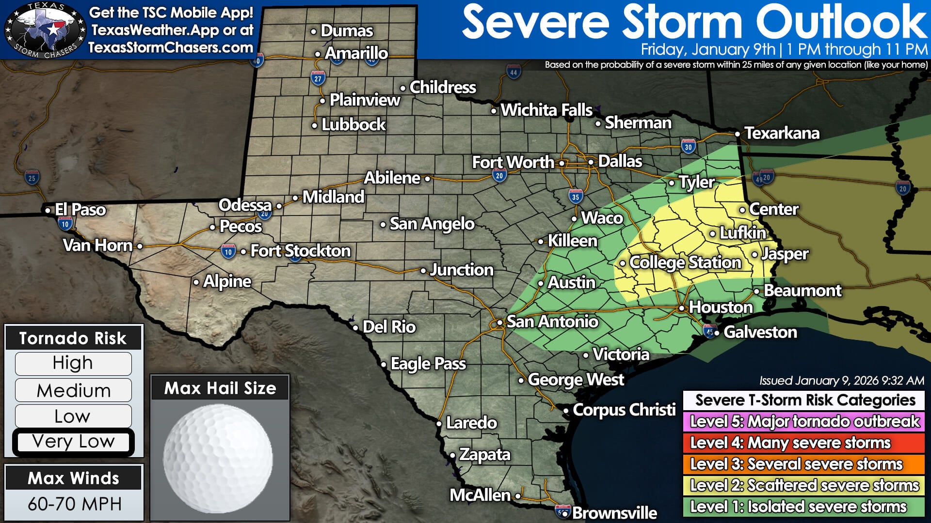
Scattered severe storms possible in East Texas Friday evening.
While snow falls in the Panhandle, a very different setup is unfolding farther east. Thunderstorm chances increase today across Central Texas, the Brazos Valley, East Texas, and Southeast Texas, with the most active period expected from early afternoon through late evening.
Some storms could become strong to severe, capable of producing:
Hail, potentially up to golf-ball size in the strongest storms
Localized damaging wind gusts
Frequent cloud-to-ground lightning
The tornado risk in Texas remains very low, though it is not zero. Storms closer to the Louisiana border may have a slightly higher chance of rotation as they move east later today and tonight.
Rainfall totals will vary significantly, with localized pockets approaching an inch in parts of East Texas, while much of the state sees lighter totals or little rainfall at all.
Wildfire Danger Remains Elevated Despite Rain
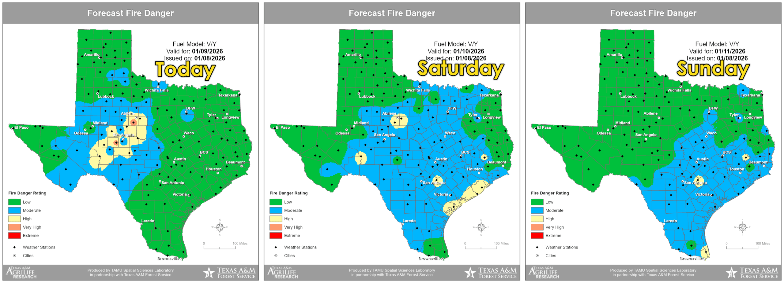
Fire danger remains mostly low across Texas through the weekend, with limited areas of moderate risk.
Even with rain and snow in parts of Texas, wildfire danger remains elevated, particularly across:
Dry vegetation, dormant winter grasses, and strong winds behind the cold front mean fires can still spread quickly, especially in areas that miss out on meaningful rainfall. Fire danger improves in parts of West Texas over the weekend but remains moderate to locally high elsewhere across the state.
Crashing Cold Front Brings a Return to January Weather
A strong cold front sweeps south across Texas tonight and Saturday, bringing:
By Saturday morning, temperatures drop sharply, particularly across West Texas and the Panhandle, where wind chills will feel significantly colder. Many locations across the western half of the state fall to freezing or below, while Central and East Texas drop into the 30s and 40s.
High temperatures this weekend generally settle into the 40s and 50s statewide, with slightly warmer conditions along the immediate Gulf Coast. This marks a clear end to the recent stretch of abnormally warm January weather.
What Comes Next
Behind this system, Texas enters a quieter stretch of weather early next week. Forecast models suggest another pattern shift later next week that could open the door to additional cold fronts and precipitation chances, though details remain uncertain at this time.
For now, the main concerns remain:
Snow impacts in the northern Panhandle
Strong storms in East and Southeast Texas today
Elevated fire danger behind the front
Cold, windy conditions settling in this weekend