
LUBBOCK, Texas (KCBD) – A cold front will move through West Texas this afternoon, bringing strong winds and a noticeable drop in temperatures to end the week.
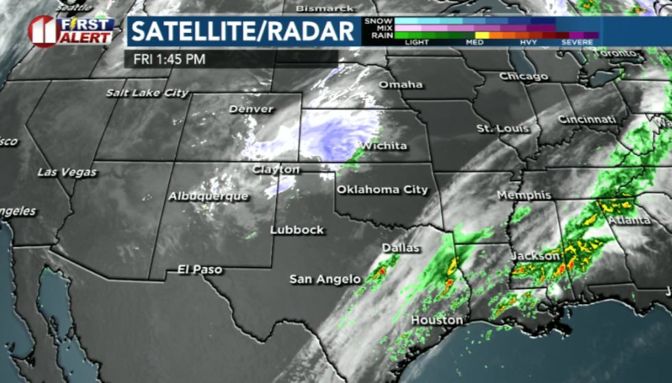 A storm system spinning through New Mexico(KCBD)
A storm system spinning through New Mexico stays just far enough north to keep most of us dry, but it still sends a cold front south this afternoon.
 Dry conditions expected to last for several days.(KCBD)
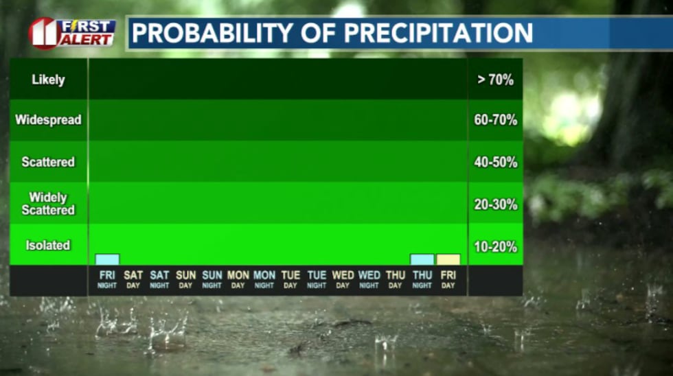
Most of the area will stay dry today. A small chance of a brief rain or a few snowflakes exists in the far northwest, but no accumulation is expected.
Any precipitation would be short-lived and spotty.
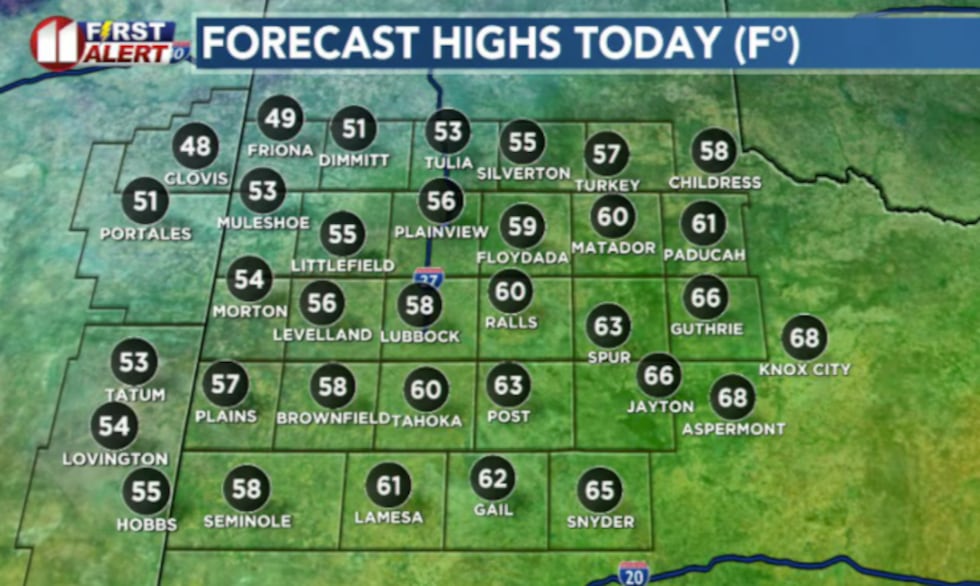 Ahead of the cold front, temperatures remain mild through early afternoon.(KCBD)
Ahead of the cold front, temperatures remain mild through early afternoon.
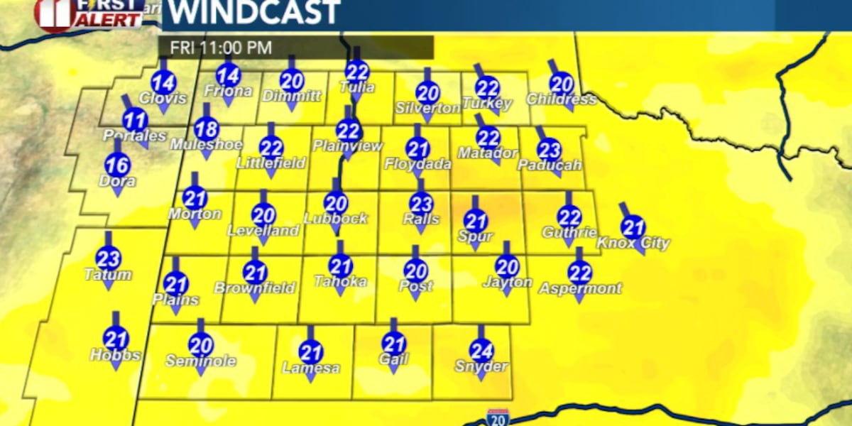
Behind the front, northerly winds crank up fast. With sustained speeds near 25 mph and gusts up to 40 to 45 mph will pull down frigid air from our north and help knock temperatures down quickly late this afternoon and evening.
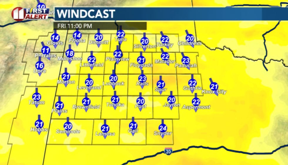 Behind the cold front, northerly winds crank up fast and help temperatures drop(KCBD)
You’ll feel the change almost immediately once the sun starts going down.
Temperatures will fall quickly tonight as skies begin to clear, allowing any heat absorbed during the day to escape.
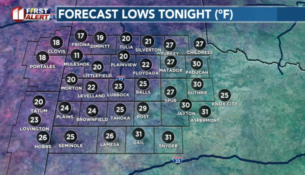 Overnight lows(KCBD)
By early Saturday morning, wind chills near zero are possible with colder spots near Muleshoe.
Saturday will be dry but chilly. Highs are expected to reach the 40s and low 50s under mostly sunny skies as high pressure settles over the region.
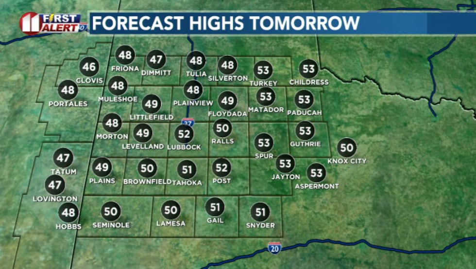 Saturday will be dry but chilly. Highs are expected to reach the 40s and low 50s under mostly sunny skies as high pressure settles over the region.(KCBD)
A warming trend begins Sunday and continues into next week. Sunshine and lighter winds will allow temperatures to climb back into the 60s, with dry conditions expected to last for several days.
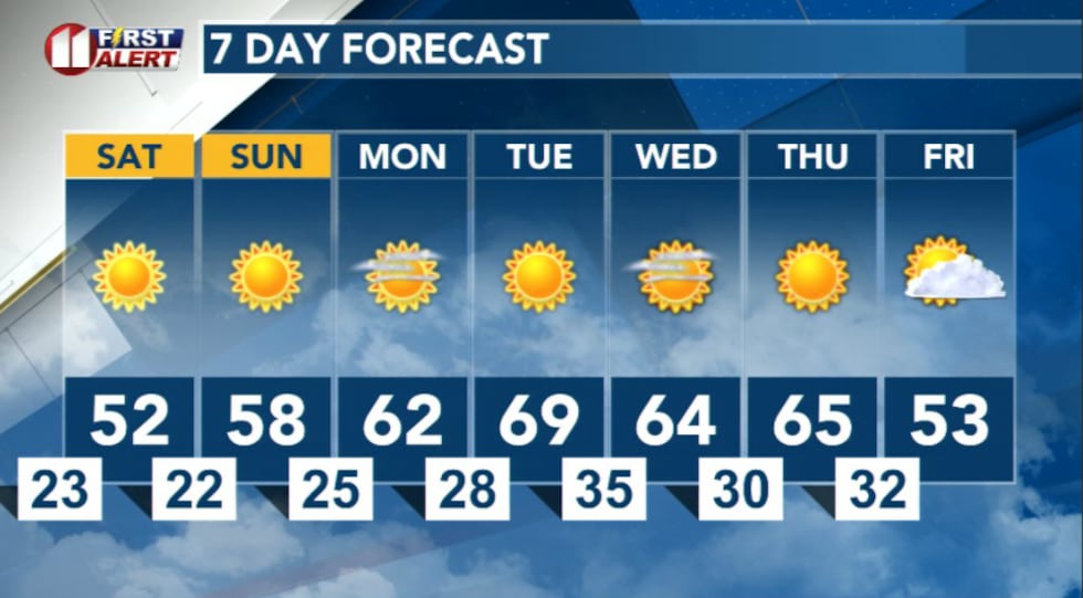 7 Day Forecast(KCBD)
Copyright 2026 KCBD. All rights reserved.