
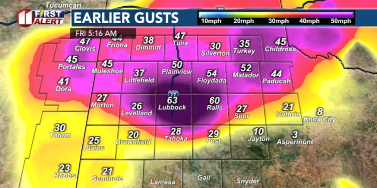
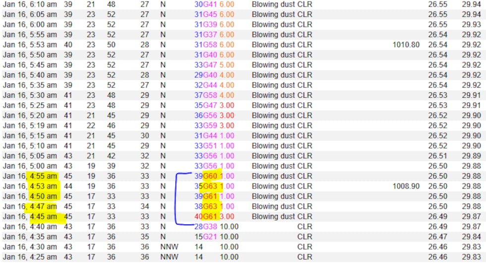
LUBBOCK, Texas (KCBD) -If you were woken up by the strong winds early this morning you weren’t alone. In fact, Lubbock Airport clocked a wind gust of 63 mph and one mile visibility around 5am. The wind advisories and warnings have since expired, but winds will remain strong for most of the day before calming down by sunset.
 Strong wind gusts captured at 5:16 AM(KCBD)
This morning’s strong winds were the direct result of a cold front that had passed through our area.
Think of a cold front like a wedge (or snowplow). As it moves through, it undercuts and lifts the warmer, lighter air out of the way. That leaves an opening for colder, denser air to surge in and replace it at the surface.
Because cold air is heavier than warm air, as it poured in and added weight to the atmosphere and caused pressure to rise quickly behind the front. At the same time, air pressure stayed lower to the south.
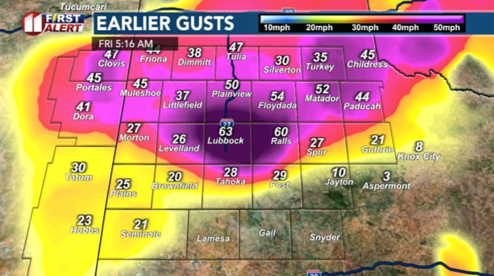
 Wind gusts peaked around 60mph this morning (NWS/Lubbock)(KCBD)
That set up a big pressure difference over a short distance. Basically a steep downhill slope in atmosphere. And air naturally moves from high pressure to low pressure. So, the steeper the slope, the faster the wind blows.
That’s exactly what happened this morning.
On top of that, colder air doesn’t just move sideways, it also sinks. As it settled in, it helped drag stronger winds from higher in the atmosphere down to the surface.
 Winds expected to die down by sunset(KCBD)
Through most of today winds remained strong running 15-25 mph but are expected to die down as we move into the evening.
Even with the cooler temperatures, the dry air and lingering wind speed mean elevated fire danger this afternoon, particularly east of I-27. It’s not a good idea for any outdoor burning.
High pressure slides closer overhead and that pressure difference mentioned above shrinks, and that downhill slope flattens out. With less imbalance to fix, the wind loses its energy and gradually eases.
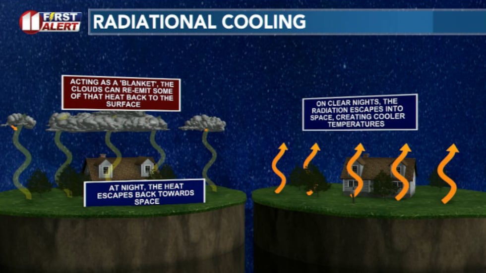
Tonight, a few clouds may move in which will add some insulation and limit how cold temperatures can get.
 Tonight, a few clouds may move in which will add some insulation and limit how cold temperatures can get(KCBD)
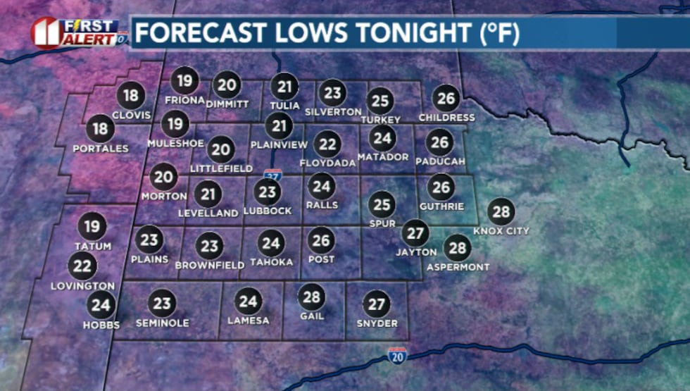
But even so, lows will still drop into the 20s for most areas, with a few teens possible where clouds thin out..
 Lows tonight(KCBD)
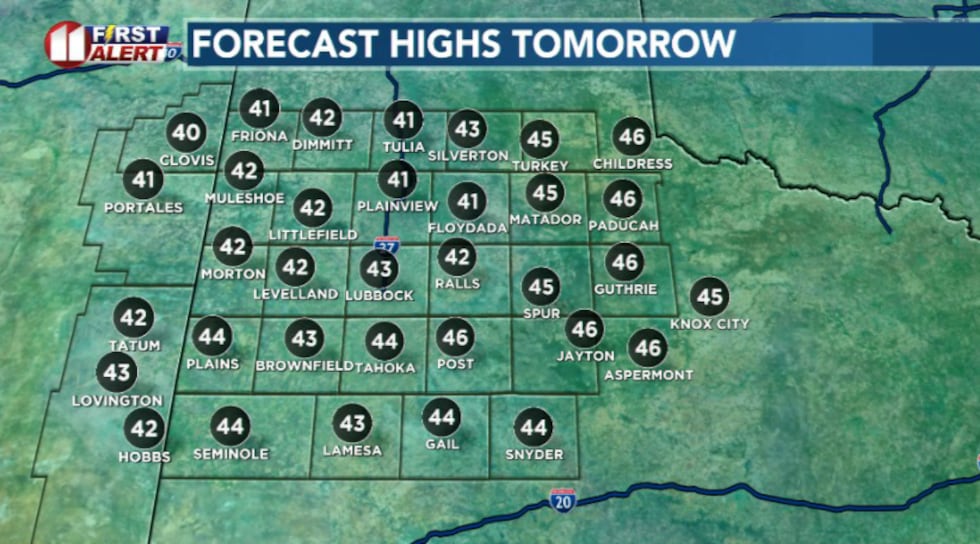
Saturday, highs will struggle to climb out of the 30s with low clouds that will stick around.
 Highs tomorrow will struggle to get out of the 30s.(KCBD)
A few flurries are possible, mainly in the northeastern counties but no accumulation is expected. There’s moisture but not enough lift to get anything going.
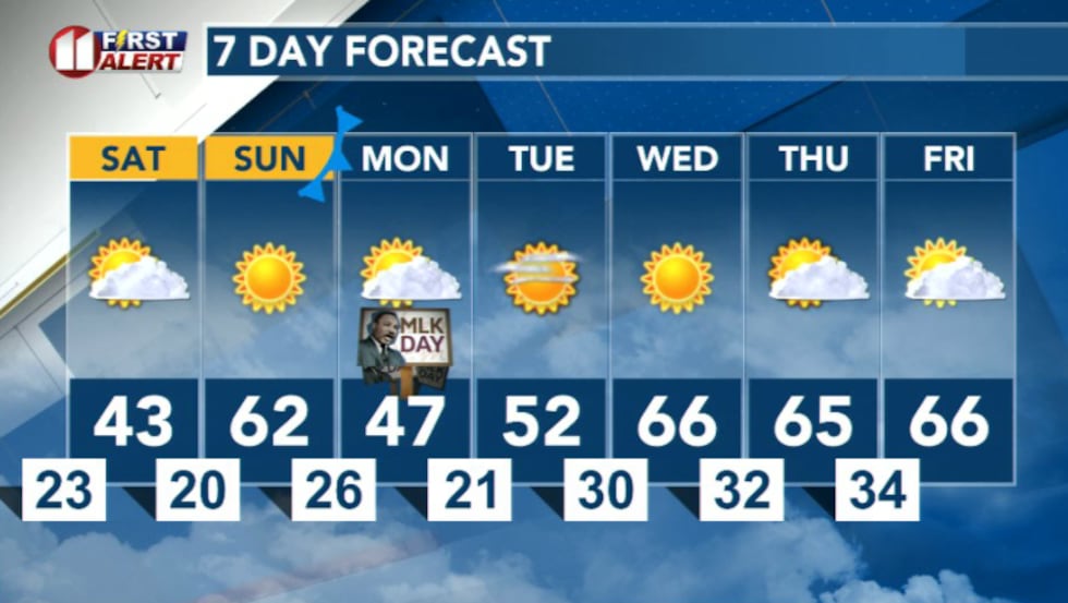
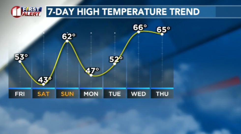 Sunday temperatures will rebound into the 50s and 60s but another cold front sneak in late Sunday night dropping Monday’s highs into the 40s. And 60s return Wednesday(KCBD)
Sunday temperatures will rebound into the 50s and 60s but another cold front sneak in late Sunday night dropping Monday’s highs into the 40s. And 60s return Wednesday.
 7 Day Forecast(KCBD)
Copyright 2026 KCBD. All rights reserved.