
LUBBOCK, Texas (KCBD) – A cold front is moving across our area. It will lead to cooler days. It appears Lubbock has reached 94 Monday afternoon. We’ll get the official confirmation a little later today. This would set a new record high for the date. The Oct. 20 record was 93, last reached here in 2012.
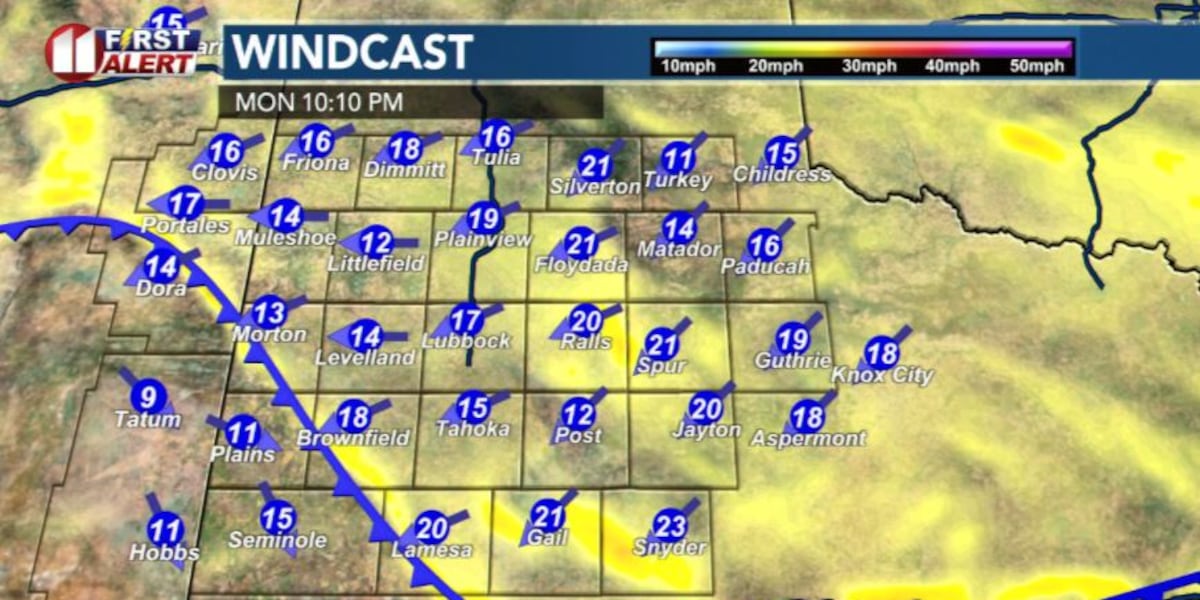
The wind has been out of the west above 20mph, gusting past 30 this afternoon. When the front slides across the area, the NE wind will kick up to around 20mph. Cooler air will then build into the area tonight.
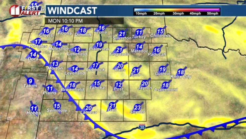 Computer model projection Monday night(Matt Ernst | KCBD)
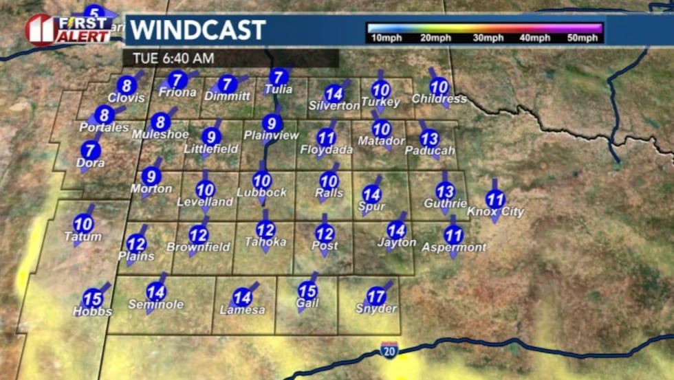 Model projection Tuesday morning(Matt Ernst | KCBD)
The wind will become light by sunrise. Along with dry air, a cooler start is expected. Low near 45 in Lubbock, with some 30s from Muleshoe to Dimmitt.
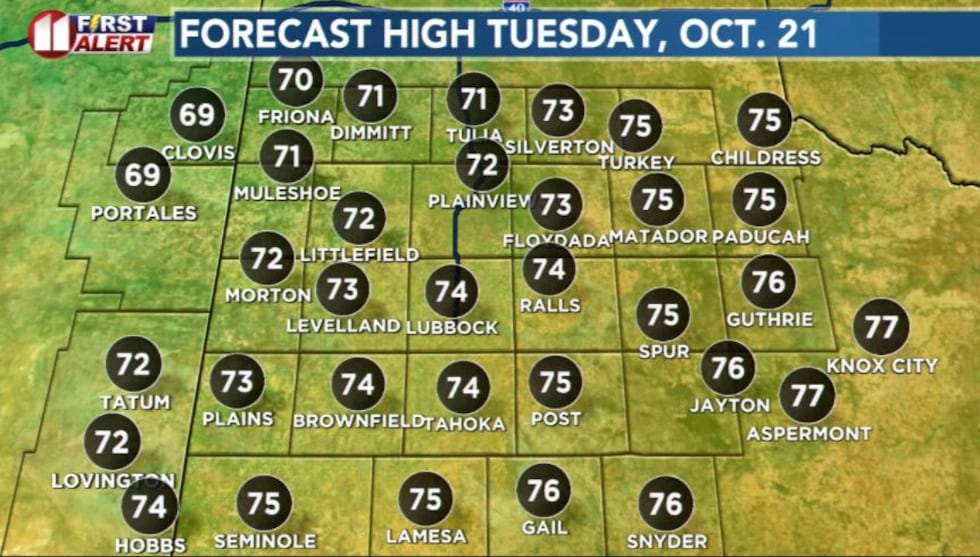
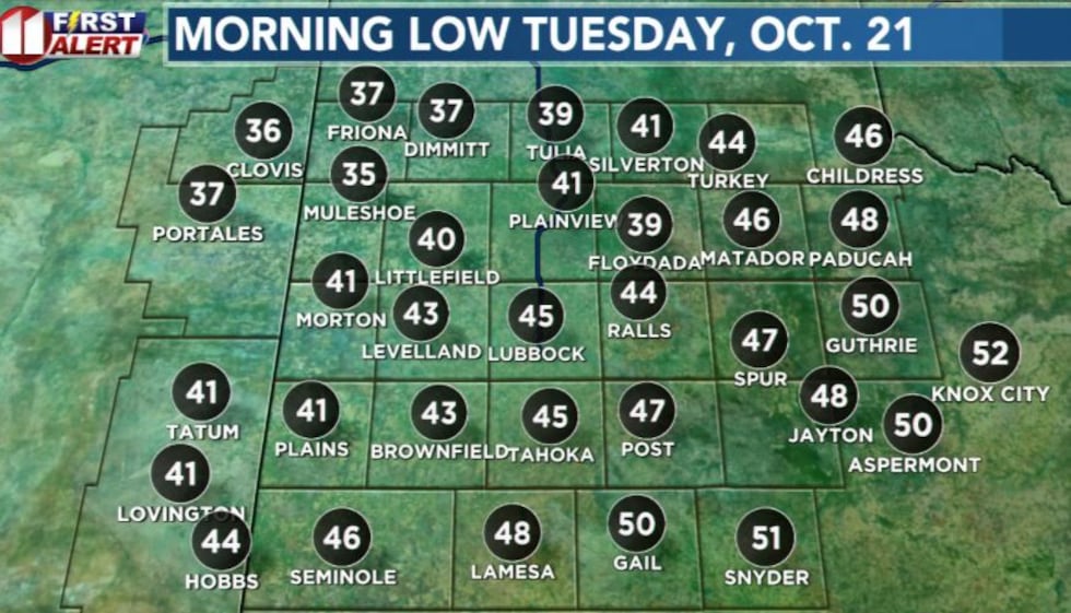 KCBD First Alert Forecast for Tuesday, Oct. 21.(Matt Ernst | KCBD)
It’ll be a sunny and cooler day Tuesday, high near 74. Wind NE/SE 5-15mph.
 KCBD First Alert Forecast for Tuesday, Oct. 21.(Matt Ernst | KCBD)
Another cool start Wednesday morning, with that afternoon climbing back to the 80s.
Clouds will increase late Wednesday into Thursday. There is a chance for rain and possibly a thunderstorm late Thursday.
Looking ahead, the weekend will feature lots of sunshine. It’ll be a sunny and mild day for the Texas Tech game Saturday afternoon.
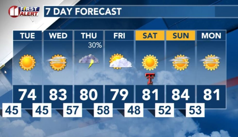 Lubbock 7-day forecast(Matt Ernst | KCBD)
Copyright 2025 KCBD. All rights reserved.