
LUBBOCK, Texas (KCBD) – Seasonably mild weather highlights our forecast through mid-week. An Arctic cold front, the strongest of the season so far, is bring significant change Friday into the weekend.
Tonight
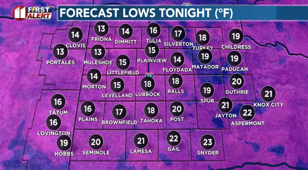 Tuesday morning temperatures may be the lowest of the season. So far.(KCBD First Alert)
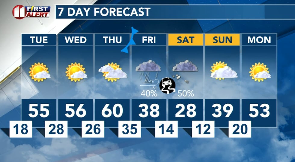
Clearing skies with a light wind bring ideal conditions for radiational cooling tonight. Temperatures will dip into the teens and 20s.
Tuesday
Tomorrow, shifting winds and a sunny sky will result in a much warmer afternoon. Southwesterly winds will become breezy, increasing to around 10 to 20 mph, with stronger gusts, in the afternoon.
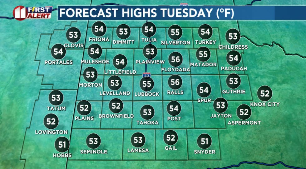 A breezy and much warmer afternoon, Tuesday, with highs slightly below to near average.(KCBD First Alert)
The direction, which includes a down-sloping component, will bring warmer air from the west back to the KCBD/FOX34 viewing area.
Wednesday – Thursday
Quiet weather, including mild temperatures for the time of year, will continue Wednesday and Thursday. Temperatures will range from lows in the 20s to highs in the 50s.
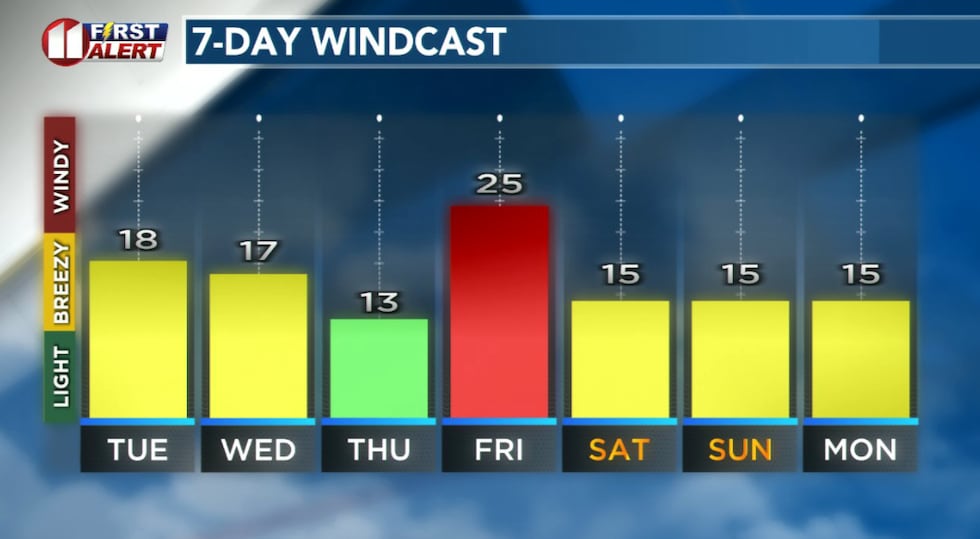 Forecast peak sustained winds are shown in this graph. Peak gusts will exceed the values shown here.(KCBD First Alert)
A bit of a breeze is likely each day.
Winter Comes Knocking
A change you likely want to take note of arrives Friday. What currently is anticipated to be the strongest cold front of this season – so far – will arrive Friday morning.
I expect highs for the day to occur just after midnight Friday (morning) and lows for the day just before midnight Saturday. That is, I expect the temperature to fall throughout the day Friday.
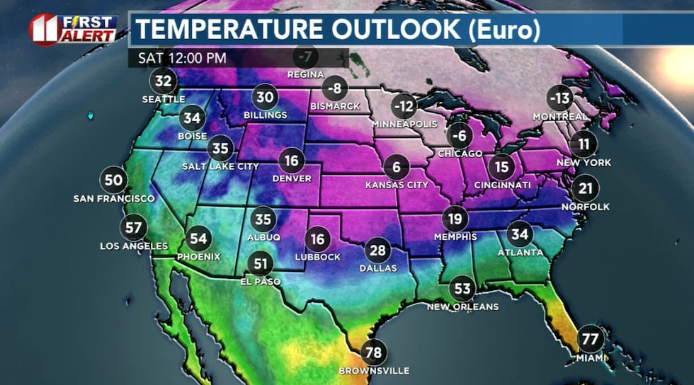 The coldest weather of the season so far is expected this weekend!(KCBD First Alert)
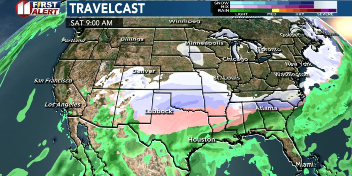
As the Arctic air settles in, an approaching weather system will approach from the southwest. Ahead of this system, moisture will flow toward West Texas, riding over the cold air at the surface. As the low moves over West Texas it will generate lift, resulting in precipitation.
Wintry Showers
The precipitation may begin as early as Friday afternoon, though evening looks a little more likely at this point, as sleet or freezing drizzle or light rain. Based on the data available now, a change over to snow will occur Friday night with snow – possibly – through afternoon.
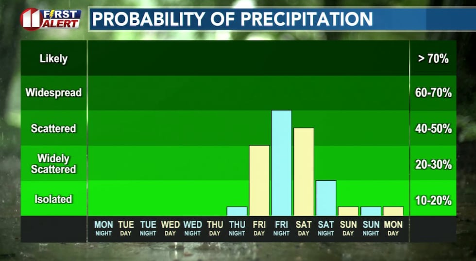 Precipitation chances increase late Friday, with an increasing chance of wintry showers.(KCBD First Alert)
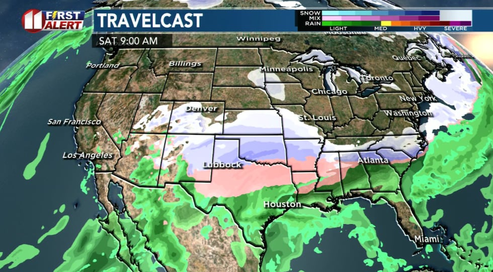
Everyone always wants to know, how much snow? And this far out, we always say, it is too early to say. That said, IF everything comes together as today’s guidance suggests, some snow is likely for much if not all of the viewing area. Amounts vary from less than inch all the way up to a foot of snow. One of the most reliable models has the heavies snow across the northern viewing area. Another places it across the southern viewing area.
 An increasing chance of wintry showers heading into the weekend.(KCBD First Alert)
One of the difficulties in saying how much and where is the actual track the system travels. A small change could mean shutting down the town, or no big deal at all. This far out, either is a possibility.
Arctic Cold Reminder
One thing I do have high confidence in is it is going to get cold Friday, will be coldest Saturday, and won’t warm much Sunday. Down at the surface where we live it certainly will be cold enough for snow. Read “On This Date” below for some perspective.
 Seasonably mild weather the next three days, then a blast of Arctic air Friday brings a chance of wintry showers.(KCBD First Alert)
A reminder ahead of the cold weather arriving at week’s end, the 4 P’s of Cold Weather: People, Pets, Plants, and Pipes. If you are not already, you have several days to prepare. I expect this to bring us our lowest temperature so far this winter. For Lubbock, the lowest so far was 20° on December 2.
On This Date
On this date in 2007, a strong upper level storm system with abundant moisture brought a mix of winter weather to the region. The majority of the precipitation across the southwest Texas Panhandle and northwest South Plains fell as snow. Farther south and east, where temperatures aloft were slightly warmer, many experienced a combination of freezing rain, sleet and snow, before changing over to all snow.
The storm system was dubbed by some Lubbock residents as the “United Storm”, due to NWS forecasts several days in advance cautioning up to 14 inches of snow in the city. These specific and record snowfall forecasts caused many residents to panic and stock up on grocery supplies, most notably from United Markets food stores where some shelves were emptied. The reality is that computer models and human forecasts are rarely accurate with the track of winter storms more than 60 hours in advance.
(Source: National Weather Service, Lubbock)
Copyright 2026 KCBD. All rights reserved.