
The arrival of the freezing temperatures, as well as the wintry precipitation for North Texas, has come much later than models were originally showing.
The good news is that not much accumulation happened overnight for DFW. The bad news: there will be wintry precipitation until Sunday morning along with icy roads and a heightened potential of power outages.

Around 5 a.m. Saturday, the winds shifted, coming from the northwest, which brought much cooler temperatures leading to snow, sleet and freezing rain. In fact, temperatures on the road got to freezing.
Precipitation is now starting to accumulate and cause icy conditions on roadways. Expect hazardous travel all day.
The forecast is calling for more rounds of wintry precipitation throughout the day. There may be a slight lull in the afternoon, but most of the day will be dreary, cold and wet. Snow, sleet and freezing rain will be possible through Sunday morning.


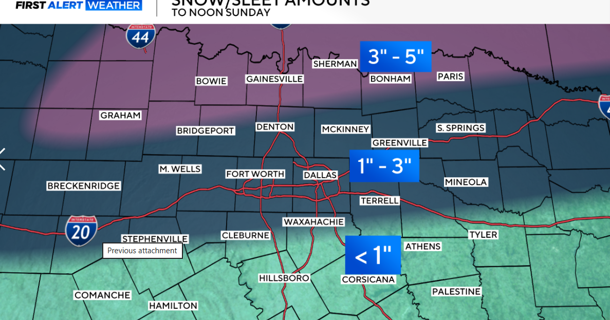
Snow and sleet totals will range from 1-3″ across North Texas with ice around .25 to .75″. This is extremely dependent on the temperature profile of the atmosphere.


A winter storm warning is in effect for hazardous winter weather until Sunday at noon. In addition, an extreme cold warning is in effect from Saturday evening to noon on Monday. Wind chill values will be dangerously cold, and temperatures may feel like 0 to -10 degrees.
Temperatures will be dangerously cold and stay at or below freezing for 75+ hours. This could lead to issues when it comes to pipes. Be sure to winter-proof your home if you haven’t already. Temperatures are expected to climb above freezing Tuesday afternoon.
As for the next seven days, the next weather maker and snow machine may be in the forecast by next weekend.
More from CBS News