
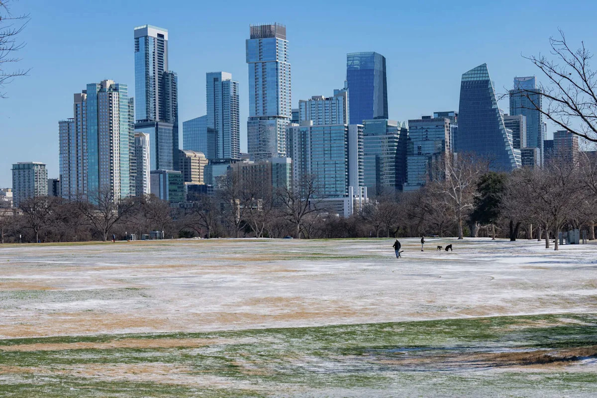
Ice is slowly disappearing from shaded spots around town as we continue to thaw out. Wednesday began in the 20s, but temperatures rose quickly into the 50s.
After another frigid start, the week’s warmest air arrives Thursday, with afternoon temperatures climbing into the 60s — slightly above the late-January average of 64 degrees. The sky will be mostly cloudy with light south winds between 5 and 10 mph.
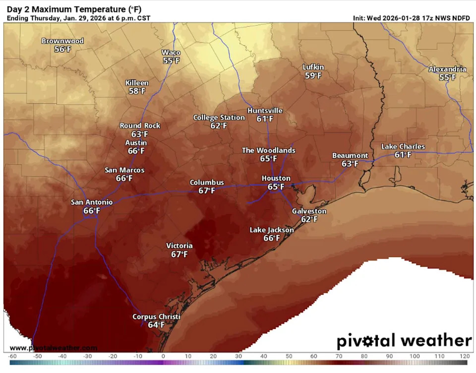
Temperatures in Central and South Texas will be the warmest of the week on Thursday with afternoon highs in the 60s. (Pivotal)
The warming trend won’t last long, though, as another cold front will sweep across Texas on Thursday night with breezy north winds and cooler temperatures settling in for Friday.
The front will move through Texas without producing any precipitation, keeping conditions dry across the state. That won’t be the case farther east, however.
As the storm system pushes east on Friday, a wintry mix is expected from Mississippi to South Carolina. Florida will see chilly rain, while areas farther north, from Tennessee to Virginia could see snow.
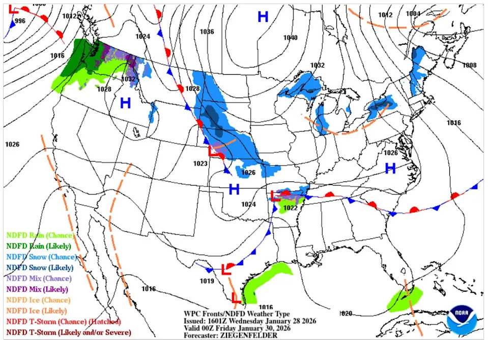
Another cold front is in the forecast for Thursday night, but this one will move through Texas dry, bringing blustery north winds and cooler temperatures. (Weather Prediction Center)
In Texas on Friday, temperatures will turn cooler. Morning temps in Austin will hover near freezing, but afternoon highs will remain relatively mild, reaching the 50s from the Panhandle to the coast. The exception will be northeast Texas, where temperatures are expected to stay in the 40s.
By Saturday, a reinforcing shot of arctic air will sweep across Texas from northeast to southwest. This will brush South-Central Texas, sending temperatures tumbling for the weekend. Morning temperatures will easily dip into the 20s on Saturday and even the teens on Sunday morning, while afternoons will range from 40 to 51 degrees.
Beyond the weekend, we’ll steadily warm back near seasonal normal levels Monday and Tuesday before another storm system approaches for midweek. Currently, we only have low to moderate rain chances in the forecast on Tuesday and Wednesday with temperatures staying well above freezing.
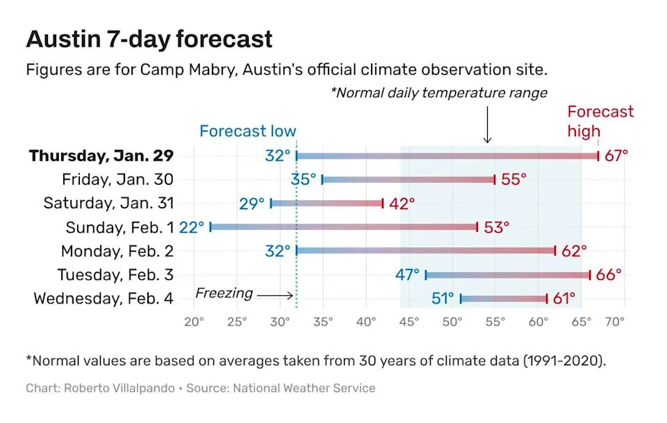
Temperatures in Austin return to normal levels in the seven-day forecast from the National Weather Service. (National Weather Service)
Winter storm wrap-up
While we are finally thawing out from the past weekend’s winter storm, let’s recap our first winter storm of 2026. An Arctic front surged across Texas last Friday, bringing rapidly falling temperatures. Before readings dropped to freezing, a Pacific atmospheric disturbance moved in Friday night, producing widespread rainfall across Central Texas with rainfall totals ranging from an inch to 2 inches.
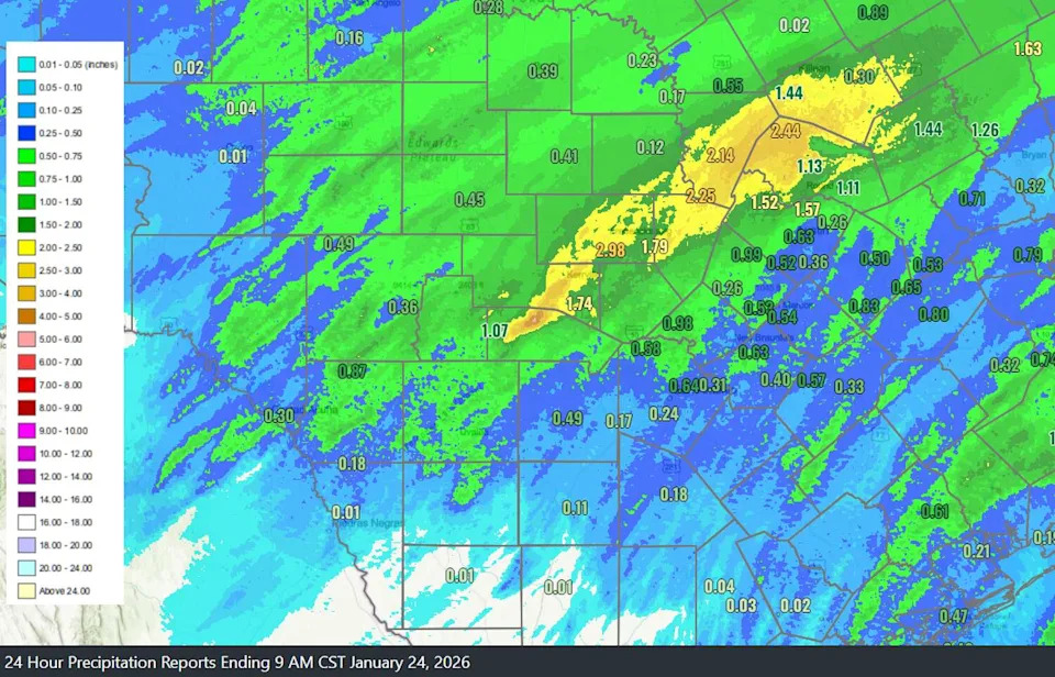
The rain ahead of last weekend’s wintry weather brought a good dose of rainfall to Central Texas. (National Weather Service)
By 6 a.m. Saturday, rain changed to freezing rain in the Hill Country, followed by a brief lull mid-morning. Temperatures reached the freezing mark in Austin around noon and remained below freezing until Monday afternoon.
Another round of moisture moved into Central Texas by Saturday evening and lasted into Sunday morning. Precipitation began as freezing rain, but as temperatures fell into the 20s after midnight, it transitioned to sleet.
When the storm ended, the Wells Branch area recorded 1.8 inches of sleet, while Lakeway picked up around an inch. Austin-Bergstrom International Airport measured 0.8 inch of sleet along with 0.11 inch of freezing rain.
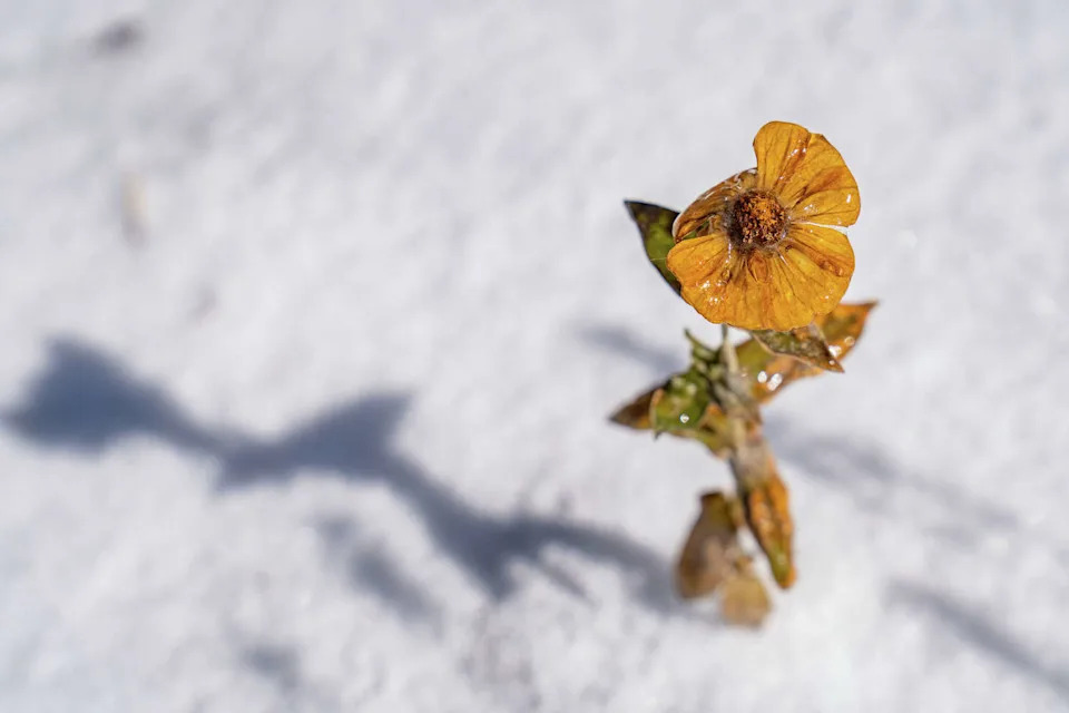
A flower is seen frozen following a winter storm in East Austin on Sunday. (Mikala Compton/Austin American-Statesman)
Record=low temperatures were set at Camp Mabry, Austin’s main weather station, on both Sunday and Monday, with lows of 19 and 18 degrees. Austin remained below freezing for 48 consecutive hours, while the airport stayed below freezing for 50 straight hours.