
A Quick Airport-Lounge Forecast
When you’re sitting in an airport lounge and decide to record a weather video… what could possibly go wrong? Thankfully, the only turbulence for now is in the atmosphere.
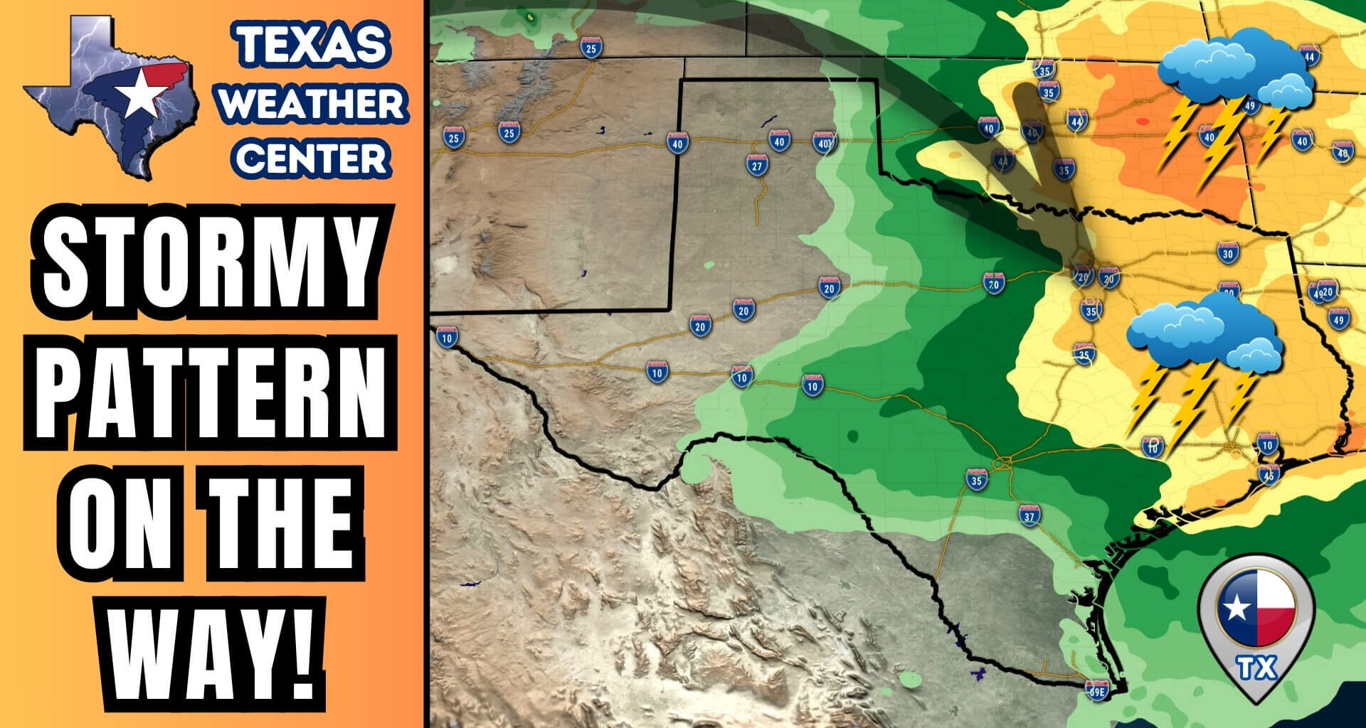
As of Tuesday morning, Texas is sliding into a more active weather pattern — meaning more rain, more storms, and fewer bone-dry days across the Lone Star State.
Today: Dry, Breezy, and Fire-Prone
A weak cold front has pushed south across the northern two-thirds of Texas today, bringing gusty north winds and slightly cooler temperatures. Most of the state will remain dry and sunny, but that also means fire danger is back.
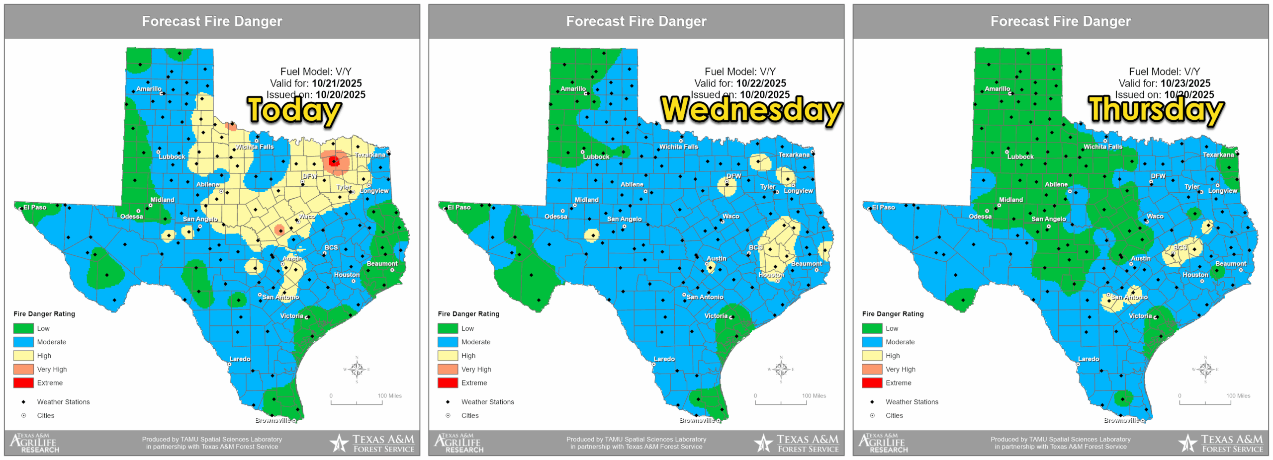
Texas A&M Forest Service highlights very high fire danger today, easing midweek as humidity increases.
The Texas A&M Forest Service highlights very high fire danger across much of northern and western Texas. Low humidity and warm temperatures will allow any sparks to spread quickly — so avoid outdoor burning, check for dragging trailer chains, and use extra caution if working outside.
Tomorrow and Thursday will bring continued elevated fire weather, but humidity will begin increasing late in the week as moisture returns from the Gulf.
Midweek Pattern: Staying Quiet for Now
Tuesday and Wednesday will be mostly quiet weather-wise. Expect mild afternoons in the 70s and 80s across most of the state, with 90s still hanging on across South Texas.
Cloud cover will increase overnight and into Wednesday as southerly flow re-establishes itself. This will pull Gulf moisture back inland and set the stage for Thursday’s storm chances.
Thursday Through Saturday: Rain and Storms Return
We’re finally tracking a meaningful chance for rain across much of Texas. A developing upper-level disturbance will bring showers and thunderstorms to the Texas Panhandle and West Texas Thursday afternoon and evening, then spread east Friday and Saturday.
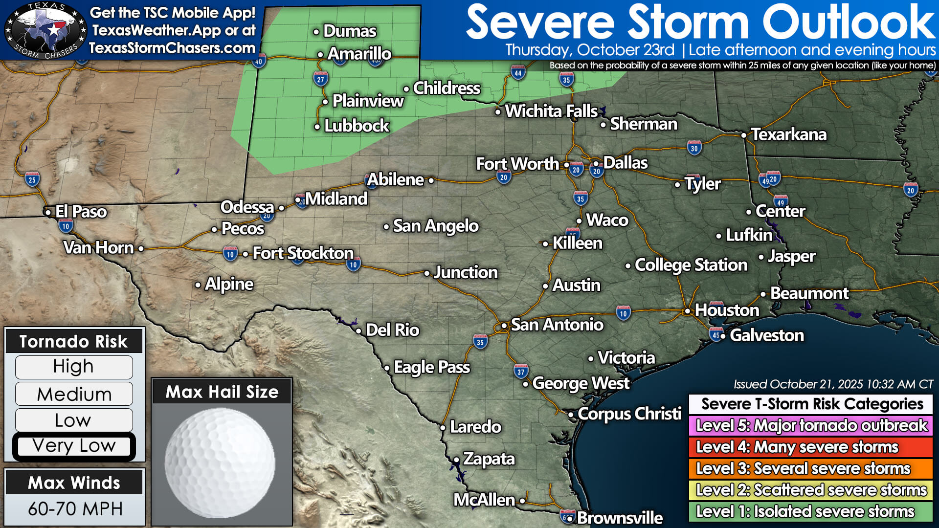
Thursday’s severe weather outlook shows isolated severe storm potential in the Texas Panhandle and West Texas.
Some of these storms could be strong or marginally severe, especially across North and Central Texas, where hail and gusty winds are possible.
Localized heavy rainfall may also cause minor street flooding, particularly across urban areas in East Texas and the Brazos Valley.
Rain Totals: Beneficial Moisture on the Way
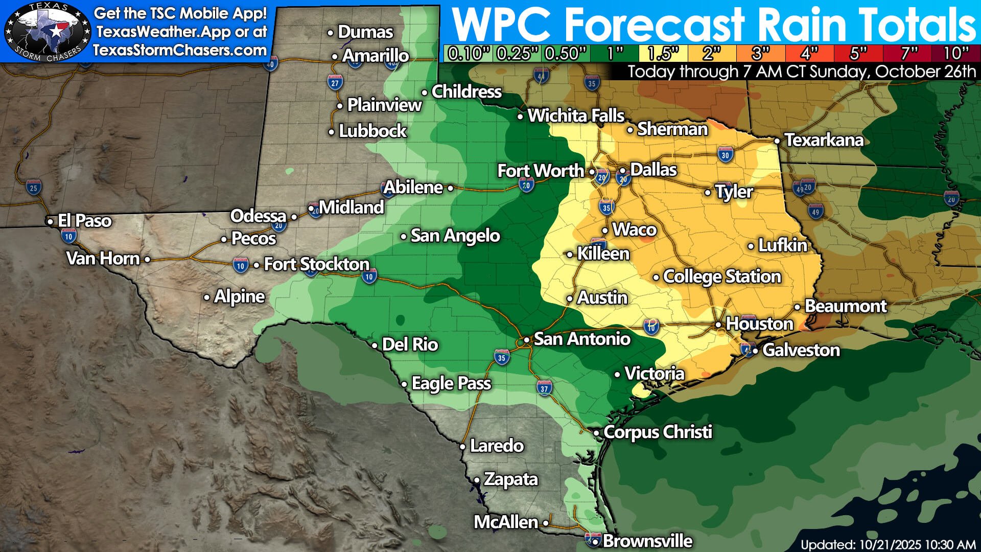
WPC rainfall forecast shows beneficial rain for the eastern half of Texas later this week.
Forecast rainfall through Sunday morning shows 1 to 3 inches of rain across East Texas, the Brazos Valley, the Golden Triangle, and Central Texas — with locally higher amounts possible.
Even the Hill Country and Big Country could see a few tenths to half an inch, which would help ease ongoing flash drought conditions and reduce wildfire risk for a while.
Temperature Roller Coaster Continues
Today’s highs range from the 70s and 80s north to the 90s and near-100°F in South Texas.
Behind the front, Wednesday brings slightly cooler conditions, then a warm-up Thursday ahead of the next storm system. By Friday and Saturday, expect another mild cooldown, with highs mainly in the 60s and 70s north and 80s to 90s south.
No Arctic outbreaks are on the horizon — just typical fall fronts to keep temperatures bouncing around.
Looking Ahead: Fall Pattern Takes Over
After months of persistent high pressure and dry weather, the ridge has finally broken down. Over the next 10 days, multiple upper-level systems are expected to move across the Southern Plains, each bringing chances for rain, storms, and weak cold fronts.
If this pattern holds, October will end on a wetter, more seasonable note — great news for drought-stricken areas.
Stay Weather Aware
You can always get your local weather forecast, track live radar, and check the latest alerts in our free Texas Storm Chasers mobile app — just search for Texas Storm Chasers in your app store.
⚡ Track live radar: https://texasstormchasers.com/radar
🌩️ Severe outlook: https://texasstormchasers.com/severe
📱 Get the app: https://texasweather.app
Thanks for tuning in, and hopefully, this airport-lounge forecast made it out before boarding time!
Stay safe, stay smart, and God bless!