
A Pacific cold front swept through Southeast Texas Saturday night, bringing a line of strong to severe thunderstorms with it. The rain didn’t last for long, though, as the front quickly sent drier air into Southeast Texas during the overnight hours.
Because this front had Pacific origins, the resulting drop in temperatures will be relatively modest. High temps Sunday will only be about 5 to 10 degrees cooler than what the region experienced on Saturday. Still, with dry air in place, it’ll feel cool and comfortable across the Houston area.
Don’t get used to it though, as yet another shift in the weather pattern is expected this week, bringing unseasonably warm weather into Southeast Texas.
Sunday’s forecast
It’ll be a cool start across southeast Texas as temperatures will likely hover in the upper 50s between 5 and 9 a.m. Winds will be quite breezy as well, with some gusts up to 20-25 mph expected.
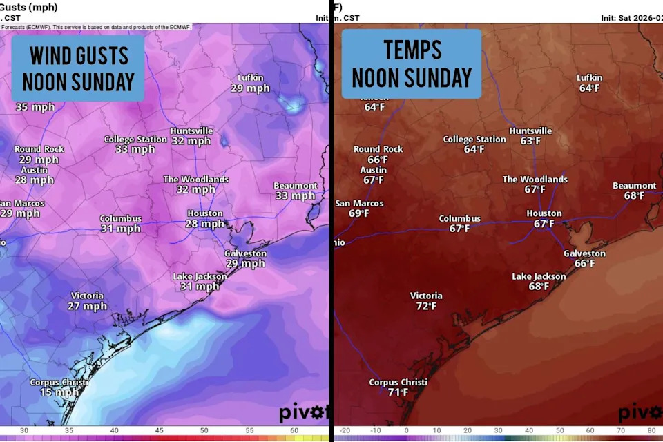
Shown are the potential wind gusts, as well as temperatures across Southeast Texas at noon Sunday. (Pivotal Weather)
Skies will be mostly clear throughout the morning, but will become partly cloudy as we push into the middle of the day. With north winds in place, temperatures will be very slow to rise, only reaching the mid-60s by noon. Afternoon high temps in Houston are expected to top out in the upper 60s – near average for mid-February.
The air will be noticeably drier as well, as dew points are expected to sit in the mid-50s. The drier air will make for a rather pleasant evening with temps in the 60s, falling into the 50s overnight.
Monday will bring similarly comfortable weather into Southeast Texas. Morning lows in the mid-50s will transition to afternoon high temps in the low 70s, just a few degrees warmer than Sunday. Partly to mostly sunny skies are expected, with no chance of rain region-wide.
Changes on the way
A summer-like high pressure system is expected to develop over the Southern U.S. early in the week. That, along with winds shifting to the south, will cause temperatures to rise to abnormal levels for mid-February.
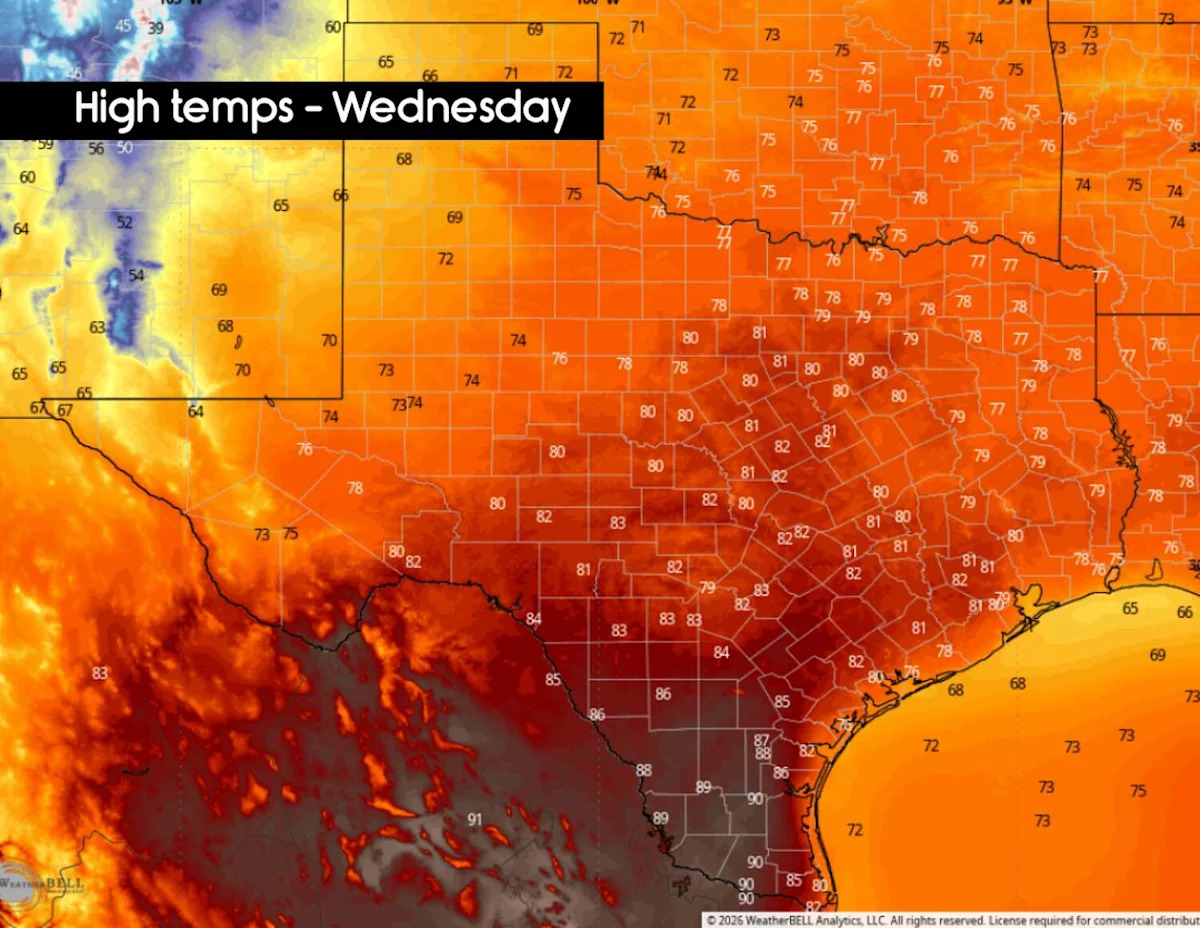
On Tuesday, afternoon temperatures are expected to rise into the mid- to upper 70s. Then by Wednesday, temps will likely surge back into the low 80s, nearly 15 degrees above average for mid-February.
The warmest day of the week is expected on Thursday. Morning low temps will be mild, only dropping into the low 60s, and afternoon high temps are likely to rise into the mid-80s under partly sunny skies. A weak cold front may move into the area by Friday, but it may only drop by a few degrees.
Long-range weather models do indicate that slightly cooler weather is likely for next weekend and early next week. Still, no major cold fronts are expected as highs will likely continue to sit in the 70s.
Rain chances may also rise slightly by next weekend. However, chances of significant, widespread rainfall remain low, causing drought conditions to become more widespread across Southeast Texas.
This article originally published at Cool Sunday expected in Houston, but a big weather pattern shift is on the way.