
SAN ANTONIO – Latest trends continue to signal a much-needed chance for rain across the San Antonio area with the added risk of thunderstorms.
The system we’ve been monitoring over the past few days is now moving into the Southwest. Our forecast for this upper-level low remains steady: it’s tracking across Texas and is strong enough to trigger showers and storms.
CLICK HERE FOR OUR INTERACTIVE RADAR
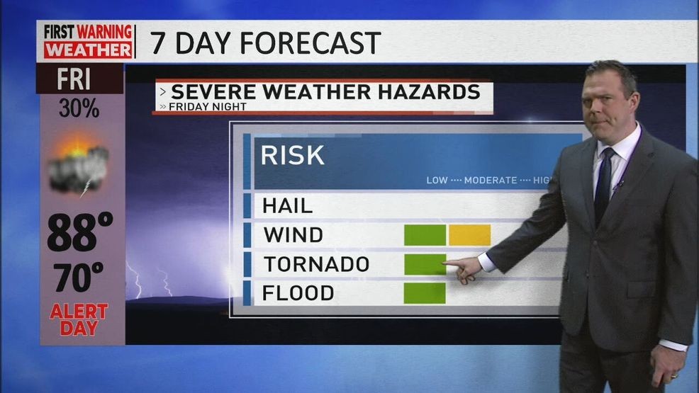
As it pushes into the state, the system will draw in ample moisture and combine it with strong atmospheric dynamics, leading to widespread rain and storms. Some storms could produce very heavy rainfall, with rates of 2–3 inches per hour in stronger cores. There’s also a chance for brief strong gusts, particularly if storms organize into a line or cluster. This setup favors wind impacts more than large hail.
First Warning Weather with{ }Meteorologist Brad Sowder
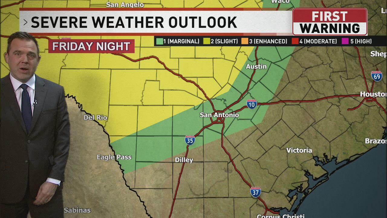
Flooding Outlook: We’re currently at level 1 of 4, but the Hill Country sits at level 2 of 4, indicating a higher chance for localized flooding.
Storms will develop out west and push into our area late Thursday evening through midnight, moving east overnight into Friday morning. Additional pop-up showers or thunderstorms may occur into Saturday afternoon before the main system finally departs Saturday night into Sunday.
Rainfall Totals: Expect 0.5–1.5+ inches across much of the area, with the far southern counties seeing significantly less due to a sharp rain shield drop-off.
Comment with Bubbles
BE THE FIRST TO COMMENT