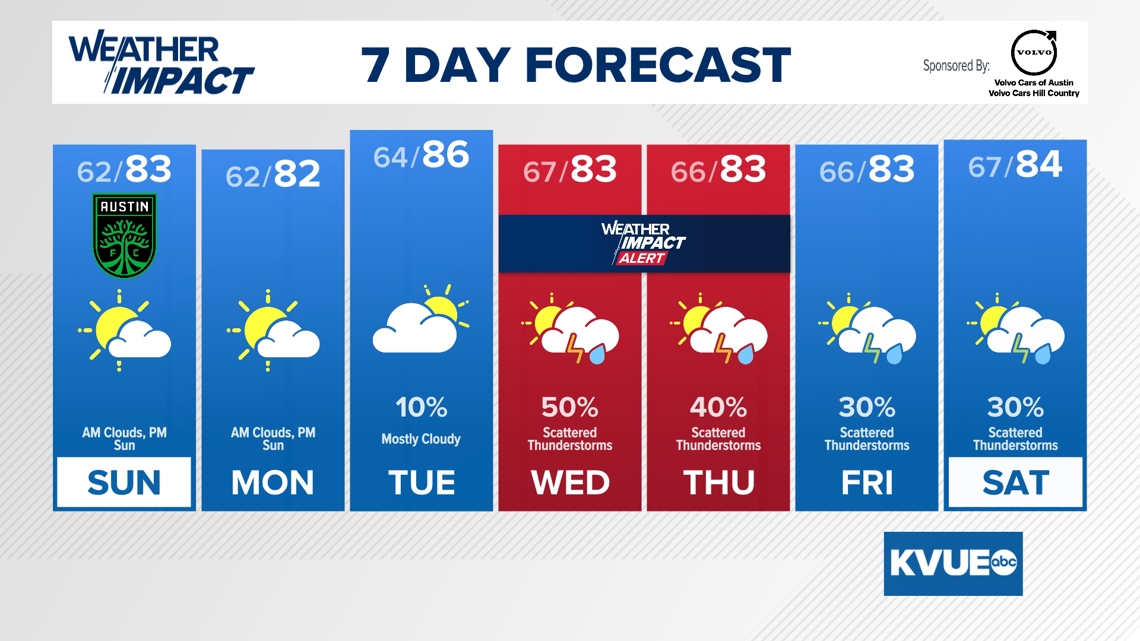
Austin faces a week of big swings, starting with highs in the mid-80s before a system brings a threat of severe storms this Wednesday and Thursday.
AUSTIN, Texas — Soak up the sunshine while you can, Central Texas. After a record-challenging start to the week, the KVUE Weather Impact Team is tracking a shift in the pattern that could bring strong to severe thunderstorms to the area by Wednesday.
We are starting the week on an unseasonably warm note. Highs on Sunday and Monday will hover in the low 80s with a mix of morning clouds and afternoon sun. By Tuesday, the heat cranks up even further, with a forecast high of 86 – well above the late February average.
If you have outdoor plans or are heading to the Austin FC match, the weather looks cooperative, if a bit humid. However, that moisture and heat are exactly what will provide the “fuel” for our midweek weather shift.
Weather Impact Alert: Wednesday and Thursday
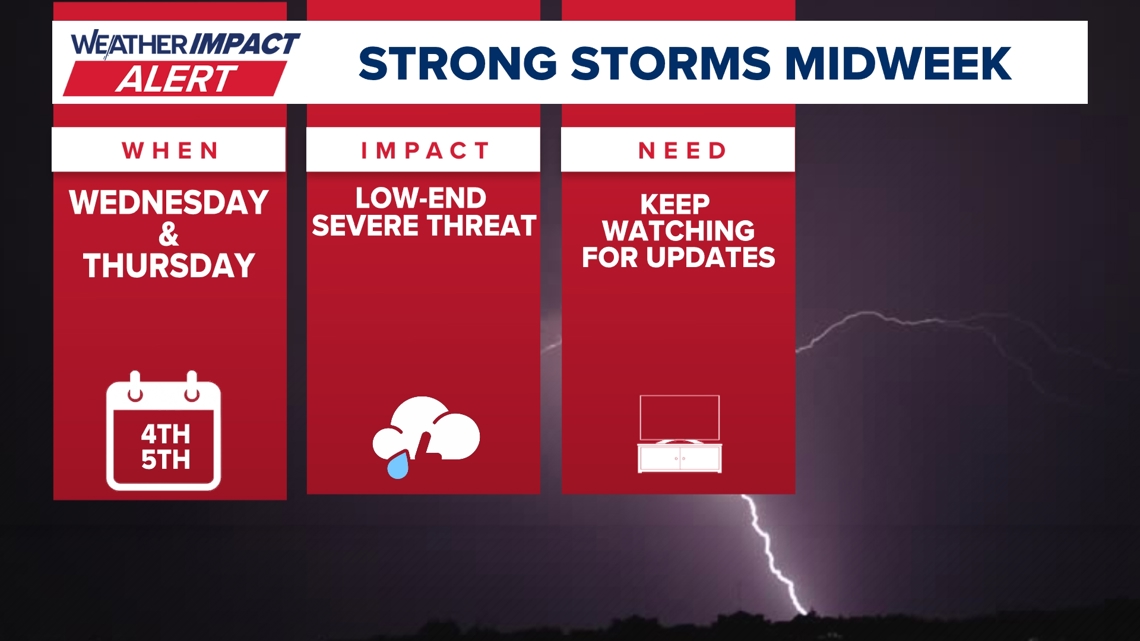
We have issued a Weather Impact Alert for Wednesday, March 4, and Thursday, March 5. A cold front approaching from the west will tap into high levels of available energy over Central Texas.

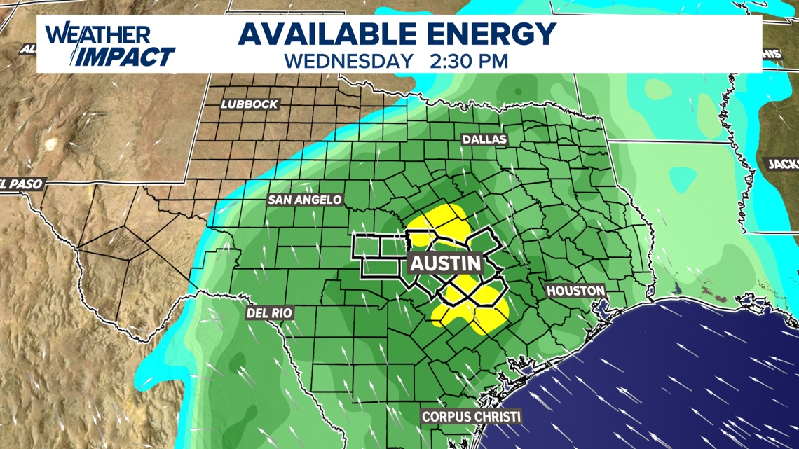
Storms are expected to develop by Wednesday afternoon. Current modeling shows scattered showers and storms becoming more widespread by 8 p.m. Wednesday.

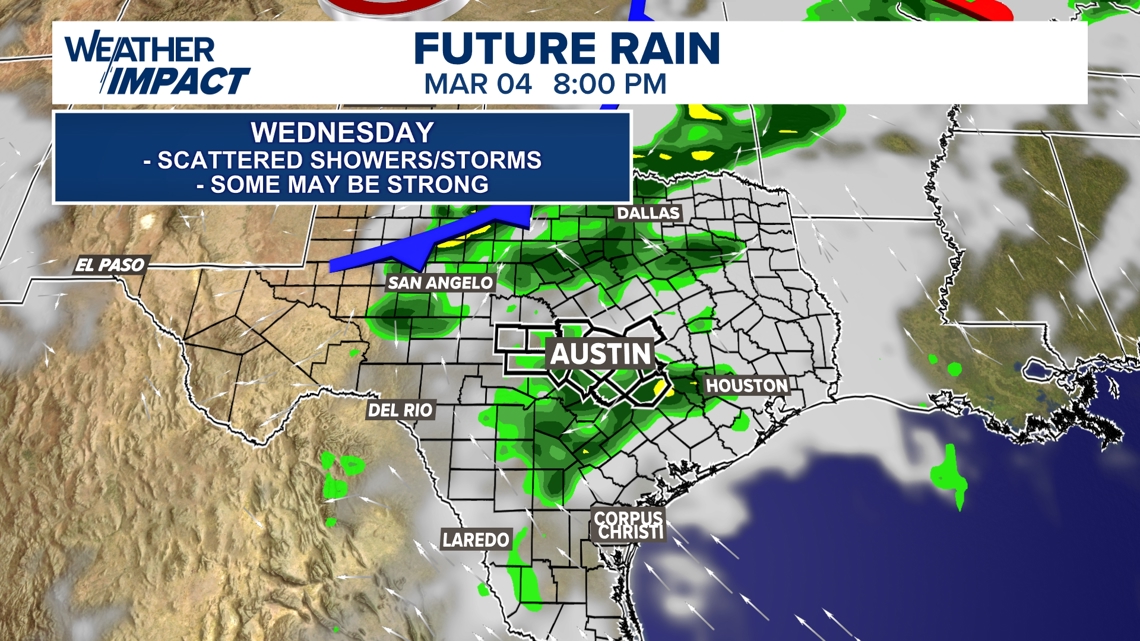
We are currently facing a low-end severe threat. These midweek storms could produce frequent lightning, heavy rain and the potential for gusty winds or small hail.
Wednesday holds a 50% chance of rain, followed by a 40% chance on Thursday.
The rest of the week
The unsettled pattern won’t clear out immediately. While the primary severe threat should diminish after Thursday, scattered thunderstorms remain in the forecast through Friday and Saturday with rain chances holding steady at 30%. Temperatures will stay consistent in the low 80s for the daytime highs and mid-60s for the overnight lows.
Because severe weather setups in Central Texas can be fluid, now is the time to make sure you have a way to receive weather alerts.
Keep watching KVUE for the latest updates on the timing and intensity of these storms.