

LUBBOCK, Texas (KCBD) – A cold front slipped through Sunday night, giving our area a short break from the recent warmth.
Our high temperature yesterday was 87 degrees, about 2 degrees short of a record high.
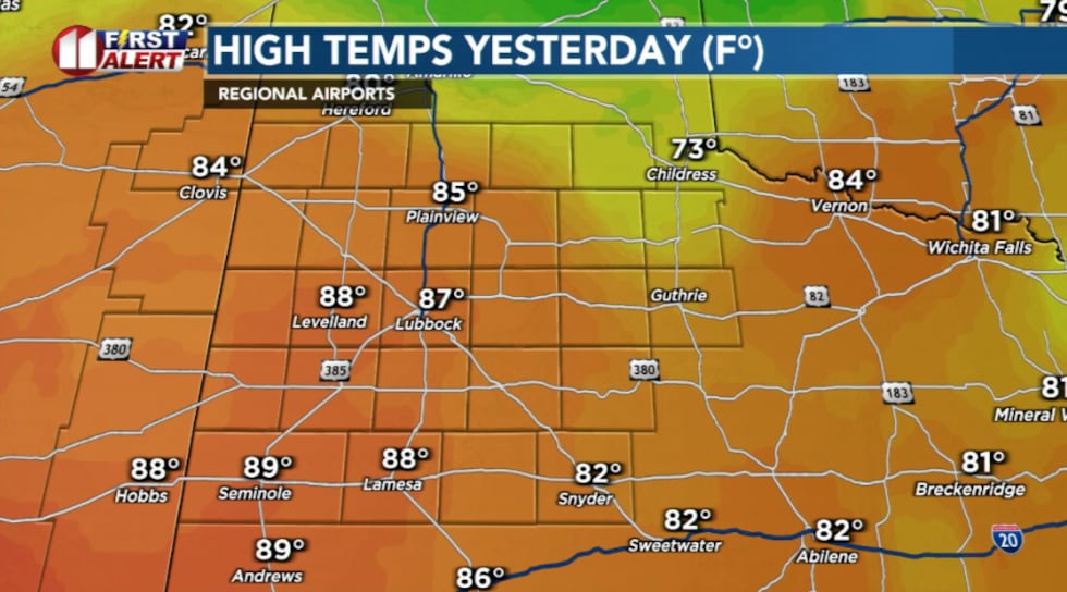 Highs yesterday(KCBD)
Today will be more seasonable for temperatures with highs in the upper 60s. The average high for this time of year is around 63 degrees.
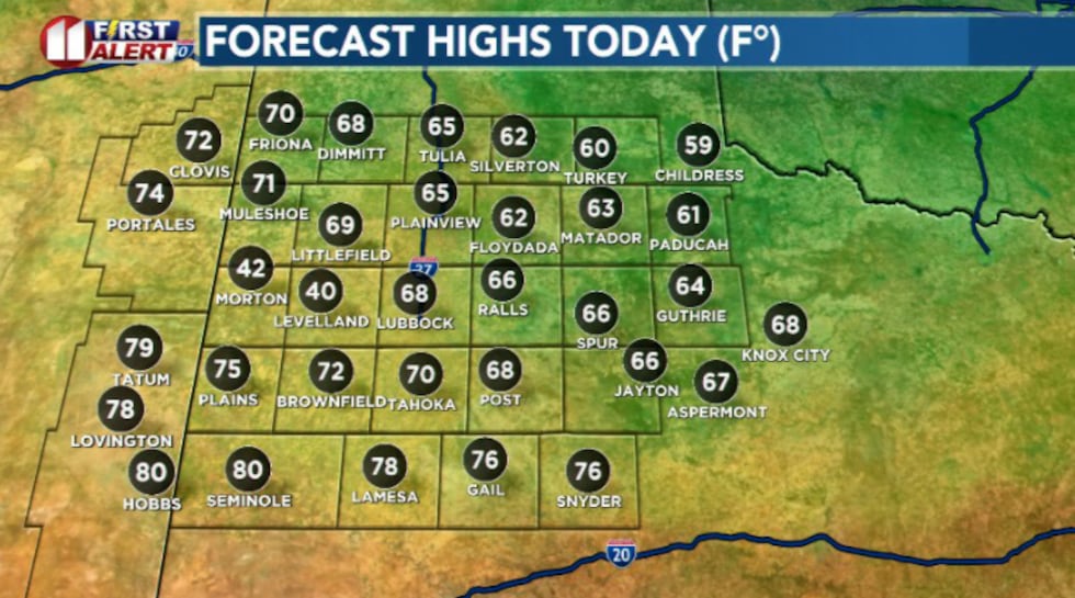 Highs today(KCBD)
Cooler, drier air is hugging the ground. Meanwhile, slightly warmer, more humid air slides up and over it.
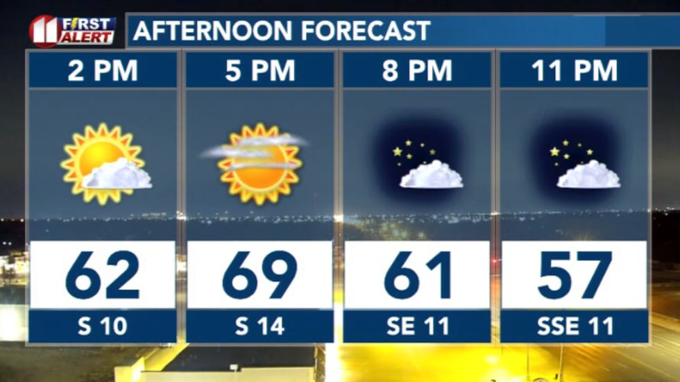 Afternoon hourly forecast(KCBD)
That gentle overrunning is enough to keep clouds locked in most of the day, but rain isn’t expected. Winds will start from the east 5 to 10 mph, becoming southeast 10 to 15 mph this afternoon.
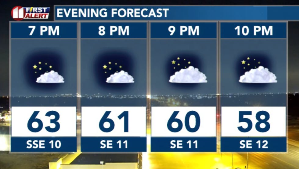 Evening forecast(KCBD)
Tuesday is when the pattern will flip, and fire weather becomes a real concern.
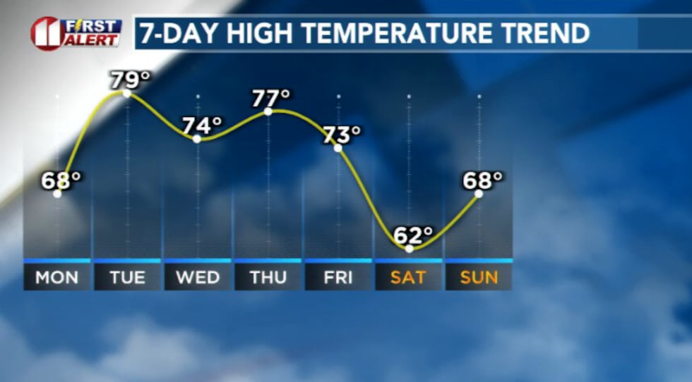 Temperature trend this week(KCBD)
An upper-level system moving over the Rockies helps deepen a surface low in northeastern New Mexico. That tightens the pressure gradient across our area and brings breezy southwest winds.
That combined with highs in the 80s and very low humidity will elevate critical fire weather concerns.
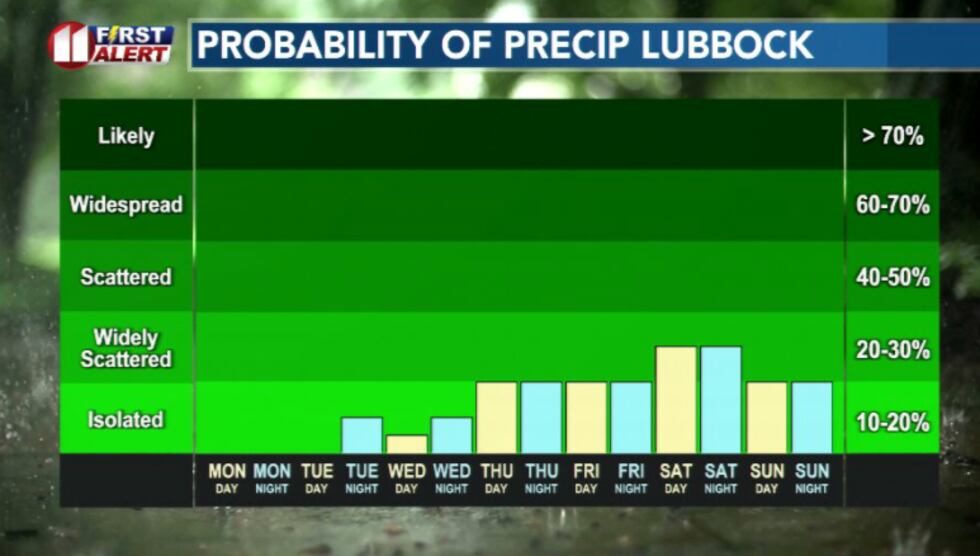 Rain chances this week(KCBD)
There’s a small chance for a stray shower or storm near Childress Tuesday afternoon, but most of the precipitation potential will stay east out of the area.
Late Tuesday another front moves through, and Wednesday temperatures will settle back into the 70s. Thursday brings another push of wind, warmth, and another window for fire danger.
There is also a late-day storm chance mainly off the Caprock Thursday, but details are still uncertain this far out.
By the weekend, a developing upper low could bring additional rain chances, though confidence in timing and coverage remains low.
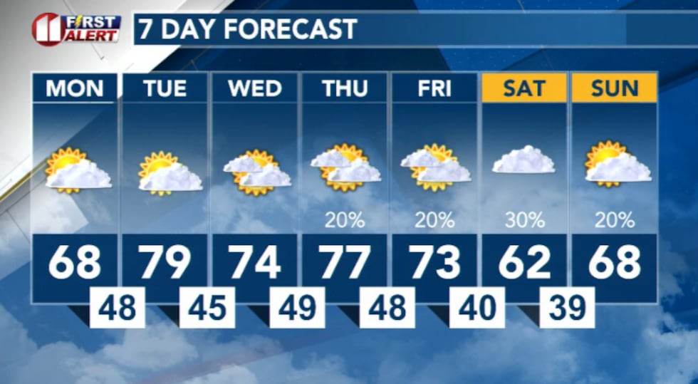 7 day forecast(KCBD)
Copyright 2026 KCBD. All rights reserved.