
Early Saturday morning update from Texas Storm Chasers.
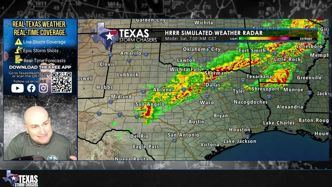
Scattered thunderstorms are beginning to develop along a cold front across Northwest Texas and the Big Country, including areas near Abilene, Wichita Falls, and Monday. These storms will move southeast through the morning hours toward North Texas and the Hill Country, eventually spreading across portions of Central and Southeast Texas later today.
The strongest storms this morning could produce:
• Hail up to quarter size
• Gusty winds
• Heavy rainfall
• Frequent cloud-to-ground lightning
The tornado threat remains very low across Texas this morning.
Additional storm chances will move southeast through the day, bringing rain and occasional thunderstorms to the Hill Country, Brazos Valley, and eventually South Texas by Saturday night.
Stay weather aware and make sure you have multiple ways to receive warnings.
You can monitor live radar anytime here:
https://texasstormchasers.com/radar
Join this channel to get access to perks:
https://www.youtube.com/channel/UCoIfgmxArIATc2EpHD3W9EA/join
Download our FREE Weather App: https://texasweather.app/
Check out the links to our website & radar, live-saving tornado alert phone calls, photo gallery, donations/store, and other social media: https://www.Linktr.ee/texasstormchasers
#TexasWeather
#TexasStorms
#DFWWeather
#SevereWeather