

AUSTIN, Texas – Buckle up and get ready for a wild weather ride in the next 24 hours.
Local perspective:
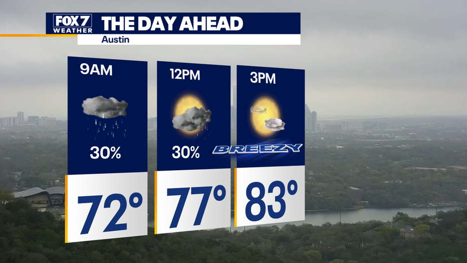
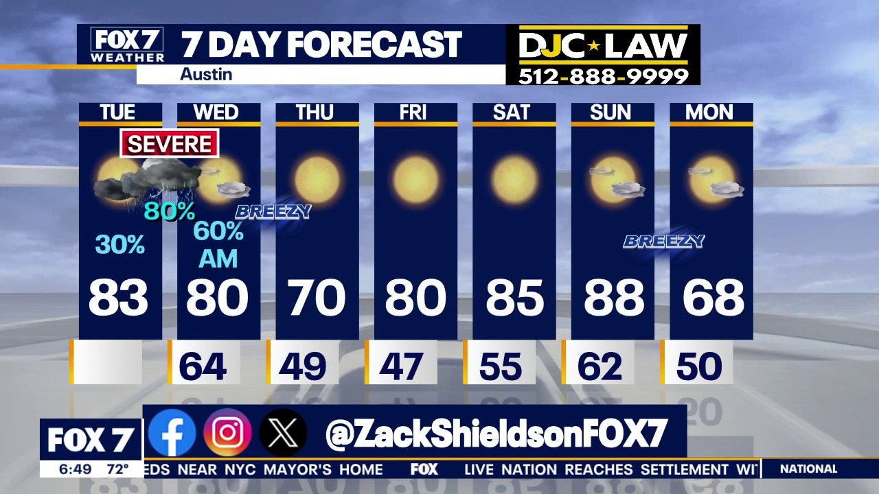
Mostly cloudy, warm, humid and breezy today with highs in the low 80s.
There is a chance of on and off light rain for the first half of the day.
Timeline:
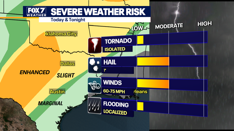
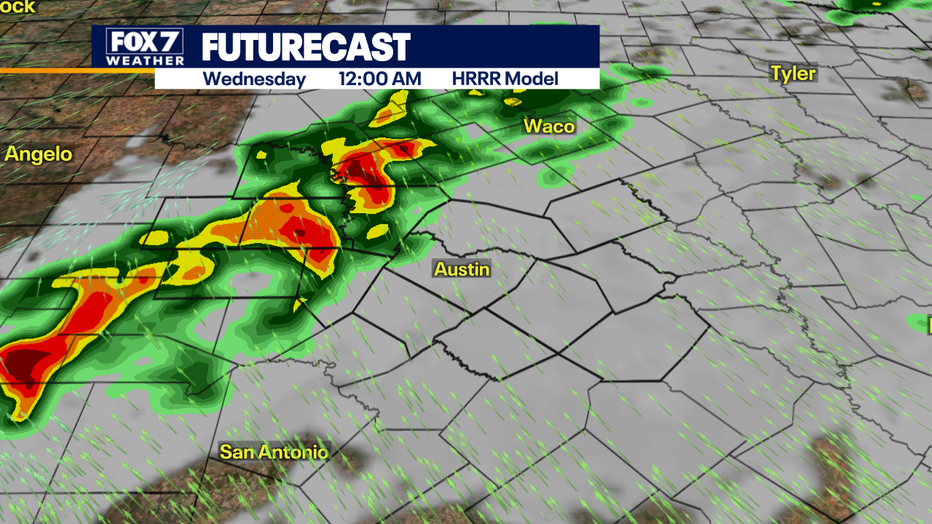
We are still waiting on the Pacific Low to help turn on the storms. This will happen tonight, and the storms will come in rounds.
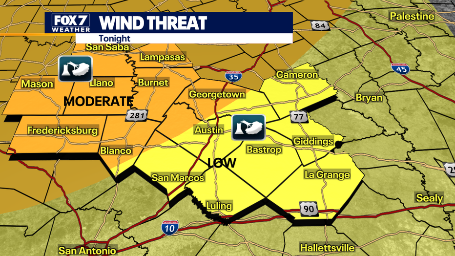
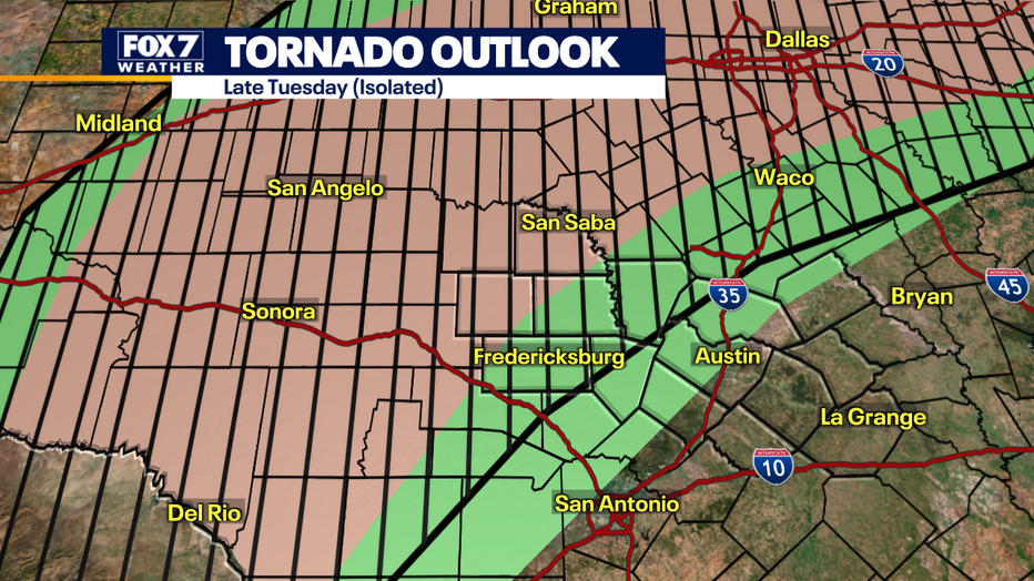
The prime spot for large hail, damaging winds and isolated tornadoes will happen from the Hill Country to West Texas.
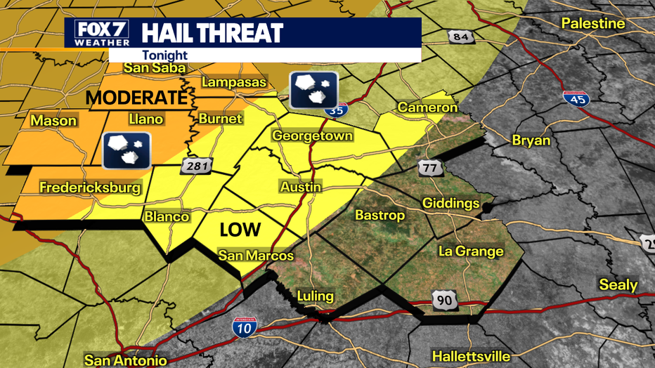
Most of the action this evening will occur west of Austin.
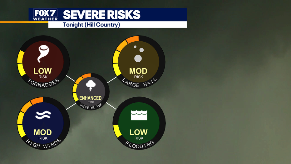
Along the I-35 corridor, we may have to wait until after midnight for our turn.
What’s next:
Wednesday is expected to be sunny, dry and breezy by the afternoon.
What you can do:
Track your local forecast for the Austin area quickly with the free FOX 7 WAPP.
The design gives you radar, hourly, and 7-day weather information just by scrolling.
Our weather alerts will warn you early and help you stay safe.
The Source: Information from meteorologist Zack Shields.