
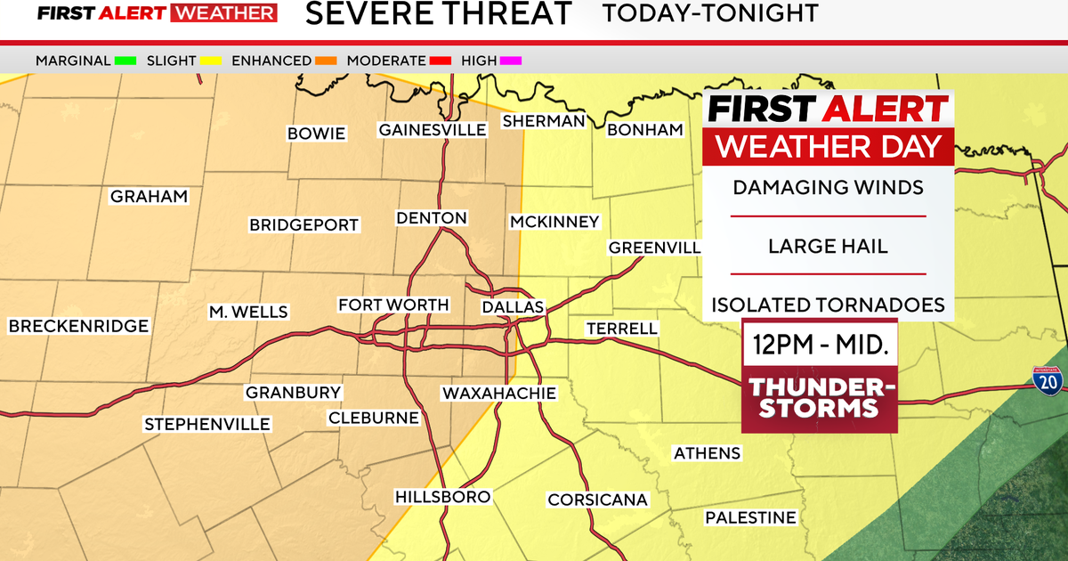
A First Alert Weather Day is in place for both Tuesday and Wednesday due to the threat of severe weather.
A tornado warning is issued for northern Palo Pinto County until 8:15 p.m. A severe thunderstorm capable of producing a tornado was located near Possum Kingdom Lake, about 19 miles southeast of Graham, moving northeast at 30 mph. The storm will be near Graham around 8:05 p.m. Take cover now.
A severe thunderstorm is issued for Stephens and Palo Pinto counties until 8:15 p.m. Wind gusts up to 70 mph and golf ball-sized hail are possible. Destructive winds of 80 mph are ongoing near I-20.
A tornado watch has been issued until 11 p.m. for Cooke, Denton, Eastland, Erath, Grayson, Hood, Jack, Montague, Palo Pinto, Parker, Somervell, Stephens, Wise and Young counties. Comanche, Hamilton and Mills counties in Central Texas are included. Destructive hail up to 4″, roughly softball size, and damaging wind gusts up to 80 mph may be expected.

Most areas from I-35 and areas west are under a level 3/5 risk for severe storms. The main threats will be for large hail 2″ or greater in size, along with strong wind gusts in excess of 70 mph.
Isolated strong tornadoes will be possible for any cells that form ahead of the main line that moves in Tuesday night.
It currently appears that the line should be pushing into Denton and the western metroplex by approximately 10 p.m. and the eastern metroplex by approximately 11 p.m. The squall line currently appears to be moving over downtown Dallas around 10:30 p.m.

Spin-up tornadoes will initially be possible along this line. As it moves toward the Dallas-Fort Worth metroplex, the threat of damaging winds will linger but will shift more to a flood threat as it pushes east.
Most likely, areas of heavy rain will linger into Wednesday morning. There’s a chance of more severe storms developing by late morning into the middle half of Wednesday afternoon. While hail (quarter-to half-dollar, 0.25-1″) and wind will still be the main threats, flooding may also continue.

After Wednesday, we will dry out and finally enter a quiet stretch of weather. Highs warm well above average through next weekend, then cool by early next week behind a strong cold front.
