
Severe storms, with potential for damaging winds and isolated tornadoes, are expected in Houston this afternoon.
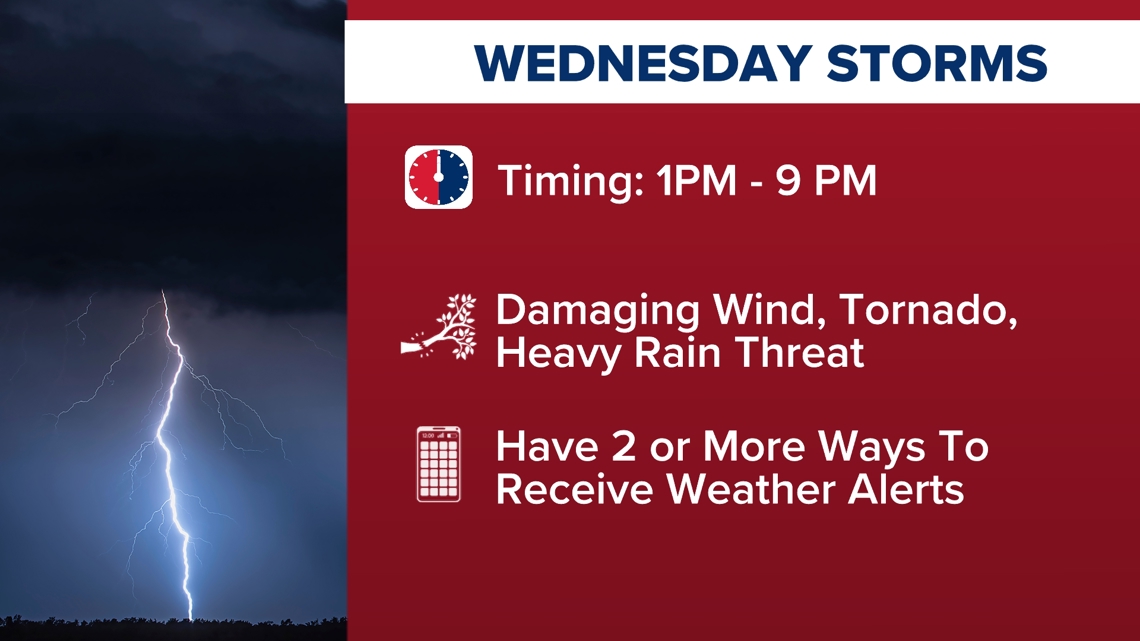
HOUSTON — A Weather Impact Alert is in effect Wednesday as storms move through Southeast Texas, bringing the potential for damaging winds, isolated tornadoes, heavy rain and localized street flooding.
The best way to stay ahead of the weather is to get the free KHOU 11+ app. We will have live updates throughout the day with updates on the storms.
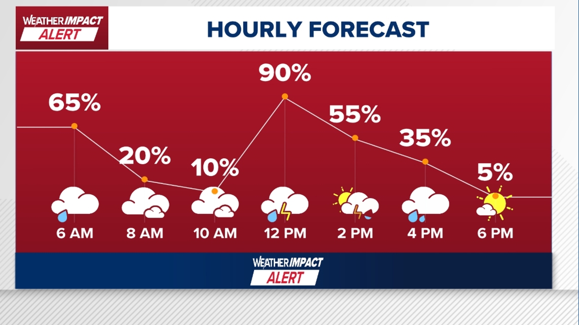
The KHOU 11 Weather Team says the strongest storms are expected later in the day, though scattered showers are already moving across parts of the region early Wednesday morning.
Storm threat increasing this afternoon
While the morning hours may only bring scattered rain, the main severe weather threat is expected during the afternoon and evening.
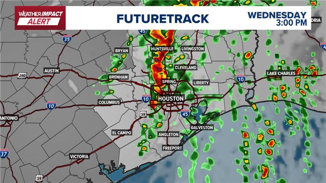
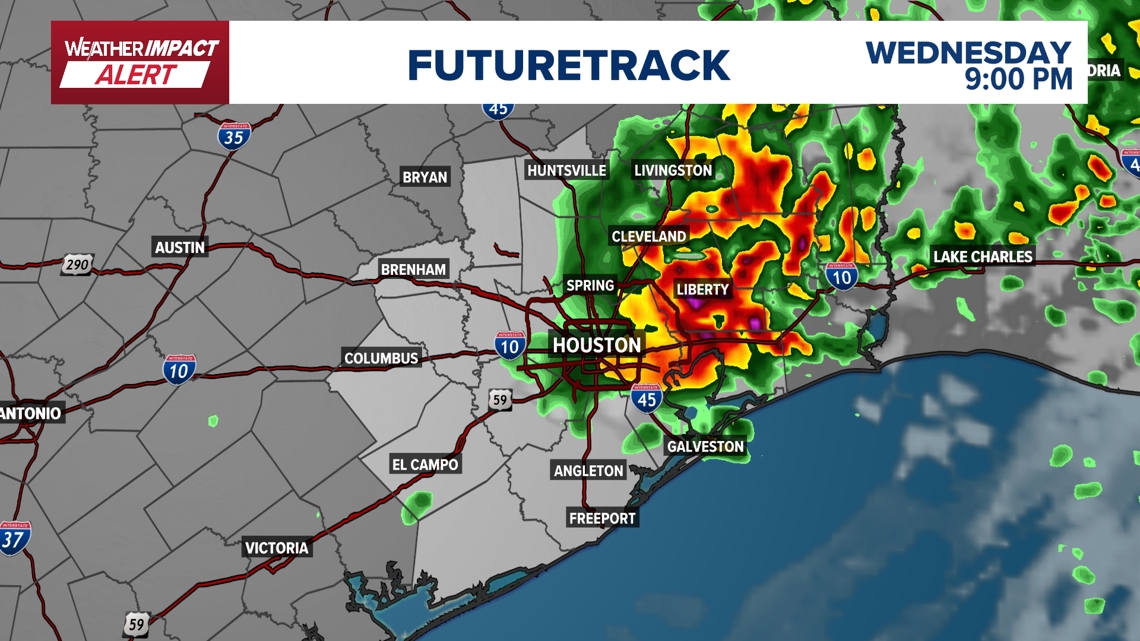
The KHOU 11 Weather Team says a line of storms developing to the north and west is expected to push toward the Houston area during the afternoon.

Timeline of potential storms
Morning
Scattered showers moving through parts of Southeast TexasSome gusty winds possible with heavier rainTravel slowdowns possible but widespread severe weather unlikely

Midday to early afternoon
Stronger storms may begin developing west of HoustonAreas like Bryan-College Station, Brenham, Columbus and El Campo could see storms first

Mid-afternoon into evening
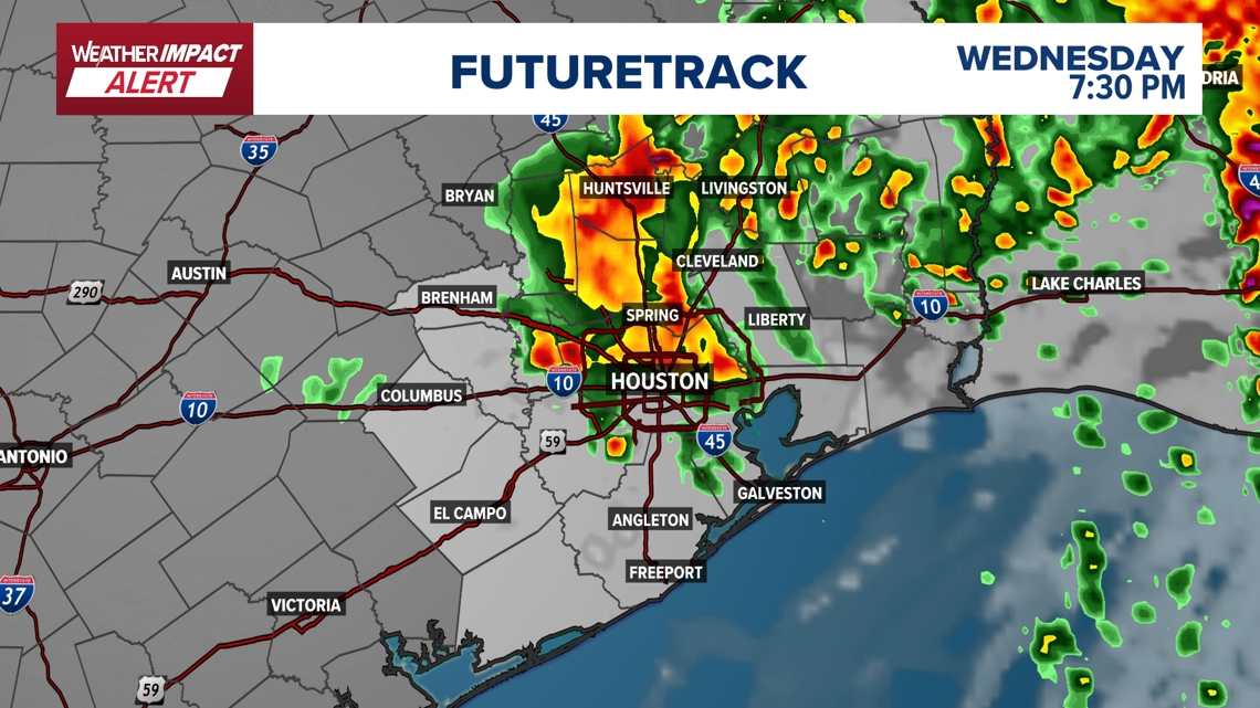
Storms could reach Harris County and the Houston metro area around mid-afternoonAdditional waves of storms may redevelop later into the evening
The KHOU 11 Weather Team says several rounds of storms are possible, meaning conditions could change quickly throughout the day.


What areas are most at risk
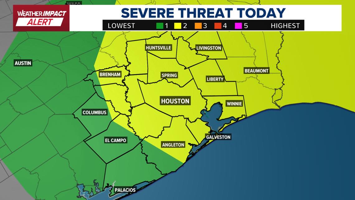
The Storm Prediction Center has placed much of Southeast Texas under a Level 2 severe weather threat, including the Houston area.
The risk area extends across many coastal and inland counties, including:
Brazoria CountyGalveston CountyChambers CountyHarris County and much of the Houston metro
Some areas farther west, including Matagorda County and parts of western Southeast Texas, may see a lower severe weather threat.

What hazards are possible
Storms later today could bring several severe weather hazards, including:
Damaging wind gustsIsolated tornadoesHeavy rainLocalized street floodingFrequent lightning
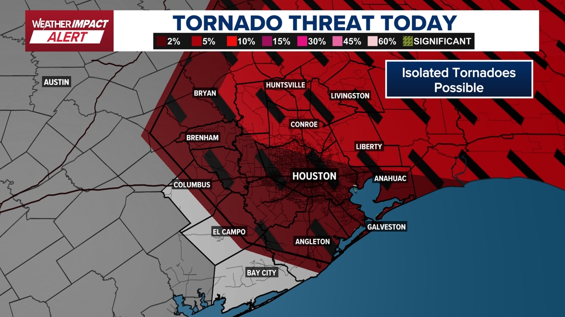
The KHOU 11 Weather Team says strong wind shear — winds moving in different directions at different heights — could allow storms to rotate, creating a chance for isolated tornadoes.

What this means for your day
The most significant impacts are expected later in the afternoon and evening, which could affect:
Afternoon commutesSchool pickup timesOutdoor activities
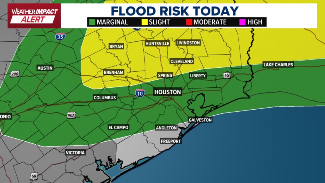
Drivers may also encounter ponding water and slick roads, especially during heavier downpours.
Residents are encouraged to monitor weather alerts and radar throughout the day in case warnings are issued.

Looking ahead: Cooler, drier weather coming
Once storms move out Wednesday night, conditions are expected to improve quickly.
Mostly sunny skiesBreezy conditionsLower humidity
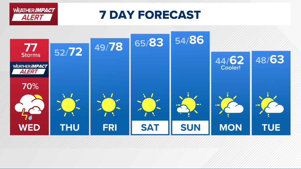
Temperatures will climb into the mid-80s later this week, but another front is expected early next week that could bring a cooler stretch with highs in the 60s and lows dipping into the 40s.

Harris County (including Houston, Pasadena, Baytown), Fort Bend County (Richmond, Sugar Land, Missouri City), Montgomery County (Conroe, The Woodlands), Brazoria County (Angleton, Pearland, Alvin, Lake Jackson), Galveston County (Galveston, League City, Texas City), Liberty County (Liberty, Cleveland, Dayton), Walker County (Huntsville, New Waverly), Waller County (Hempstead, Prairie View, Waller), Polk County (Livingston, Corrigan), Chambers County (Anahuac, Mont Belvieu, Winnie), Wharton County (Wharton, El Campo), Washington County (Brenham), Matagorda County (Bay City, Palacios), Grimes County (Anderson, Navasota), Austin County (Bellville, Sealy), Colorado County (Columbus, Eagle Lake, Weimar), Trinity County (Groveton, Trinity).