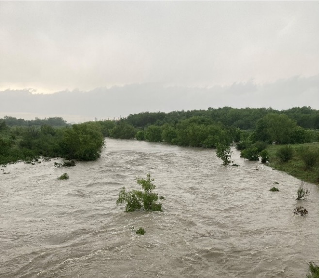
March 8–14, 2026, is National Flood Awareness Week, a time dedicated to helping communities understand their flood risks and prepare before severe weather strikes. Flood awareness is essential in South Central Texas, one of the most flood-prone areas in the nation. In 2025, our region experienced devastating floods. San Antonio saw nearly seven inches of rainfall in three hours, and weeks later the Guadalupe River rose more than 26 feet in under an hour. These events serve as powerful reminders of how quickly flash floods can develop and how critical timely information truly is.
The San Antonio River Authority remains committed to protecting the communities of Bexar, Wilson, Karnes, and Goliad counties by expanding flood-monitoring tools and making real-time data more accessible than ever.
A Growing Regional Flood Monitoring Network
The River Authority has expanded its HALT (High Water Alert Lifesaving Technology) network across all four counties, strengthening roadway flood monitoring throughout the San Antonio River Basin. Each HALT sensor provides real-time data using color indicators: green for safe, yellow for rising water, and red for closed. With new pilot gauges already added in Karnes and Goliad counties and more in development, this growing system increases visibility and safety throughout the region.
You can access roadway conditions through county-specific sites — BexarFlood.org, WilsonFlood.org, KarnesFlood.org, and GoliadFlood.org — all linked to the same regional map and alert system under SARiverFlood.org. These sites allow residents to check conditions quickly and stay informed as weather changes.

Get Alerts for the Crossings You Care About
Residents across the River Authority’s jurisdiction can sign up for text or email alerts through each county’s flood website. By selecting specific low-water crossings, you’ll receive notifications when water levels change, helping you make safer travel decisions before you head out.
With more than 200 HALT systems operating across the region, monitored 24/7 through partnerships with local jurisdictions, this growing network ensures that communities have timely, reliable information. As the system continues to expand, additional counties within the basin may be added to the network.
Spotlight: The “When Rivers Rise Fast” Blog Series
Last fall, we published our “When Rivers Rise Fast” blog series to better equip residents of Bexar, Karnes, Wilson, and Goliad counties with the knowledge they need to prepare for and respond to flash floods in the San Antonio River Basin.
This series takes a deep dive into how flash floods form, why they develop so quickly in our region, and how even familiar roadways can become dangerous in minutes. It also provides a closer look at the expanded flood warning system now being rolled out across the basin, explaining how gauges, sensors, alerts, and monitoring tools work together to protect the public.
In addition, the series highlights practical, easy-to-use resources available to the community. These include tools for checking real-time road conditions, ways to map safer routes during storms, and guidance for staying aware of conditions throughout the watershed. Whether you’re commuting, traveling, or simply planning your day, the information in this series empowers you to make informed, safe decisions when severe weather approaches.
By revisiting the “When Rivers Rise Fast” series, residents can deepen their understanding of local flood risks and learn how to use the expanding monitoring network effectively.
Click on the images below to read the “When Rivers Rise Fast” blog series so you can stay informed and prepared.