
HOUSTON — A strong cold front is expected to move into the Houston area Sunday night, bringing a quick round of possible storms and a sharp drop in temperatures that will make the start of the week feel more like winter. That’s why the KHOU 11 Weather Team has issued an hourly Weather Impact Alert from 6 p.m. Sunday to 12 p.m. Monday.
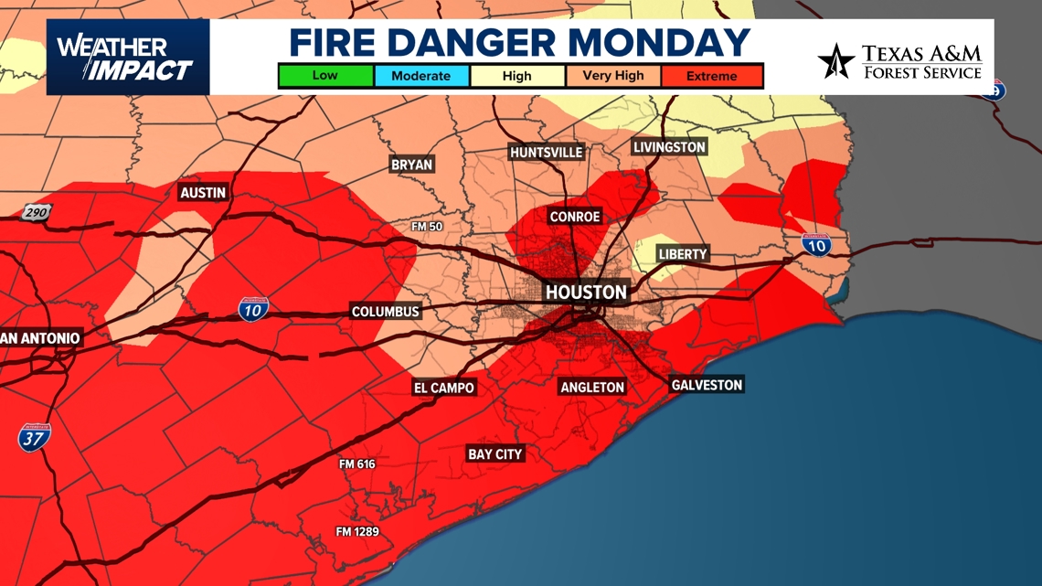
The front will push through the region Sunday evening, producing a narrow band of showers — and possibly thunderstorms — before ushering in much colder air and windy, very dry conditions for Monday and Tuesday.
The KHOU 11 Weather Team expects a dramatic temperature swing as the front arrives. Highs will climb to about 86 degrees Sunday under warm, breezy conditions, but temperatures will drop sharply behind the front. Monday’s high is expected to reach only 56 degrees, with Tuesday topping out near 65.
The cold air mass moving south will create a strong temperature contrast, with temperatures in the 70s ahead of the front and in the 50s behind it. That contrast could help spark severe thunderstorms across central portions of the United States, though Houston is expected to see only a thin line of showers associated with the front.
A line of showers and storms could begin developing ahead of the front around 7 p.m. Sunday.
Harris County (including Houston, Pasadena, Baytown), Fort Bend County (Richmond, Sugar Land, Missouri City), Montgomery County (Conroe, The Woodlands), Brazoria County (Angleton, Pearland, Alvin, Lake Jackson), Galveston County (Galveston, League City, Texas City), Liberty County (Liberty, Cleveland, Dayton), Walker County (Huntsville, New Waverly), Waller County (Hempstead, Prairie View, Waller), Polk County (Livingston, Corrigan), Chambers County (Anahuac, Mont Belvieu, Winnie), Wharton County (Wharton, El Campo), Washington County (Brenham), Matagorda County (Bay City, Palacios), Grimes County (Anderson, Navasota), Austin County (Bellville, Sealy), Colorado County (Columbus, Eagle Lake, Weimar), Trinity County (Groveton, Trinity).