
Monday morning starts cold, with temperatures in the 30s and feel-like temperatures in the 20s, prompting a First Alert Weather Day across North Texas.
After setting a new record high Sunday of 87°, Monday is over 50° colder than that point. Expect it to stay chilly throughout the day with breezy winds – gusting up to 30 mph at times. Sunday’s top wind gust was 61 mph in McKinney.


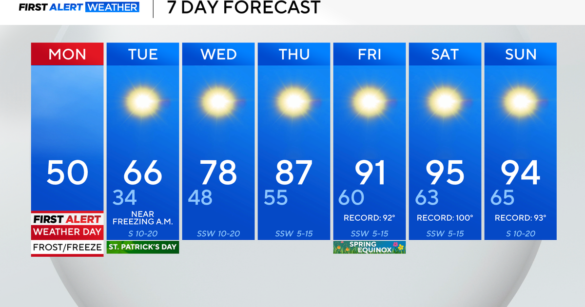
A freeze warning continues Monday morning as temperatures are close to or even below freezing for some. By the afternoon, it will be a struggle to get warmer than the low-50s. Winds could reach 30 mph, with an elevated fire threat area-wide.
After one more cold night, there’s a warm-up on the way later this week. A big high-pressure ridge will build in, and as a result, DFW will reach record highs by the end of the workweek. Temperatures are expected to soar into the mid-90s.

The 7-day forecast stays nice and dry, making it great for any outdoor plans for St. Patrick’s Day. Friday is the spring equinox, when we see equal amounts of day and night worldwide.
